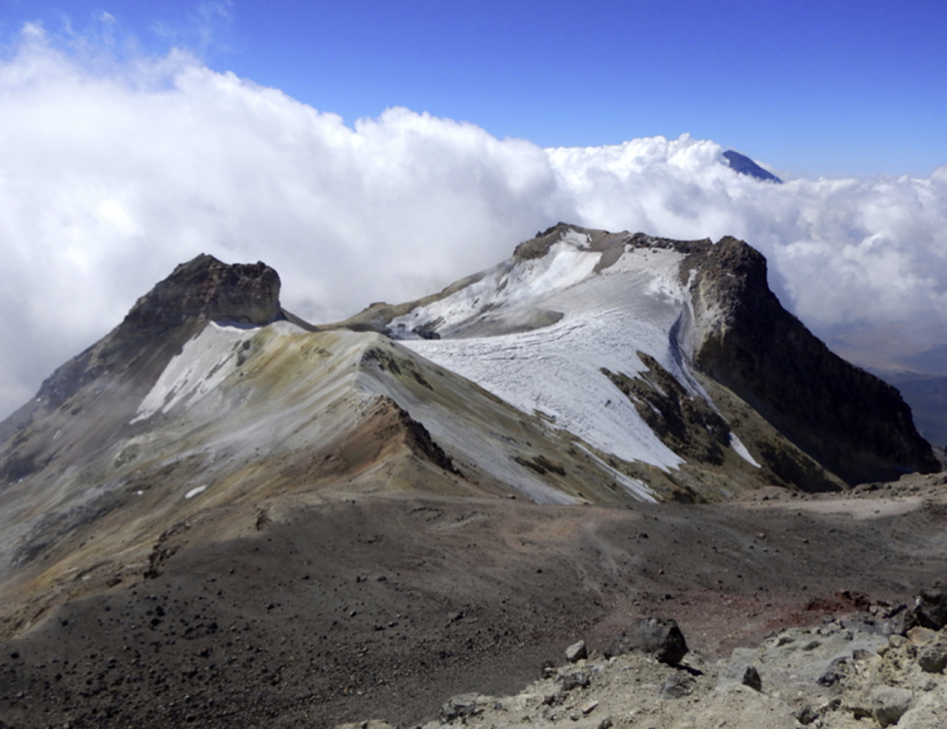
View from the Ridge of the Sun route, near the summit of the Iztaccíhuatl volcano (in Spanish: Mujer dormida; in English: “sleeping woman”); (GPS coordinates: 19°0’48.4”N 98°38’29.3”W). Photographed in April 2018 after an 8-h climb from La Joyita base camp located at 3900 m above sea level.
Iztaccíhuatl is an extant volcano located 65 km southeast of Mexico City with an estimated age of 900,000 y. 1 It is one of Mexico's most popular mountaineering destinations due to its ease of access, numerous climbing routes, and outstanding views of the Popocatepetl volcano, averaging 45,000 visitors per year. A new geological survey measured the true summit (the west summit) at 5215 m, making it the third highest mountain in the country, just behind Pico de Orizaba or Citlaltépetl (5636 m) and Don Goyo or Popocatépetl volcano (5426 m).
Eighteen glaciers are thought to have existed in this mountain in the past.
2
Currently, only 3 important glaciers remain: the Ayoloco glacier, the crater glacier, and the southeast glacier. These glaciers have lost 43% of their area in the last 30 y. The Ayoloco glacier measures approximately 300 m and has an average retreat rate at the tongue of -21 m annually,1,2 which is obviously noted in this photograph taken from the Ridge of the Sun route, pointing south, at 5100 m at about 45 min to the summit. Popocatepetl volcano is covered by clouds in the background. Photograph by Rodrigo Ville-Benavides, MD.