
Abstract
The article delves into the current history, space, and landscape of Highway 90, Israel's longest highway. Spanning the entire country, the highway aligns with Israel's eastern border, while traversing the contested territories of the West Bank. The inquiry addresses Highway 90 as a borderoad, exploring its biography in the geopolitical historical context through five conceptual forms of segmentation that highlight temporal-spatial intricacies and key aspects of the route: regional segmentation, geopolitical segmentation, elusive northwest Dead Sea segmentation, historical-synchronic segmentation, and a synthesis introduced as the borderoad landscape segmentation. The analysis reveals that segmentation operates not only as a methodological tool, but also emerges as the road's main characteristic, introducing the borderoad as a segmented whole that serves to enhance the nexus of nation, territory, and border. The discussion pertains to historical–geopolitical conflicts, highlighting the route's hybrid military–civilian characteristics. It addresses the border as a meta-narrative, while reflecting the conjunction of time-space within the geopolitical context.
Keywords
Introduction
Highway 90, the longest route in the country, spans over 478 km, from the town of Metula on the border with Lebanon to Eilat, on the southern border with Egypt. About one-quarter of the route – 118 km – passes through the contested occupied territory of the West Bank. Despite its peripheral location, the highway holds significant historical and geopolitical importance in Israel, and commonly referred to by its segments, as (from north to south) “the road to the north”, “the road along the Sea of Galilee”, “the Jordan Valley road”, “the Dead Sea road”, “the Arava road”, or simply “the road to Eilat” (Figure 1).
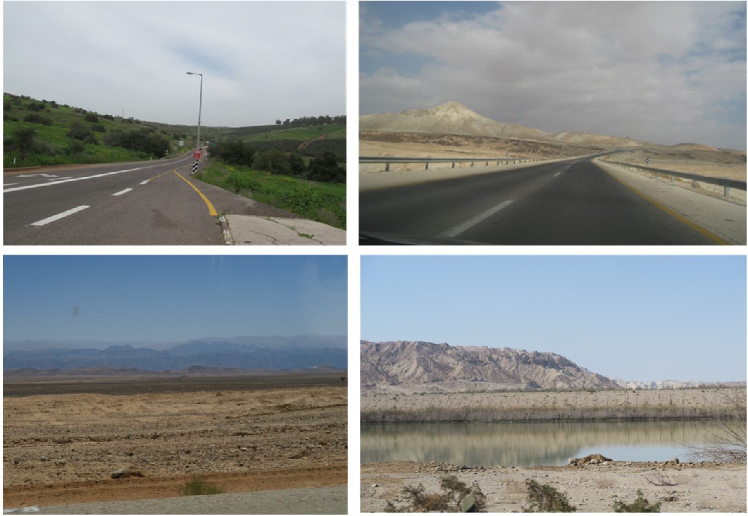
Highway 90, general views (clockwise from upper left): Upper Galilee; Jordan Valley/West Bank; Dead Sea; Arava Desert. Source: the author.
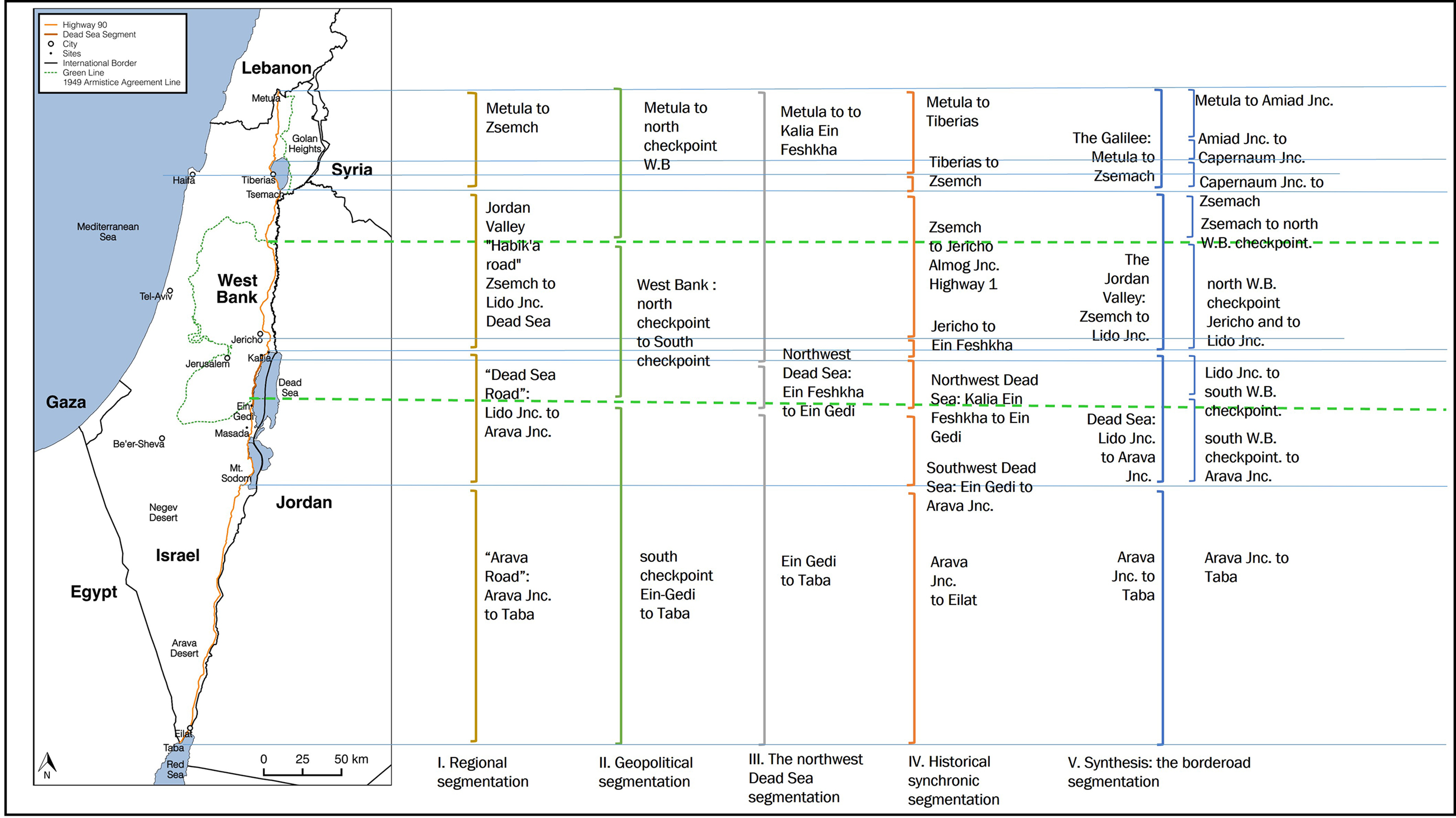
General map and scheme of five segmentations of Highway 90. Source: the author.
Running along the Great Rift Valley, the route extends parallel to the state's eastern border. In the north, it traverses the Hula Valley near the border line drawn in the 1949 Armistice Agreements between Israel and Syria and formed Israel's frontier with Syria until 1967. Further south, the highway continues along the border between Israel and Jordan, running through the Jordan Valley and the West Bank to the Dead Sea and Arava Desert, and ending in Taba, 10km south of Eilat at the country's southernmost point. The space and landscape of Highway 90 are a palimpsest on which disputed territories have been drawn and redrawn, a linear space that is layered and charged with contested histories.
The article frames the biographical analysis in relation to the critical literature on highways and border studies, and elaborates on the historical background concerning the evolution of Israel's motorway network in the context of the region's geopolitics. It then presents a short diachronic biography of Highway 90, followed by an historical overview of the unsettled borders along the highway. Aiming to conceptualise the hybrid space and landscape of the road and the border, the article introduces the terms “borderoad”, “borderoadscape”, and “borderoadspace”. These notions convey the affinities and proximity between the border and the road, while implying that the space and landscape of Highway 90 operate as a coherent whole. Nonetheless, despite its name and apparent geographic coherence, Highway 90 was not always a continuous route; rather, it is comprised of discrete parts, whose segments reflect the space's intricate geopolitical history. In order to unfold these time-space intricacies, the article conceptualises and analyses five different segmentations of the highway, each focusing on a different key aspect (Figure 2): regional segmentation, geopolitical segmentation, elusive segmentation (the northwest Dead Sea 1967–1971), historical-synchronic segmentation, and a synthesis introduced as the borderoad landscape segmentation. These perspectives reveal the dynamic interplay between the geopolitical history of space and the highway, while underscoring its hybrid military–civilian character as a borderoad formed by the outcome of regional conflicts, wars, and peace agreements. Thus, the main section centres on spatial segmentation as reflecting the historical geopolitics of the borderoadspace.
The discussion then addresses five key issues: the borderoad as a segmented whole: the military–civilian character of the route, and the border as a meta-narrative; the reflection of the region's historical, military, and geopolitical conflicts; the conjunction of time-space within the geopolitical context. This discussion draws on the perception of highways and roads as ideological means of national formation 1 within a given historical and geopolitical context, while attending to the manifold facets of the region's conflicts. This critical inquiry builds on a qualitative discourse and on extensive archival work in the Israeli State Archive, the archive of the former Israeli Public Work Department (PWD, now the National Transport Infrastructure Company Netivei Israel), private archives, national media, and personal interviews.
Framework and background
The critical literature has highlighted roads and highways as places of national significance and as a means of state-building, 2 demonstrating their function in the formation of national consciousness and collective memory. 3 Scholars have also underscored the historical military and civilian character of roads, 4 emphasising their role as a means of controlling and regimenting land, territory, and its human population. 5 The discourse on mobility stresses the political dimension of highways as a core factor facilitating movement, space, and the evolution of highway networks, while underscoring the role of highways as agents of power. 6 A vast body of scholarship on roads and highways pertains to their historical facet. 7 However, only a limited body of critical literature is concerned with the biographies of roads 8 in the context of modernism 9 and landscape. 10 In the realm of critical border studies, dynamic border perceptions stress borders as a means of identity formation, 11 underscoring the nexus of border, nation, and territory. 12 The interdisciplinary discourse on borders presented in this article conceptualises the notion of the borderscape, 13 while also underlining the idea of the frontier and its military–civilian dialectics. 14 This article is positioned at the intersection of these critical discourses on highways and borders, while offering a spatial-historical analysis of segmentation as shaping and reflecting perceptions of the borderoad.
A short history of Israel's motorway network in relation to historical geopolitics
The evolution of the state's modern motorway network developed through the period of the British Mandate in Palestine (1921/22–1948) and the establishment of the State of Israel (1948) and continues in the present. Serving as a means of ideology and territorialisation, it encapsulates the interplay between military and civilian concerns, while reflecting regional geopolitical shifts, the state's political and ideological priorities, and the requirements of additional agencies.
According to Reichman and to Rabinowitz and Vardi, during the British Mandate, the motorway system was shaped by military, strategic, and economic factors, intertwined with the spatial needs of the local communities. 15 The political upheaval against the British Mandate in 1929–1939 led to a convergence of interests between the Mandate authorities and the pre-state Jewish community, further spurring the construction of a motorway network that supported the dispersion of Jewish settlements. 16 This process also motivated the view of remote agricultural settlements as crucial to determining the borders of the future state.
During the Second World War, the British Mandate built motorways primarily for military-strategic and economic reasons, with less consideration of local needs and existing roads: “on grounds of public security in order to provide communication to areas hitherto inaccessible to wheeled traffic and in order generally to facilitate the movement of troops and police”. 17 This convergence of military and civilian interests was similarly expressed in late 1940s: “on behalf of the military authorities in order to deal with the great increase in the volume of military traffic following the outbreak of the war”. 18 As a result, on the eve of Israel's establishment, the country's motorway network consisted of a mix of local, rural, poorly maintained centripetal roads, alongside more modern, well-maintained centrifugal ones. This network laid the foundation for the state's modern highways, serving to promote the dispersion of the population, and to define the future state's territory and borders while also establishing its military–civilian context.
Israel's First National Master Plan of 1951 portrays the motorway network as further facilitating the dispersion of rural or agricultural settlements. 19 It perpetuates the conflation of civilian needs and of strategic and tactic military requirements pertaining to the new state's borders within the Green Line drawn in the 1949 Armistice Agreement, also referred to as “the 1967 lines” or “borders”. 20 Economic growth in the 1960s was reflected in extensive expansions of main highways and urban expressways. 21
The 1967 War marked a watershed in the region's geopolitical history, and profoundly affected every aspect of Israeli society, politics, and space. The war resulted in the occupation of the West Bank, the Gaza strip, the Sinai Peninsula, and the Golan Heights. This prompted corresponding expansions in the highway network, which were aligned with the state's agenda of maintaining control over the occupied territories, while serving both military requirements and political-ideological purposes. The trauma and political turmoil following the 1973 War reaffirmed these state priorities. In 1976, the State's National Master Plan for Roads (TAMA 3) was finally approved, 22 significantly adhering to the Green Line as its border for highway planning. This meant that while highways in sovereign Israel were planned and constructed by the state's PWD 23 following formal statutory procedures, roads in the West Bank – including a segment of Highway 90 – were under the responsibility of the IDF civil governor in conjunction with PWD.
Following the Israeli-Egyptian peace treaty in 1979, the next two decades saw the unfolding of significant geopolitical events: Israel's unilateral annexation of the Golan Heights in 1981, the outbreak of the First Lebanon War in 1982, and the first Intifada (Palestinian uprising in 1987–1991). On a more positive note, the 1990s were also marked by the signing of the Israeli-Palestinian Oslo Accords in 1993 and 1995 – whose aim was a peaceful resolution of the Israeli-Palestinian conflict by means of bilateral recognition – and of the Israeli-Jordanian peace treaty in 1994.
During the 1980s, the highway system's expansion reflected the state's policy of enhancing the Jewish presence in the Galilee and West Bank. 24 Israel's withdrawal from the Sinai Peninsula in the early 1980s also led to the construction and renewal of roads along the border with Egypt. The late 1980s also saw the initial emergence of environmental concerns that influenced planning, construction, and design. 25 By the end of this decade, the highway network was comprised of local, centripetal, winding, lower-quality roads linking rural towns, and villages; and a modern, centrifugal highway system, which necessitated the construction of new access roads, relief roads and bypasses. 26 The 1990s further advanced national political and military interests at the expense of economic, social, or environmental considerations, particularly by promoting peripheral settlements. 27 By the turn of the millennium, the Israeli highway network reflected the state's territorial perception, often using motorways as a means to accomplish political and strategic goals. The 2005 integrated National Master Plan for Construction, Development, and Conservation (TAMA 35) introduced a more nuanced approach, taking into consideration land use, landscape, and environmental factors.
A short diachronic biography of Highway 90 and milestone events
Highway 90 reflects historical and geopolitical changes within larger regional transformations, which have shaped a highly segmented route since antiquity. Notable segments already appear on the Poitinger Map of roads throughout the Roman Empire: these include the road from Tiberias north into the mountains, as well as south along the Jordan River, to the Roman cities Scythopolis (nowadays Beit She’an) and Herichonte (Herodian Jericho). In the south, the road traversed the Arava Desert, linking the Sinai Mountains and Red Sea (the Eilat-Aqaba Bay), and leading to Jerusalem.
The 1880 PEF map 28 presents significant parts of the route, extending north from Tiberias to the Christian sites of Magdala and Tabgha by the Sea of Galilee, and further through the marshland of the Hula Valley into the mountains of modern Lebanon and Syria. To the south, the map traces the Roman road from Tiberias to Jericho. Several decades later, in 1915, the Ottoman ruler Djemal Pasha initiated the road north from Tiberias to the Galilee's Jewish communities of Rosh Pina and Metula. By the end of the First World War and the beginning of the British Mandate, approximately 125 km of the route were already in place; other sections of the present-day highway were dirt roads or paths.
During the British Mandate, the road developed as part of the previously discussed motorway network. From the 1930s onwards, there has been ongoing maintenance of the northern Jordan Valley segments leading to the valley's kibbutzim. 29 The Jericho-Dead Sea segment was jointly constructed in 1931 by Arab contractors from Jerusalem and Jewish socialist workers. Road maps from 1943 and 1945 indicate its various segments: in the north, the Zemach train station served as a pivotal transportation hub, connecting the soling roads that were gradually built from there to Metula in the 1930s, and from Zemach to Jericho and the northern Potash factory during the Second World War. Along the north coast of the Dead Sea, the road linked a small Jewish community, the marine airport, and the then-fashionable Kallia Hotel 30 nearby Ein Feshkha (now days Einot Tzukim) springs. 31 Since there was no road at the northwest Dead Sea section due to the steep fault cliffs and fluctuation of sea level, transportation between the north and south Dead Sea Potash factories relied on boats for passengers and goods. Further south, the road connected British military checkpoints from Mt. Sodom to Taba was labelled a “dry weather”, “soling”, or “dirt” road. By the end of the British Mandate, nearly all segments of the road had been constructed, and some were even paved with asphalt, apart from the northwest Dead Sea segment. 32
In the first two decades of Israeli statehood, prior to 1967, the Green Line divided the incomplete route into three parts: northern and southern sections were within Israel's borders, while the middle section – the West Bank – was in Jordanian territory. 33 During this period, Israel developed the northern segment of the road, connecting old and new Kibbutzim and rural immigrant settlements along the Jordan Valley, while also using it to maintain the eastern border and underscore the state's sovereignty. In the south, a modern highway to Eilat was gradually built, connecting the city to the Dead Sea and Beersheba 34 ; the southwest Dead Sea segment also connected Mt. Sodom and Kibbutz Ein Gedi (est. 1956). By 1967, the southern highway was completed, forming most of the present-day route. 35
After the 1967 war, the state built the northwest Dead Sea segment that enabled the completion of the highway, consolidating it as a coherent borderoad, and thus as a symbolic statement of domination over land and territory. 36 In the Sinai Peninsula, the route extended southward to Sharm-el-Sheikh, adding approximately 200 km along the Red Sea. With the approval of the TAMA3 and the renaming of highways, Highway 90 was officially designated by this name. 37 Thus, by the late 1970s, Highway 90 was recognised as a complete highway, despite the variations in its form, width, maintenance, and military–political status.
During the 1980s and 1990s, the status “Scenic Road” was first introduced, initially designating a tourist attraction and later a statutory category. 38 This category was consequently given expression on tourist road maps attesting to the unique, moon-like marl landscape in the north of the highway's Arava segment, and to the breathtaking view of the Dead Sea landscape, as well as to the views in the north of the Jordan Valley and along the Sea of Galilee. The Oslo Accords (1993/1995) designated Jericho as an “A zone” under full Palestinian authority. Consequently, the road section that previously ran through the town was replaced by a new 17 km-long segment bypassing Jericho to the east, running even closer to the border.
Since then, economic prosperity and population growth have increased circulation, adding strain to Highway 90, which is still mostly a two-lane, undivided highway. Throughout its evolution, the biography of Highway 90 has been intertwined with geopolitical events in the region, while converging with the history of the country. These events shaped the borderoad space and landscape and formed the borderoad not only as an infrastructure designed to promote mobility and transportation, but also as an embodiment of ideology and geopolitical means.
Highway 90 and the state's unsettled borders
The region's modern borders emerged from the Sykes–Picot Agreement (1916) and the San Remo Conference (1920), followed by the British Mandate in the aftermath of the First World War. The state's currently unsettled borders reflect the outcome of wars, armistice agreements, annexations, and peace treaties, as well as unresolved conflicts, which have materialised in the borderoadspace. 39 From a historical–geopolitical perspective, the northern end of Highway 90, by the closed Israel-Lebanon border, reflects the military tensions between the two states. Established in 1949, this border has been marked since the late 1970s by ongoing conflicts and increased military tensions persisting and intensifying to the present day. 40
In the east, the borders with Syria and Jordan were initially outlined by the British, incorporating the Sea of Galilee and the Jordan River as natural boundaries, alongside an inner administrative boundary demarcating the area known as the West Bank. 41 This section of Highway 90 followed the borderline, and often endured hostile military aggression. This remained the situation until 1967, when the occupation of the Golan Heights and the West Bank sparked fierce dispute. The 1981 unilateral annexation of the Golan shifted the northeast border eastward, subsequently demarking the northern segment of highway 90 as a reminder of the borderline with Syria.
The Israeli-Palestinian Oslo accords (1993/1995) settled territorial zones in the West Bank. 42 Nonetheless, the Oslo accords have since gradually dissolved in the wake of enduring geopolitical turmoil in the region. 43 The Israeli-Jordanian peace treaty (1994) stabilised the border along the West Bank, the Dead Sea, and the Arava Desert. However, the border between the West Bank and Jordan (which is demarcated by the Jordan River) is defined as an administrative one, pending a trilateral agreement involving Israel, Jordan, and the Palestinian Authority that has yet to come. 44 Also concerning the West Bank, along its route Highway 90 forms two intersections with the Green Line, marked by two Israeli checkpoints that indicate the military governess of the West Bank.
The Israeli-Jordanian peace treaty facilitated the formation of three active international border crossings along Highway 90, and a maritime border that traverses the Dead Sea. 45 In the south, the Israeli-Egyptian peace treaty (1979) established a secure border crossing in Taba, which mainly serves tourists travelling between Israel and Sinai.
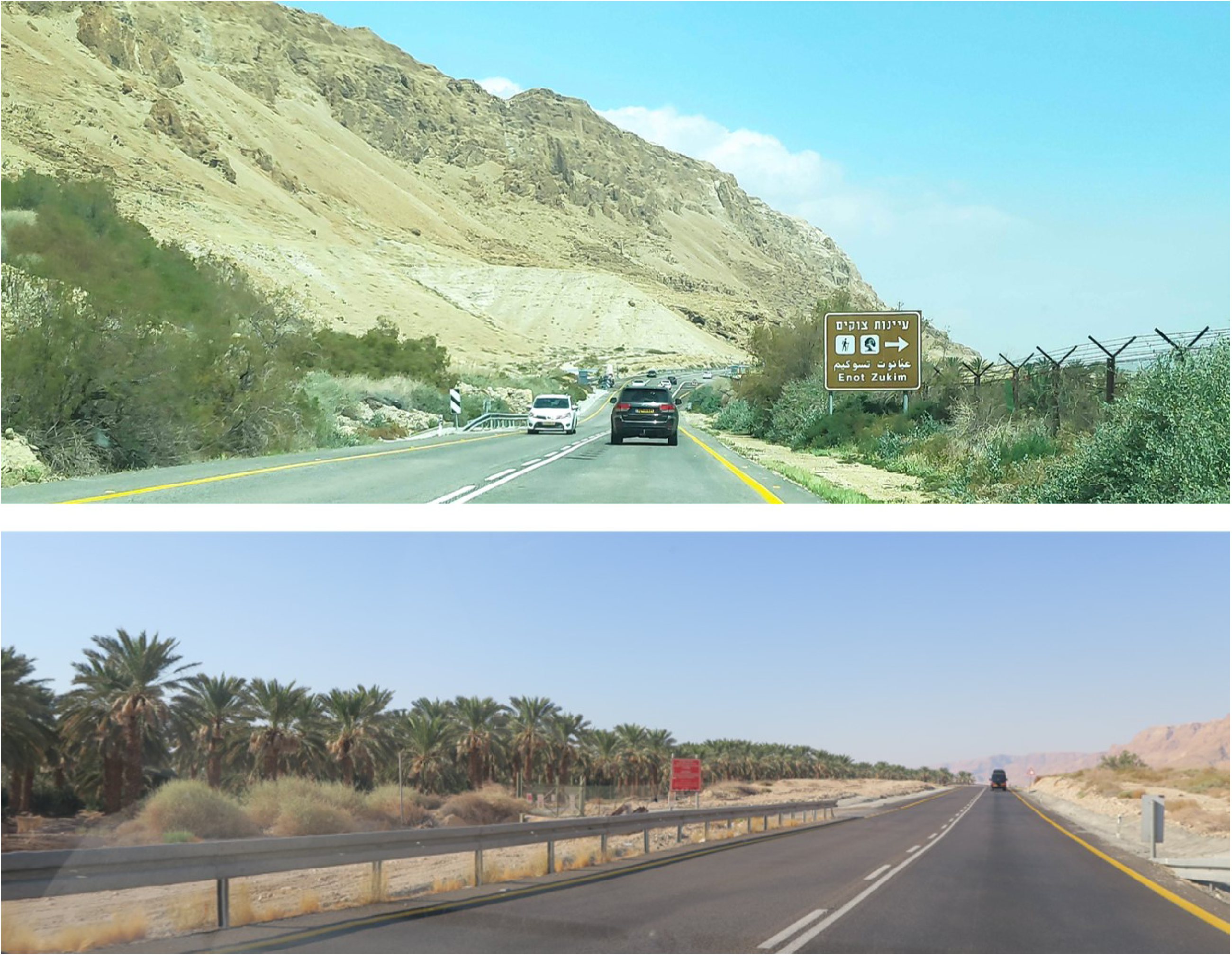
The notion of the borderoad as concerning Highway 90 addresses these juxtapositions between the highway and the border. Nonetheless, despite its vital role and presence in the national consciousness, Israel's eastern border often appears ambiguous, its elusive presence (Figures 3 and 4) 46 implied by occasional landscape performances such as an intrusion-tracking dirt road, segments of patrol roads, occasional signboards, remnants of old minefields, and sporadic stretches of barbed wire. 47
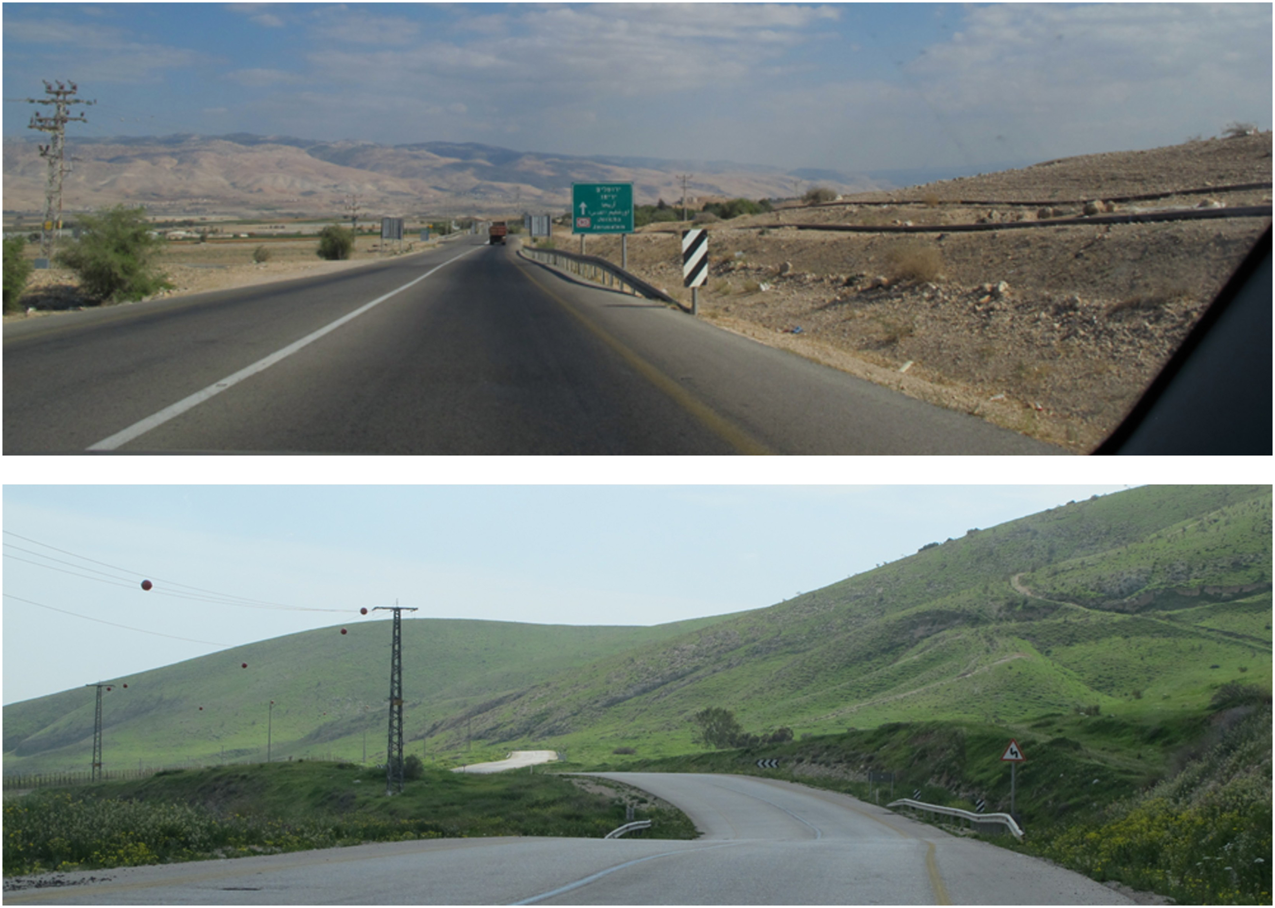
Highway 90, Jordan Valley/West Bank. Source: the author.
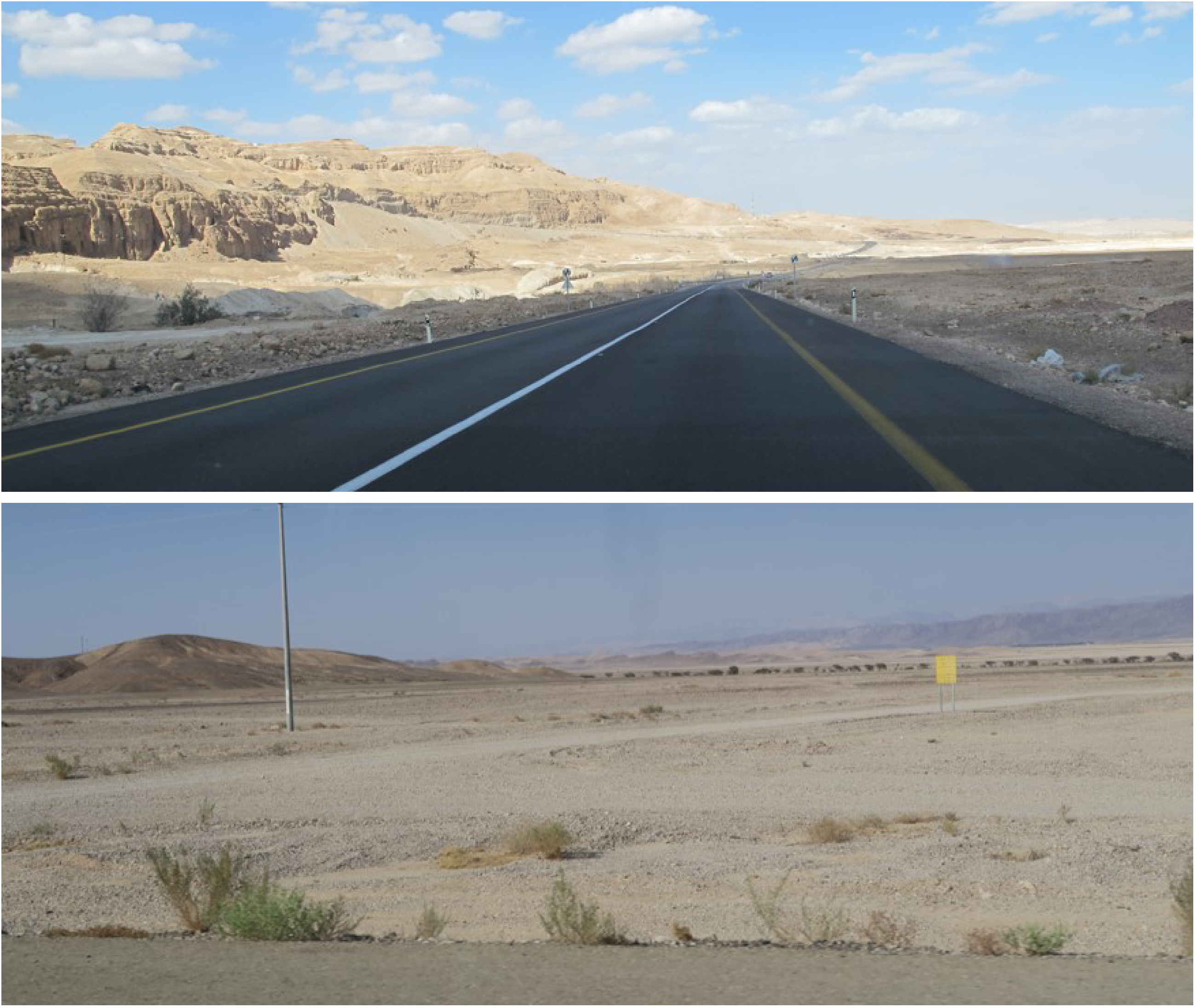
Highway 90, southern Arava Desert. General view. Source: the author.
Overall, the Israeli highway network and borders are historically interwoven state infrastructures, forming a cohesive network that reflects the geopolitical and ideological convergence of highways, territory, and borders. The short biography of highway 90 and the overview of its historical relations to the state's border further suggests this tangled nexus. The following analysis delves into five suggested segmentations of the highway within the historical–geopolitical context, further revealing Highway 90's multifaceted materialisation of history, space, and conflicts.
Segmentations and the borderoadspace
The dynamic history of the region consolidated highway 90 as a borderoad. While the highway operates as a coherent transportation artery, an inquiry into its route introduces five optional segmentations, highlighting segmentation as one of its prominent characteristics (Figure 2). These segmentations reveal a tight bond between time and space, and attest to the intricacies of the highway that traverses the multilayered historical and geopolitical sphere within diverse geographical regions and landscapes. Each segmentation offers distinct viewpoints that highlight historical–geopolitical perspectives, while shedding light on the dialectic between the linear whole and its parts. The main themes that run as a common thread throughout this exploration are the military–civilian character of the route and the border as a meta-narrative, the reflection of the region's historical, military, and geopolitical conflicts in the space and landscape of the route, and the conjunction of time-space within the geopolitical context.
As one can see in Figure 2, the five segmentations share the same terminus points – the state's northern border with Lebanon within the town of Metula, and the Taba crossing on the southern border with Egypt. Throughout the route, they often overlap, offering different perspectives on the segments, which are interconnected by means of junctions, interchanges, and checkpoints.
These segmentations are predicated upon the author's subjective viewpoint and experience, and are therefore affected by many factors including, most notably, nationality, citizenship, and geopolitical affiliation. The author's subjectivity is also influenced by her positionality as an Israeli driver. This implies substantial freedom of movement and travel along the entire route for Israelis, which others, particularly Palestinians from the West Bank, do not have. 48
Regional segmentation
This segmentation is rooted in a broadly accepted Israeli understanding of the route. This perception is shaped by the natural environment and regional divisions of space, while conveying geopolitical–historical references. It relies on the common popular perception of the highway's four primary segments.
The northern Galilee segment, which mostly follows the pre-1967 border with Syria, extends from the northern border, traversing the Hulla Valley and ending at the Zemach Junction and the industrial zone of nearby kibbutzim located at the southern end of the Sea of Galilee. The Jordan Valley Segment follows the Jordan River to the Dead Sea, and is often referred to as the “Jordan Valley Road”. The “Dead Sea Road” Segment runs alongside the Judean Desert, from the Lido junction where the Jordan River meets the Dead Sea, to the Arava Desert Junction close to its southern end. The “Arava Road” continues to the border with Egypt at Taba.
The Jordan Valley Road (Figure 3) was associated in the 1970s with hostile infiltrations across the border into Israel. These events were followed by retaliatory military operations performed by the IDF's Central Command and lead by Major General Rehavam Ze’evi, who was known as “Gandi”. In 2002, this segment was officially designated “Gandi Road” in commemoration of Ze’evi, who had subsequently served as Minister of Tourism and was identified with a radical right-wing ideological stance promoting Israeli annexation of the West Bank. Commemorating Gandi in this manner could be considered as a political-ideological declaration concerning the Israeli-Palestinian dispute over the West Bank, which is traversed by the road. 49
Geopolitical segmentation: The Green Line 1948–1967
This segmentation addresses the contested territories of the West Bank defined by the Green Line, the former border between Israel and Jordan prior 1967. The post-war change in its status represents a pivotal moment in the region's history, marking the eruption of an ideological dispute that has since deepened the political rift within Israeli society (Figure 5). For many, the Green Line symbolises the intolerable normalisation of the occupation of the West Bank. Others, on the right side of the political spectrum, underline military arguments, advocating for the erasure of the Green Line and embracing a vision of the biblical land of Israel.
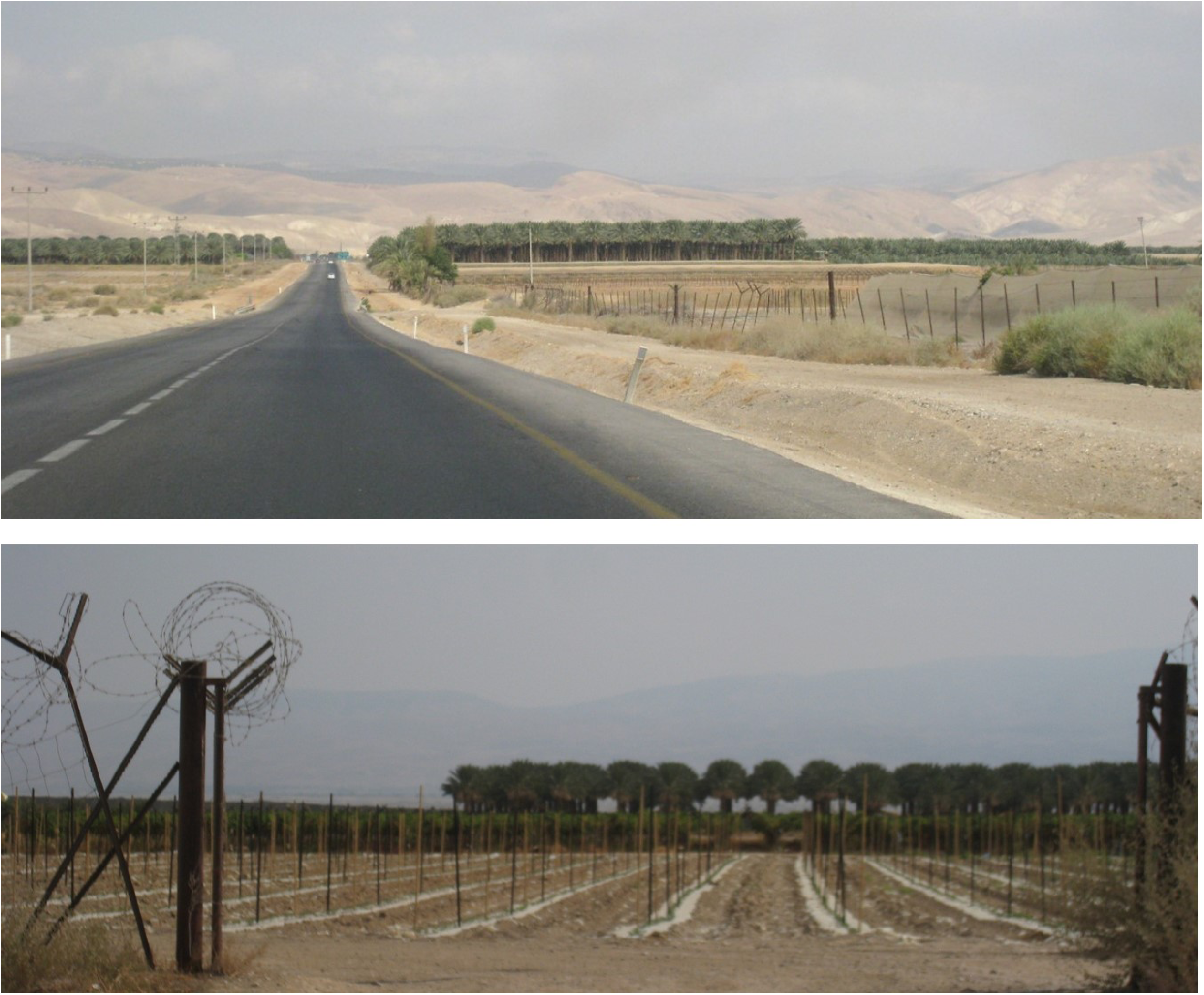
Highway 90 in the Jordan Valley/West Bank. General view with date groves and vineyard. Source: the author.
This segmentation divides the highway into three segments. The northern segment runs from the northern border to the northern Green Line checkpoint, in the Jordan Valley/West Bank (km 366), and has been within the state's sovereign territory since 1948. The middle segment traverses the West Bank to the southern checkpoint (km 258), located north of Kibbutz Ein Gedi, approximately 10 km within the West Bank. This highway segment was formerly under the authority of the IDF civil governor officially in charge of the West Bank. Since 1999, it is under the authority of the PWD/Netivei Israel. 50 The southern segment runs along the southwest part of the Dead Sea and the Arava Desert to the border with Egypt.
This geopolitical segmentation underscores the political-ideological facet of Highway 90, which is inextricable from its route through the disputed territories, therefore conveying a subjective experience of space: for Israelis, the checkpoints merely mark exit points from and entry points into sovereign Israel, which usually go almost unnoticed and rarely interrupt their travel. For Palestinians, however, the checkpoints restrict movement into and out of the Jordan Valley/West Bank, depending on changing restriction policies.
The northwest Dead Sea 1967–1971: The elusive segmentation
The 35 km segment on the northwest coastline of the Dead Sea was constructed between 1967 and 1971 in an area characterised by a dramatic topography of steep fault cliffs and severe geographical conditions (Figure 6). 51 The northern and southern routes were already constructed by 1967, yet the geography of the segment from Ein Gedi to Ein Feshkha was practically insurmountable. After the 1967 war, the state refrained from constructing permanent buildings or infrastructures in the occupied territories (other than for military purposes). However, the outcome of the war appeared to open a window of opportunity for building the missing segment of the road, and achieving a cohesive route from the northern border to Taba and from there to Sharm-el-Sheikh at the southern tip of the Sinai Peninsula where a similar plan was executed.
Northwest Dead Sea segment. Landscape featuring the fault cliff, the Ein Feshkha Spring (upper image), and date groves (lower image). Source: the author.
The idea to build the road was initiated and promoted by senior officials of the Nature Reserves Authority (NRA) who were also former senior IDF officers. Apparently, their considerations encompassed civil, military, and political-ideological factors, no less than the apparent primary focus on landscape and environmental concerns. The work, including a landscape survey and a careful in situ design, was executed as a joint effort of military, governmental, and environmentalist state agents (NRA, IDF, and PWD) supported by parliament members and ministers who frequently visited the site. The popular media celebrated the symbolic connection between Mt. Hermon in the north and Sinai in the south, 52 as well as between historical-national symbols located alongside the road: the world heritage site of Masada, the last Jewish stronghold in the revolt against the Romans (73 CE), and the Qumran caves, where the Dead Sea Scrolls were found. 53 In the road's inauguration ceremony, then-Minister of Labor Yosef Almogi referred to the road as a “Peace Road,” announcing it to be a tribute to the state of Israel on its 23rd Independence Day. 54
The significance of the road's construction is inseparable from the historical moment of connecting the north and the south of the country, while running through the contested West Bank. Thus, the building of the road achieved an apparent territorial integrity, a historical–geopolitical transformation of the route, and the formation of an entire borderoad.
Although this segmentation of Highway 90 consists of three segments, there is almost no concrete sign attesting to the milestone occurrence of its completion. Indeed, this segmentation is elusive, while nevertheless conveying a historical significance. The northern segment extends from the northern border to Kallia and the Ein Feshkha springs along the northwest coast of the Dead Sea. Prior to 1967, this section was partially in Israeli territory and partially in Jordanian territory. The northwest Dead Sea segment forms the second segment, running along the coastline and the steep fault cliffs. The southern segment continues from there to Taba. This perspective underscores the transformation of space after the 1967 war. However, for Israelis, this division is barely noticeable, and travel is seamless. The only reminder of this historical watershed is a land art sculpture titled Even Derech (Milestone). Created by the artist Doron Bar-Adon for the highway's 1971 inauguration, it is situated where the old road to Ein Gedi meets the new one at 246 km.
The primaeval biblical landscape of that segment, along with the careful in situ ecological design and tailored building process, reflects the state's understanding of the intertwining of territorial and military perceptions, 55 while reconciling national perceptions of progress with the sublimity and awe of the landscape. Together, these elements contribute to the formation of Israeli collective memory and national consciousness, offering a unified historical–geographical perception of the road that enhances the nexus of border, nation, and territory.
Historical-synchronic segmentation: Modernism and milestone events 1920–1971
The synchronic segmentation focuses on historical milestones within the space of the route, which shape a perception of these events as neither linear nor diachronic but rather as synchronous. It is comprised of seven segments that string together major achievements in the country's development throughout the twentieth century, which include building agricultural cooperative communities (kibbutzim), constructing infrastructure, and promoting industry. This segmentation underscores the connection between a vision of progress and the national ethos, thus highlighting the merging of technology, high speed, geographical continuity with the nexus of border, nation, and territory. 56
The northern part of the road is divided, as noted, into two segments built by socialist pioneers in the 1920s: from Metula to Tiberias, and from there to Zemach Junction and the nearby industrial zone. The Jordan Valley segment extends from Zemach through the Jordan Valley and the West Bank to Jericho and the Almog Junction with Highway 1, which leads to Jerusalem. It is comprised of sections built by the British Mandate PWD, primarily in the 1930s and 1940s. Here, on the border between Israel and Jordan, at the Naharayim meeting point of the Jordan River and the Yarmouk River, the first HydroElectric Power Station in the region was founded in 1927–1933. 57
The next segment, from the Jericho/Highway 1 junction to the northern Dead Sea, is a short, connective segment, yet is crucial for industry, commerce, and travelling. During the 1930s and 1940s, it connected Jerusalem and Jericho with highly significant sites: the North Potash Factory, the Kallia Hotel, the marine airport, and the nearby Ein Feshkha springs. The abovementioned northwest Dead Sea segment is a pivotal segment representing the country's pursuit of technology and progress, enhancing highly dominant ideas of speed, flow of movement, and national power, as embodied in the state's vision of a highway with no stops. The southwest Dead Sea segment, running from Kibbutz Ein Gedi to the Arava Junction, celebrates the state's vision of intertwining industry, tourism, infrastructure, and the territorial and ideological materialisation of modernist ideals. The remains of the old South Potash Factory and its workers camp, dating to the 1930s, has become a national symbol, representing both the modernist vision of man conquering the desert, and the last Israeli stronghold during the 1948 war. Lastly, the southernmost segment leads to Eilat, once a remote point and now an escapist, would-be Las Vegas on the shore of the Red Sea. Viewed together, these segments address the history of the state, showcasing modernism's gradual materialisation as an integral part of the country's legacy. 58
The borderoad landscape segmentation: A synthesis
Seeking to enfold the intricacies of the borderoadspace introduced thus far, the synthesis segmentation identifies four main sections of the route and eight subsections. It encompasses historical–geopolitical aspects and regional–geographical ones while stressing landscape characteristics that reflect these aspects as a manifestation of the borderoadscape idea.
The Galilee segment, spanning approximately 74 km, extends all the way to Zemach. This entire segment is populated by small rural settlements and kibbutzim (mostly est. in the 1920s–1930s), the border town of Kiryat Shmona (est. 1949) in the north, and Tiberias by the Sea of Galilee. It includes three distinct geographical subunits that vary in terms of historical–geopolitical context as well as in terms of landscape, geology, geography, and topography. The Upper Galilee section features a pastoral agricultural landscape, which for the most part is an extensively developed modern highway. However, similar to many roads in the Upper Galilee that are close to the border, various sections of Highway 90 are lined with rows of towering Eucalyptus trees, mostly planted in the 1950s. Clusters of Eucalyptus trees have become a landscape characteristic of roads along the borders, since they were planted to obscure the roads from enemy eyes across the hostile border (Figure 7). 59 A short connective section that is approximately 6km long cuts through the mountain cliffs from the Amiad Junction, descending down to the Sea of Galilee from an elevation of 200 m above sea level to 200 m below sea level at the Capernaum Junction. From this section onwards, the highway is mostly a two-lane road. The Sea of Galilee section is characterised by a lush landscape of mature date palms, mango, and avocado groves. The scenery of the Golan Heights to the east, on the opposite side of the Sea of Galilee, captures the history of this region, which endured Syrian hostility until 1967. Eucalyptus trees along the Sea of Galilee segment also played a role in shielding the roads from the view of enemy observers across the border. Although the physical presence of the border has become a distant memory, the landscape operates as a constant reminder of the area's history and fragile geopolitical status. The presence of the eastern border becomes more evident in the following segment, as one heads south from Zemach, where the border is merely a few kilometres from the road.
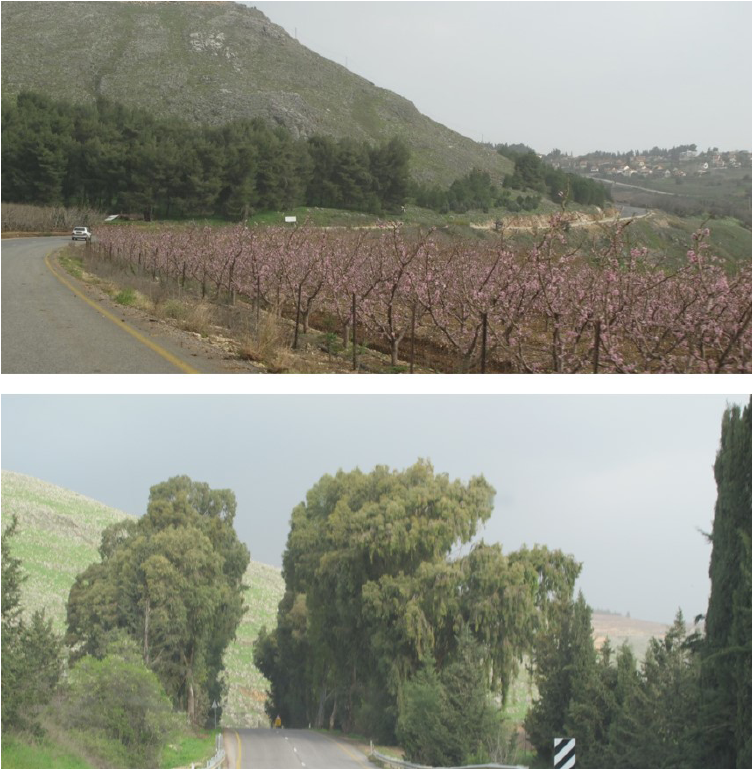
Highway 90 in the Upper Galilee: Fruit groves (upper image) and Eucalyptus trees (lower image) nearby Metula. Source: the author.
The Jordan Valley segment of the highway, which is approximately 120 km long, encompasses the entire geographical expanse of the Jordan Valley, which is marked by the Israeli-Palestinian conflict. Its two subsections are characterised by dramatic changes in climate and geography, and no less dramatic geopolitical ones. The Jordan River's winding course acts as a natural border throughout the Jordan Valley; albeit rarely visible due to the region's topography, it is deeply ingrained in Israeli national consciousness. 60 The upper Jordan Valley, situated within Israeli sovereign territory, is distinguished by its thriving agriculture, date groves, and veteran kibbutzim. Heading southward, one encounters the geopolitical periphery of the country – settlements established in the 1950s, mostly for low-income immigrant populations, including the town of Bet She’an adjacent to the renowned archaeological site Scythopolis. These settlements were strategically developed to define and protect the state's eastern border, continuing to safeguard it today. Here as well, the highway serves the dual purpose of connecting these settlements, while operating as a spatial-territorial statement concerning the nation's border and territory.
Heading south into the lower Jordan Valley, the two-lane highway draws increasingly closer to the eastern border, sometimes extending just several dozen metres west of it, as one crosses the Green Line checkpoint, entering a twilight zone of conflicts over sovereignty and political entanglements. This desert's-edge landscape is composed of controversial Israeli settlements established after the 1967 war, Palestinian villages – both those recognised by the State of Israel and unrecognised ones, old minefields, military firing zones and restricted military zones along the route. The agrarian scenery similarly reflects the entangled territorial conflict: controversial Israeli cooperatives of date groves and vineyards (Figure 5), modest Palestinian plots in the vicinity of villages, and larger Palestinian plots of dates near Jericho. 61 East of Jericho lies Qasr el-Yahud, a Christian baptismal site on the Jordan River, surrounded by a surreal ruinscape of ancient monasteries and minefields. 62 Throughout the West Bank, the highway runs mostly through the C Zone, which is under full Israeli control. In the Jericho region, however, it runs adjacent to the Palestinian A zone, briefly passing through the Palestinian village of Al-Auja. At this point, while both sides of the highway are under the control of the Palestinian Authority, the highway itself is under Israeli control, often supervised by an IDF presence.
The Dead Sea segment spans approximately 100 km and is divided into two sections – outside and inside the Green Line. It is imbued with contradictions and tensions characteristic of the borderoadscape, and is marked by the environmental crisis of the Dead Sea region, where the landscape of the fault cliffs reveals the ecological catastrophe – a receding water level and sinkholes.
The northern segment commences at the Lido Junction at the northern end of the Dead Sea, the site of the Jordan River's modest estuary, hinting at the nearby border and at the area's character as a sensitive military zone (Figure 8). Within the landscape of fault cliffs and date groves, this section is characterised by a conflation of national-historical sites and a scenery of ecological collapse: the national-archeological heritage site of the Qumran Caves, situated on the cliff above the road; the ruins of the North Potash Factory and the remains of a pioneering workers community; the remains of the old Kallia Hotel; former Jordanian and British military camps; and the remains of recreational beaches, all but one deserted due to the environmental crisis of water-level recession. Although the ecological collapse is not restricted to the coastline, it has deeply affected the route along the Dead Sea. The multiplying sinkholes endanger highway safety and demand innovative engineering solutions, therefore significantly impacting the route and landscape along the Dead Sea. Over time, the interplay of historical–geopolitical conflicts, ecological catastrophe, and persistent military unrest has left this section with a surreal borderoad ruinscape (Figure 8).
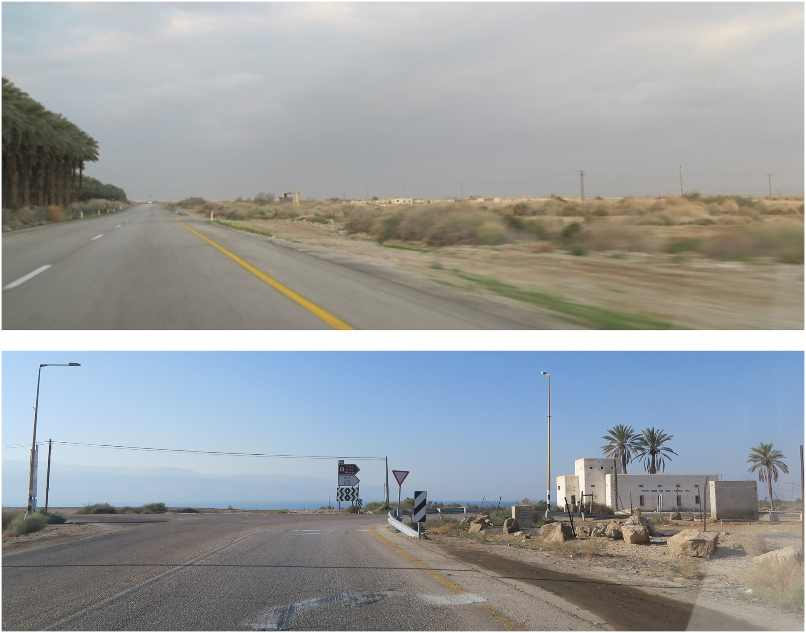
Highway 90, the northern end of the Dead Sea: View of date groves and a former Jordanian military camp (upper image); view of the Lido Junction, Jordan River estuary and the remains of the pre-state Jewish community buildings (lower image). Source: the author
The southern checkpoint near Kibbutz Ein Gedi marks the return to sovereign Israeli territory. A short distance away is Masada, one of the country's most powerful national symbols. 63 The landscape of this section is punctuated by hotels and commercial tourist sites, the contemporary Potash industry zone built in the 1950s, with its geometrical evaporation salt pools, the remains of the old Potash Factory and the nearby ruins of the worker's camp built in the 1930s. The highway's route along the Dead Sea fluctuates between relatively low elevations at the Dead Sea level and mountainous sections, reflecting the variations in water level that led to the route's topographical changes over the years. 64 The presence of the maritime border along the Dead Sea is maintained by means of occasional signboards, remnants of old minefields, and various lookouts offering views across the border and the Dead Sea. This conflation of historical sites, tourist attractions and a sublime landscape suffused with Israel's national ethos gradually dissolves into the moon-like terrain of soft marl hills as one departs from the Dead Sea and enters the Arava Desert.
Along the Arava Desert segment, approximately 183 km. in length, the rift widens towards the south, and the landscape changes into dark granite mountains. A few kibbutzim and small agrarian communities are scattered along the desert highway in a recurring scenery of vast date groves, perpetuating the agricultural landscape along the entire route. Established beginning in the 1950s, most communities began as military-agricultural NAHAL (Pioneering Combat Youth) programmes. As in the northern Jorden Valley, these outposts were originally intended for border maintenance, successfully defying the harsh climate and severe environmental conditions, and ultimately becoming kibbutzim and other permanent communities. Here too, Highway 90 functions to link the settlements, while also serving as a mechanism for border and territorial maintenance.
The borderoadscape segmentation thus stresses the synthesis of landscape and space into a sort of palimpsest reflecting distant and recent histories, geopolitical conflicts, politics and ideology, and their role in the overall evolution of the highway.
Discussion: Five historical–geopolitical themes concerning the borderoadspace
The dynamic history of regional conflicts includes peace treaties, wars, armistice agreements, continuous military tensions, and the apparent normalisation of Israel's occupation of the West Bank, which resonate in the space and landscape of Highway 90 and shape its perception. The synchronic formation of the highway and its segments influenced the course of the route, while reflecting the historical course of the country, its borders, and its transportation network. As the only highway that traverse the entire country, its evolution cannot be disentangled from the geopolitical events that affect the state's space and borders; nor can one ignore the multiple functions and meanings of an infrastructure in a charged geopolitical space vacillating between war and peace.
The article demonstrates that the analytic act of segmenting the highway is not only a methodological means, but also a way of conveying multiple spatial-historical perceptions that operate simultaneously, while revealing that no single historical perspective of segmentation is more dominant or significant than the others. The segmentations articulate perspectives that do not diminish or negate one another, but rather bolster the idea that the borderoadspace is a realm of multiple historical perspectives. They also imply that past and present are intertwined, and that the geopolitical history of the highway continues to contribute to its making. This brings to mind the concept of historical metachronism, which can serve to conceptualise temporal and spatial multiplicities that defy diachronic paradigms, thus enabling us to simultaneously perceive the multiple layers of the route. 65 The analysis suggests that segmentations are centred around five historical–geopolitical themes that resonate with one another. The concept of the borderoad encapsulates these core issues.
The route as a segmented whole
Segmentation is a prominent feature of Highway 90. However, as previously mentioned, the route was only completed in 1971, and was officially designated as “Highway 90” by the end of the 1970s, solidifying its status as an entire route. The highway's evolution as a cohesive entity thus gives rise to a dialectic tension between segmentation and wholeness.
The critical discourse on highways and roads has already elucidated their national significance. 66 Edensor underscores the notion of “national spatialisation”, linking motorscapes and the formation of collective consciousness and national identity. 67 He stresses that “Modern nation-building entails the incorporation of internal differences, so that whatever regional and ethnic differences may pre-date the nation formation they all become subservient to, and part of, the greater nation identity”. 68 Furthermore, he argues that “Local differences are absorbed into a ‘code of larger significance’”, stressing that regional specialty is perceived as part of national diversity. 69 Understanding the highway as a segmented whole further manifests Edensor's idea, since the segments of Highway 90 pertain to geopolitical core events in the state, the nation, and the region's history. These events crafted the hybrid military–civilian character of the road, playing a significant role in the formation of national identity. Recurrent landscape performances further enhance this dialectic between the segments and the whole: date groves along the route (Figures 5, 6 and 8), as well as occasional border signs that indicate its proximity. Banal traffic signs indicating place names, directions and distances also enhance national spatialisation, shaping the perception of a coherent route composed of segments. 70
The military–civilian character of the route and the border as meta-narrative
The history of the state's motorway network, together with the short biography of the highway, indicates their military–civilian character since their modern inception in the British Mandate period, and demonstrates the entanglement of the highway and the border, including the contested Green Line. The idea of the borderoad implies that the border and the highway do not represent a stark dichotomy between civilian and military spaces; rather, they demonstrate their dialectical intertwinement. The inquiry suggests that the highway operate as a means of connecting border settlements and military border zones while seizing territory and maintaining the frontier. As such, it is a materialisation of the state's agenda of maintaining the land, while serving both military requirements and political-ideological purposes. Consequently, the highway operates as a linear, semi-civilian and semi-military space that reflects a more general characteristic of Israeli space, landscape, and society. 71
The analysis demonstrates that each of the five outlined segmentations addresses the notion of the border's presence in space and in the landscape, thus revealing it to be a meta-narrative of the route. As Israel's easternmost route, Highway 90 possesses significant civilian and military importance, which renders it equally vital in times of war, armistice, or peace, while highlighting its territorial significance. The highway therefore operates as a symbolic border. 72 Once it was completed, enabling apparently flawless, non-stop travel from north to south, Highway 90 also became a borderoad that links the state's northern and southern borders, while tracing its eastern border and connecting towns, kibbutzim, and agricultural settlements along it.
In this context, the blurring of the Green Line is revealed as a recurring theme, despite the deep political divisions within the Israeli society. Since 1967, it has been expressed through practices and mechanisms that are manifested in the borderoadspace and borderoadscape: the northern and southern checkpoints which restrict mainly Palestinians; the recurring performance of date groves along the whole route in and out the West Bank; everyday road signs that enhance the Israeli presence while demarcating territorial continuity; 73 and military zones along the route. 74 Moreover, as argued in the analysis of the second and third segmentations, the borderoad forms a coherent continuum, and is therefore itself a mechanism that blurs the Green Line. While some of these practices are explicit, others are subtle and implicit, appearing as seemingly banal.
The reflection of the historical military and geopolitical conflicts of the region, and the conjunctions of time-space within the geopolitical context
Throughout the article, the inquiry stresses the entanglement of historical–geopolitical aspects and their materialisation in the contemporary route, space and landscape of Highway 90. The five conceptual forms of segmentation mainly derive from the evolution of the route that was – and still is – subjected to military, territorial, and political conflicts. The first segmentation provides a context and point of reference for the other four segmentations, which refer to historical, spatiotemporal aspects of the route, and the vacillation between peace and war. The second, third, and fourth segmentations stress spatial perceptions that refer to geopolitical historical occurrences, while the fifth suggests a synthesis that concerns the reflections of these occurrences in the landscape. The conjunction of past and present, the contemporary and the historical, is facilitated by the fact that while Israel is a young state established only in 1948, its history is rooted in both the ancient and the recent past. This historical inquiry is thus an inquiry into current history, a history of the present.
Summary and conclusion
The article inquires the evolution of Highway 90 as a borderoad that operates as a segmented whole. The evolution of Israel's motorway network, the short diachronic biography of Highway 90 and the overview of the highway and the state's border, contextualises the current history of Highway 90, stressing the intricate convergence of time and space. The analysis conceptualises five perceptual segmentations concerning historical–geopolitical aspects of the borderoadscape and borderoadspace. These segmentations operate not only as an analytical tool and methodological approach; taken together they manifest the multiplicity of the route, reflecting its layered histories and the region's persistent conflicts.
Addressing the borderoad landscape and space through perspectives pertaining to current geopolitical history, the discussion demonstrates that Highway 90 is characterised by a dialectic tension pertaining to its military–civilian character and to the border as the meta-narrative of the borderoadspace. The inquiry thus highlights the borderoad as an infrastructure that conveys national symbols and operates as a means of national spatialisation, shaping national–territorial perceptions and contributing to the cultivation of the nexus between border, nation, and territory. The notion of the segmented whole encapsulates the idea that the route complies with the transformation of its space. The recurring outbursts of geopolitical conflict demonstrate that past and present are powerfully intertwined, underscoring the significance of this inquiry as an examination of contemporary history.
Footnotes
Declaration of conflicting interests
The author declared no potential conflicts of interest with respect to the research, authorship, and/or publication of this article.
Funding
The author received no financial support for the research, authorship, and/or publication of this article.