
Abstract
The bastides of Languedoc form a significant sector of medieval urban history, yet their descriptions are often clouded by conflicting opinions and anachronistic views. This article aims to clarify some of the confusion about the word “bastide” through an etymological study and examination of charters in which the word was first used to designate new towns. The economic and political contexts preceding the bastide foundations are equally important. The bastides did not appear in southwestern France as an ex novo phenomenon ; rather, they followed on the heels of experiments in residential development and in a monetary economy that had been ongoing for two centuries by the counts of Toulouse.
Introduction
The significance of the bastides of southern France derives from the phenomenon of their numbers—hundreds were established within a century in a distinct region—and from the fact that most of them brought new types of benefits to both their inhabitants and their founders during a period of growth and change in western Europe. A general and simplified definition is that bastides were new towns established between 1250 and 1350 in the Southwest of France containing some common characteristics: fortifications, unique legal privileges, the paréage, a contract between two parties at the time of foundation or charter, and a gridded layout with a marketplace at its center. 1 There is much more to the story, however, and this article aims to clarify some of the confusion about the word “bastide” and to show that these towns did not appear in southwestern France as an ex novo phenomenon in the fourteenth century, as one is sometimes led to believe, but that they followed on the heels of experiments in residential development and in a monetary economy that had been ongoing for two centuries. Past studies have often been form-based, but here I wish to stress the documentary evidence, which shows us that the early stages of the phenomenon represented a gradual sea change in relationships between lords and commoners. The economic and political contexts preceding these town foundations are critical to the story and deserve more attention, as do the etymology and the charters in which the word “bastide” was first used to designate a new town. These written sources show us that the term “bastide” was quite variable and also that it never appeared in the charters of many of the towns considered bastides in contemporary texts.
These above-referenced experiments occurred in the territory controlled by the counts of Toulouse, beginning in the twelfth century, along the Garonne, Aveyron, and Tarn River corridors. The development of these settlements was interrupted by the Albigensian Crusade but was resumed in the 1220s by Count Raymond VII of Toulouse and by his lieutenant Sicard Alaman. They took the form of new town foundations or the re-definition of existing settlements through the instruments of charters. Key elements of these charters were the provision for houses and lots of equal dimensions; the provision for a body of consuls, sometimes elected by town citizens; and an emphasis on commercial activity signified either by extensive items regulating fees for specific goods sold at market or by mention of marketplaces. It is also in these charters where we find the first use of the term “bastide” in reference to a town, rather than to a fortified habitation.
The term “bastide” enjoyed numerous applications and manifestations in medieval Languedoc, and it has enjoyed as many or more interpretations in subsequent scholarship. French historians began writing about bastides in the seventeenth century, and although most of them were concerned with depicting bastides as extensions of seigneurial power, some puzzled—understandably—over the use of the term and its meaning. 2 Eighteenth-century historians of bastides were more concerned with concepts of municipal governance and the grid as an expression of democracy, an idea which maintained its popularity into the twentieth century. 3 The 1700s were also a time when the discovery of medieval documents and the creation of archives resulted in some remarkable compilations of original sources—the Histoire Générale de Languedoc being foremost in this regard. 4 For the nineteenth century, Baron Haussmann’s words to Napoleon III were a succinct expression of the larger interest in medieval settlements and architecture as expressions of national identity: “[The] persistence of a Sovereign to search within the past for an explanation of the present and for a preparation for the future is the highest expression and the most striking manifestation of modern tendencies.” 5 Nineteenth-century views of bastides were extensions of those germinated in the eighteenth century, reinforced with floods of archival material to show them as models of order and productive rural life. The “perfection” of the grid became increasingly important. 6 This focus shifted in the early twentieth century when Henri Lavedan created a typology of form and praised the attributes of bastides with irregular forms, borrowing from the work of Camillo Sitte, which emphasized the value of the picturesque in urban layouts. 7 The turn of the century was a time when cities were growing rapidly, and the study of urban design was closely related to theories of application. This is the point at which bastides entered the lexicon of studies written in English. But to conclude with French historians’ work, in the mid-twentieth century, coinciding with the emphasis of the Annales school on local and rural history, historians of bastides eschewed generalizations in favor of specific and comprehensive contextual presentations. One of the most notable scholars of bastides in this period was Charles Higounet. 8 His legacy continues in the work of many scholars whose work is key to an informed view of bastides in the twenty-first century. 9
“Now the history of urban form can be used as a design quarry . . .” 10 : Spiro Kostof wrote this as part of the “Introduction” to his book The City Shaped in the late-twentieth century, and that is exactly how bastides became part of the English lexicon in the early years of that same century. It is probably Thomas Frederick Tout who can be credited with introducing an English-reading audience on the bastides in his lecture on “Mediaeval Town Planning” in 1917, shortly after the Housing and Town Planning Act was passed in Great Britain (Figure 1). 11 Subsequent works in English up through the 1990s, whether works of history or theories of application, usually cited Tout for information about bastides and, after 1967, Beresford. 12 Maurice Beresford’s work was by far the most detailed, using archival material to describe the bastides of the English kings in England, Wales, and Gascony, and it was he who limited the definition of bastide to towns on the continent because he found no instance of the word in the English documents. 13 Since then, several scholars writing in English have included bastides in their discussion of urban history and/or form. 14
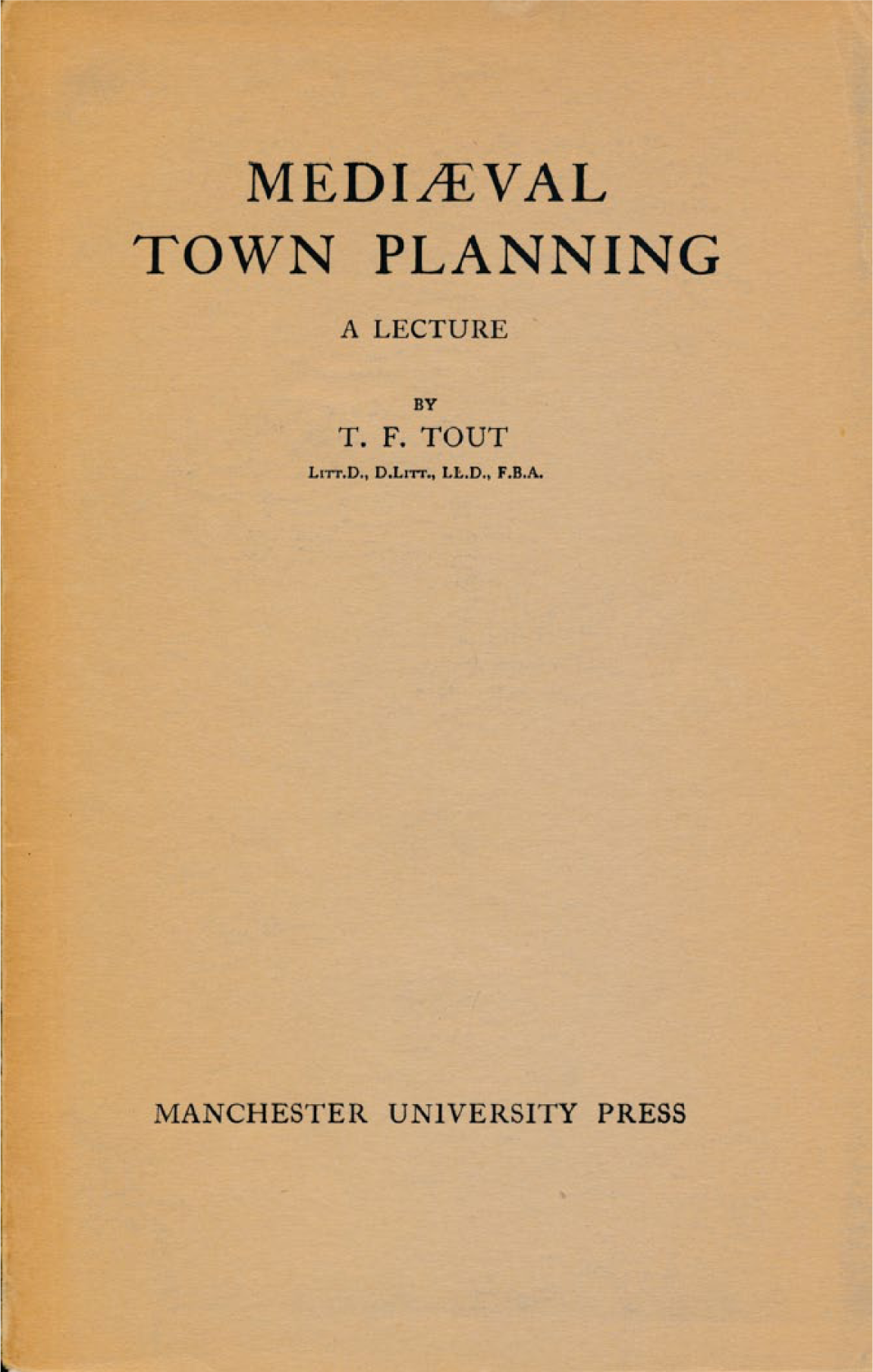
The cover of T. F. Tout’s “Mediaeval Town Planning,” published by the University of Manchester Press in 1948.
Still, the fact remains that it is difficult to define the bastides. The English texts understandably rely on French sources, but French studies make it clear that scholars of the native soil struggle for clarity as well. “The bastide is a symbol, because it has gradually become an abstract image of a thing that only rarely existed in its entirety.” 15 Thus, Florence Pujol introduced his historiography of the bastides in 1991. Since that time, another factor has begun to contribute to this abstraction: the role of the bastides in the tourist industry in the Southwest of France. 16 There are now “Circuits of Bastides” publicized for eight French départements, driving tours that include towns designated by roadside signs as bastides (Figure 2). 17 These road signs sometimes contain a simple and powerful graphic that reinforces the association of bastides with a grid layout, one of the four symbolic characteristics described by Pujol. This iconic shape is reflected in the layout of only about 5 percent of the roughly three hundred towns considered bastides (Sauveterre-d’Aveyron, Grenade-sur-Garonne, Mirande, and Montpazier are a few of the best-known examples). 18 Yet the grid is probably the most problematic element, as it has been used to make such contrasting analyses. For some writers the grid served as a sign of a democratic process, but for others it was a symbol of authority and an imprint of power. 19 Regardless of interpretation or incidence, the grid remains a compelling form, the focus of at least two sizeable publications about bastides. 20
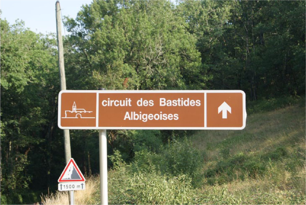
Publicity for the Circuit des Bastides in the Département of Tarn (photo by author).
Other factors contribute to the complexity of the problem of definition. There is the geography. Bastide towns are found spread over an area of fourteen départements in the South of France (Figure 3), which total about eighty-eight thousand square kilometers or thirty-three thousand square miles (about the size of the state of Maine in the northeastern United States). The topography of this area includes the alluvial plains on either side of the Garonne River, the gentle rolling, or vallonée, landscape of the lower Tarn valley, the steep slopes of the Pyrenees, and the limestone buttes and mesas of Quercy and of Périgord. The variety of this topography suggests equally variable forms for settlements and buildings and for their regional economies.

Map of France showing the fourteen départements (shaded) containing bastides described by contemporary authors.
There are the founders and their political histories. In general, bastide towns were created between 1249 and 1350, during a period of relative peace in the South. The list of founders includes forty-eight French alone: two princes, five kings, four counts and one countess, eleven royal or princely representatives, seven local lords, and eighteen religious establishments including the Knights Templars and the Hospitallers. 21 In England, four king-dukes and their representatives were involved in founding or chartering towns as bastides in Gascony between 1259 and 1350. 22 Foundation motives varied considerably. Many bastides were founded for commercial profit—the largest number of foundations coincide with the explosive growth of the wine trade in the late thirteenth and early fourteenth centuries—but it is also the case that many of those founded after 1270 in Gascony were established as markers of the territorial tensions between the English and the French. As always, there are exceptions. Both Montauban and Castelnau-de-Lévis (towns that became bastides by name years after they were established) are located in the eastern sector of the range of bastide foundations, but the motives for their foundations were different: Montauban was founded in 1144 to compete with the commerce of a nearby town located next to a confluence of rivers, whereas Castelnau-de-Lévis was founded in 1256 to establish a frontier presence for the count of Toulouse. One little-discussed means of foundation is by the accumulation of property confiscated from those considered heretics. Although most often these confiscations were individual pieces of property, there is at least one instance of an entire village being seized (Salles-sur-l’Hers). 23
There are multiple charters of customs. Although the definition of a bastide has often been linked to the idea of a “new town,” in fact many towns chartered as bastides were existing small settlements, and the charters designating them as bastides were sometimes simply confirmations of earlier charters. 24 The largest wave of this re-naming occurred when Alphonse de Poitiers assumed the role of the count of Toulouse in 1249. Not only did he found new towns as bastides but he also re-chartered existing towns that wanted the status and benefits found in the bastide charters. 25 Especially in the years 1268-1270, the count was petitioned to re-charter towns as bastides, for which act he charged a fee or was gifted with land. 26
These variables are intimidating and defy attempts to craft a summary definition of bastide. The name bastide may have been a buzzword conferring status on towns and villages just as the term “New Urbanism” was used to attract people to newly built suburbs in the 1990s. 27 And just as towns billing themselves as belonging to the New Urbanism movement vary considerably from the original model (Seaside, Florida) depending on the site and the developer, the bastides were equally variable expressions of local geography and politics. Yet there are elements that can form a foundation for definition, and town charters are a good place to look for them. 28 It may be appropriate to limit the definition of “bastide” to the term “bastide charters,” since the use of the term in a charter leaves us no doubt that some medieval mind identified the town in question as a bastide, even as that term had variable meanings in its day. Charters take many forms, but the focus here will be on nine town charters that are associated with Raymond VII and his lieutenant Sicard Alaman in the first half of the thirteenth century, because it is in these charters where we find commonalities reflecting the institution of municipal self-control that was a peculiarity associated with counts of Toulouse, the growing reliance on a monetary economy, and a new emphasis on commercial activity—all attributes which will characterize the numerous bastide charters of subsequent decades. In addition, we will find specifications for equal lot parcel allotments in these charters, a practice that had its origins in the sauvetés of the eleventh century. These allotments and their associated taxes (or relief therefrom) were often the headliners of the charters, suggesting their importance as promotional hooks for prospective inhabitants. But before we examine the roots of this development and the charters themselves, let us look at language.
Etymology and Historical Summary
The medieval Latin word bastida, which is translated to bastide in French as well as English, was, like many medieval Latin words, an amalgam of a vernacular root and a Latin ending. 29 The Oxford English Dictionary (OED) entry for bastide defines its origin in Old French, an adaptation of Provencal, and a noun from the feminine past participle of the verb bastir meaning “to build.” The first definition of the word “bastide” is (1) a. A bastel house or fortlet; b. a temporary hut or tower erected for besieging purposes; and the second is (2) a country house in southern France. 30 The word bastille, whose origin is cited as adopted from French but also late Latin (as bastilia), is defined as (1) a tower or bastion of a castle, a fortified tower, or a small fortress; (2) spec. in siege operations, a wooden tower on wheels for the protection of the besieging troops or one of a series of huts, surrounded by entrenchments, provided for their accommodation; (3) name of the prison fortress built in Paris in the fourteenth century and destroyed in 1789; (4) by extension, a prison. 31
The derivation for the word bastille from late Latin is obscure, although there are related words in the etymological family. Both bastaga (or bastagia and basterna) are related to the containers built to transport baggage or persons, those for persons being “enclosed on all sides,” much as the later bastille was physically protected on all sides, either by a wooden palisade or by being situated on a high hill. 32 Antoine Furetière (1619-1688) placed the word “bastide” in a family containing bastir and bastille and related to the Latin bastiae, a term he defined as meaning “towers for defense.” 33 The word bastille is found in documents from many parts of France, but “bastide” seems to be unique to the South. Furetière described it as a synonym for villa or domus that has been applied to country homes for recreation in Provence as well as to forts. “Forts were called bastides, or bastilles. They were also called populationes, from the Latin word populatio or populates, that is to say the opposite of what one normally understands of them.” 34 This is because the word populatio in Latin refers to “a laying waste, ravaging, plundering, spoiling, or devastation,” as does the word populates, although the word populus refers to people, as well as to regions and districts. 35 This contradiction might be explained by the developmental idea from Roman use that land must be cleared—akin to the activity of “laying waste”—before it is built on. 36 Other words that were often used synonymously with bastide include castrum, stare (medieval Latin for “residence”), and turris, the Latin word for tower, although villa was still one of the most frequently used synonyms. 37 Carcassonne was described as a villa in the seventeenth century even though the word bastida is present in its medieval documents. The word villa seems to have been a popular choice simply because of its ubiquity and familiarity. 38 Recently, scholars have worked to clean up this etymological confusion, and discussions about bastides are cradled within a larger context that includes many other terms, such as ager, burgus, castrum, diocesis, episcopatus, pagus, parochia, saltus, suburbium, terra, vicaria, and villa. 39 This awareness of such a multiplicity of terms helps us to avoid the tendency to generalize settlement patterns.
To return to the term “bastide,” its earliest use seems to occur in the late twelfth century in the Southeast. Its use then spread to the West, and its meaning shifted during the thirteenth century to approximate the contemporary concept of a new town or settlement. The earliest use of the word was associated with defense, and dictionary and encyclopedia entries have overwhelmingly favored defensive associations with the word, which is probably why so many scholars have assumed that bastide towns were fortified. One of the earliest uses of the term is found in a document of 1180 from the region near the Italian border, which mentions a bastide at the edge of the “Pogliola torrent.” 40 This bastide was probably a single structure, as were most of the bastides in Provence and to the North of Provence. 41 But bastides were not always single defensive structures. They could also be agricultural complexes or villages that had developed over time. 42 Some evidence for this mix is found in the inventory made for Charles of Anjou in 1252 and 1278 of his newly acquired property in Provence, which listed a tiny number of bastides—fourteen—out of more than three hundred castra. These bastides were usually described as a bastide or a castrum; for example, In castro Archaudi seu bastida (Entry 514). Whether castra or bastides, these settlements could be either an isolated building or a small village. 43 In Provence, these bastides remained isolated structures or small pre-existing towns, and during the fifteenth and sixteenth centuries the nomenclature shifted to reflect residential use alone. Turris sive bastida became domus sive bastida or mayson sive bastida with both domus and mayson signifying a singular structure. By the eighteenth century, many of these isolated sites had been turned into recreational farmsteads and were so popular that in September of 1737, the Bishop of Marseille wrote to his bailiff to complain that progress on administrative matters had halted because all the businessmen of the town were amusing themselves at their bastides. 44
In the West, the word “bastide” meant a defensive site as well, being synonymous with munitiones or forcias in texts in the early thirteenth century. In a Carcassonne register from 1204, license was given to build bastides for fortification purposes (Licentiam damus ut in locis idoneis quos elegeritis infra terminum praedicti pignoris, possitis novas Bastidas sive munitiones aedificare.) 45 In 1211, again at Carcassonne, Raymond Trencavel surrendered all his rights—in the “cities and suburbs, in the castra and villages, in the forts and bastides, etc.”—to Simon de Montfort . . . omnibus aliis locis, videlicet in civitatibus & burgis, in castris & villis, in forciis & bastidis, in hominibus & feminis, in fermantiis & justiciis . . . 46 Here, forciis and bastidis can be understood as synonymous, and similar to the word munitiones, used in a defensive context. 47 In 1222, the chronicler Guillaume de Puylaurens described the capture of a bastide belonging to Doat Alaman (bastitam Deodati Alamani et munitionem qui ibi erat). 48
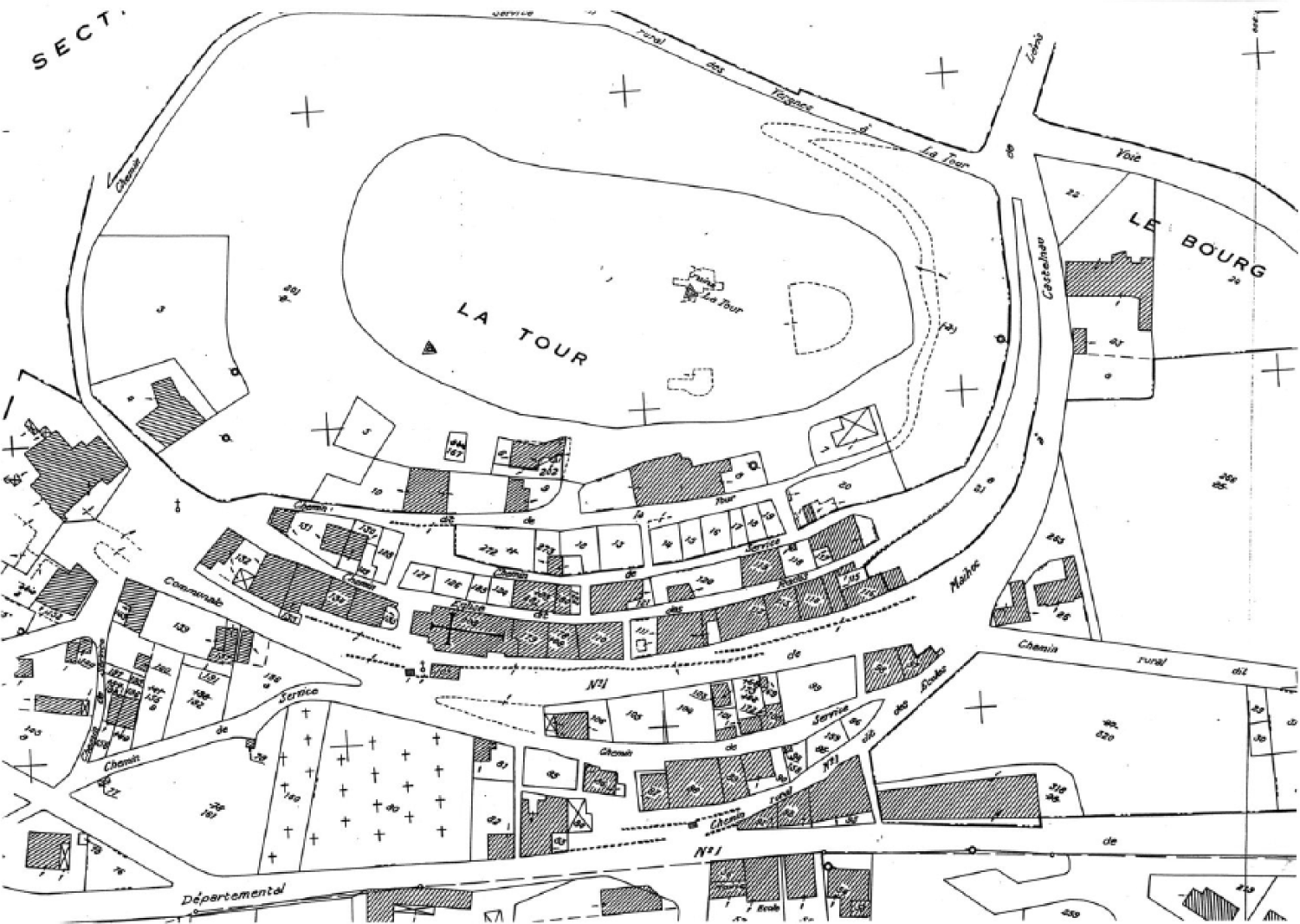
In 1222 also, Raymond VII founded the castrum of Cordes, and this castrum was later called “the first bastide” by Odon de Saint-Blanquat for reasons that are still unclear. 49 Perhaps it was the drama and beauty of the town and site that contributed to Saint-Blanquat’s election of Cordes, along with its commercial success and the unusual size of its market halle built in 1273. This castrum, the archival documents of which have never seen the term “bastide” grace their parchment pages, is a good example of the confusion surrounding the definition of bastides. 50 Cordes retained its status until about 2002, after which time it was reclassified as the castrum it is by the Centre d’Etude des Bastides. 51 The first bastide is now considered to be Lisle-sur-Tarn, also supposedly founded by Raymond VII shortly after signing the Treaty of Paris in 1229. 52 Unfortunately no charters for this town have yet been found dating before 1462, and the status of Lisle-sur-Tarn as the first bastide is equally dubious as that of Cordes, as its fifteenth-century charter does not list it as such nor do other medieval documents. 53 The form of the town, however, suits the archetype of the bastide quite well: it has a large, square central marketplace from which a rough grid is generated (Figure 4). The marketplace is notable in that it has almost exactly the same dimensions as that of Montauban, a villam (town) founded by Raymond’s ancestor Alphonse-Jourdain in 1144.
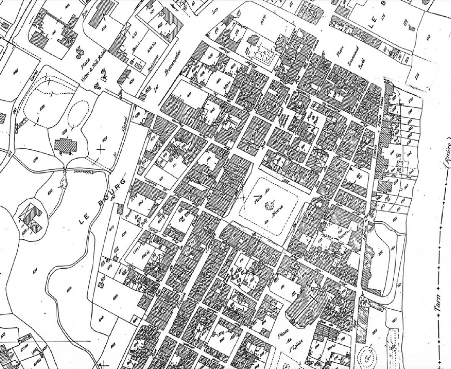
Cadastral plan of Lisle-sur-Tarn.
Let us abandon the search for the first bastide as a new town and admit that the chimera does not exist! However, we can safely say that the word in this context—that of a new town—does appear in charters of the 1240s, and the concept was at least in one case associated with the idea of generating revenue. 54 The earliest link between the word bastida and new town foundation seems to occur in two of the charters—those of Bouloc and Montastruc, both issued in 1242 by Sicard Alaman. These references, however important, are subtle, and it won’t be until after 1249 when Alphonse de Poitiers became the titular count of Toulouse that the word bastida is found in new formulas throughout the West, for example, as a bastida seu munitiones or as a bastida seu populationes. 55
Alphonse de Poitiers (1220-1271) is a key figure in the history of bastide charters. He was the brother of King Louis IX and the titular count of Toulouse from 1249—the year that Raymond VII died—until the year of his own death. 56 After the death of Raymond VII, one of the main ways in which Alphonse established his authority in the South was through town foundation and the issuance of charters. Happily, we have extensive records of his correspondence with his seneschals and others who acted in his absence (he visited Toulouse on only one occasion), and thus, we can read about his bastides, notably as the foundations of his officers starting in the year 1255. 57 These acts include not only new foundations but also the issuance of new charters for existing towns and acts of merger. They also include issues related to tiny settlements called bastides that would not satisfy anyone’s definition of a market town. 58 The other helpful document we have for lists of bastides is the Saisimentum, a compilation of acts and lists made shortly after Alphonse’s death, which includes an inventory of the towns under his control, listing them by type (common examples are villa, castrum, and bastida). 59
In these references to the bastides of Alphonse, the word munitiones, which disappeared after his death, is misleading. It was probably a holdover from earlier usage, because very few towns were concerned about active fortifications in the second half of the thirteenth century. 60 However, many charters required townspeople to either build walls and gates or to be taxed for them, and because these building projects were so expensive, very few new town foundations in the first three-quarters of the thirteenth century had walls. 61 In fact, simply by constructing contingent houses at the perimeter of the town in such a way so that their most private walls faced outward an effective barrier was formed. Gates, however, were more frequently built because they served as a means of defining jurisdictional boundaries and checkpoints for tax and fee collection, and not the least, they were important symbols of power. Town gates are probably the most frequent image found on consular seals of this period. 62 All of this changed after 1279 where tensions in certain areas leading to the Hundred Years War put a new set of priorities in place.
The number of bastide foundations increased significantly in the latter years of the thirteenth century and the first half of the fourteenth century. In France, both Philip III (1270-1285) and Philip IV (1285-1314) founded several, and the English kings began their foundations shortly after the deaths of Alphonse de Poitiers and his wife Jeanne (they died within three days of one another in Sicily on their way back from Crusade in 1271). This event triggered the transfer of the Agenais lands, which had been part of Jeanne’s mother’s dowry and were to return to the English kings if Jeanne died childless (Jeanne’s mother was Eleanor of Aquitaine). In 1279, an agreement was finally reached, and King Edward I of England began his program of town plantation, which was continued by both Edward II and Edward III, up until the year 1348. 63 These bastides of Gascony have attracted the bulk of the scholarship over the years—understandably, because there is so much textual evidence for them, and they are quite consistent in form, although they represent not more than 30 percent of the total number of bastides. 64
The Roots of the Phenomenon
The development of urban growth and new towns was a widespread phenomenon throughout western Europe beginning in the twelfth century and has been well-documented by authors who include a discussion of the French bastides. This section seeks the roots for the development of bastides in the land governed by the counts of Toulouse through the geography and through the political and economic contexts that preceded their establishment. If we accept that the earliest instances of the term bastida as a concept related to new town development occurred in charters written by Sicard Alaman in the thirteenth century, it is logical to look to the territory in which he operated for clues to the reasons for the use of this concept and as a point of comparison with what went before. In the twelfth and thirteenth centuries, the territories extending from north Toulouse to the juncture of the Garonne and Aveyron Rivers and East along the Tarn River corridor became fertile ground for the creation of new types of settlements that could take advantage of the increase in wine trade and river traffic. The model of settlements based on a military or religious center, a castle or an abbey, gave way to one in which the center of town was a void—the marketplace—where all sorts of goods might be exchanged. This void was surrounded by streets ideally laid out to encourage easy access for the hundreds of carts that trundled their way to market each week. For those living in these towns, exigencies of service and payment in nature were replaced by monetary relationships to lords, a relationship ostensibly secured by the written record in the charters.
This shift was not necessarily an abrupt one in this region. Some of its components had their foundations in the geography of the South, in the laws and land-holding patterns established under Roman rule, and in the laissez-faire policy of the counts of Toulouse. The geography suited the growth of a strong commercial sector from an early date, long before the counts ruled the land. The thoroughfare of the Garonne River was a natural link between the lively trade of the Mediterranean Basin and the Atlantic seaboard and the British Isles. Save for a brief land portage, goods moved easily from one area to the other along this commodious river. The many opportunities to buy and sell goods resulted in a large merchant class and many local markets trading regional goods as well as luxury items from far away.
The people of Languedoc were also landowners. From the fourth century, this area was marked by a great number of free-holding proprietors as a result of the persistence of Roman law, a legal system that enabled all children to inherit property. This pattern continued until the early twelfth century, when a good percentage of land began to pass into fief holdings. 65 There was a flood of freemen “borrowing on their home equity” for several decades, so the opportunities to own land again as inhabitants in newly founded or chartered towns after the disruption of the Crusade must have been very welcome. Roman law also allowed women to inherit and alienate property, and this is perhaps why women have a constant presence in the charters. In almost all of them, whether in Latin or in Occitan, the salutations are addressed to both men and women (hominibus et mulieribus or totz hom et tota femna, for example). The items concerning alienation and inheritance repeat this formula, as do most other items in the charters.
A critical part of these new charters is a self-governing instrument: the provision of a body of consuls elected by town citizens. With respect to towns chartered by the counts of Toulouse, this aspect of urban life was precipitated in the late eleventh century when Count Raymond IV left Toulouse for his castle at Beaucaire in preparation for the First Crusade. The count had always spent more time at his eastern castle than in Toulouse, and finally, the “goodmen,” or consuls, of Toulouse began to govern municipal affairs there. When Raymond’s son Alphonse-Jourdain became count in 1114 he was forced to concede much power to these consuls. In 1152, when Raymond V took power, he too was forced to confirm regulations proposed by the Common Council (commune consilium) of the ville (the city) and of the faubourg (the bourg) of Toulouse. 66 An important shift had occurred, both in power structure and in physical identity. This reversal of power provided a model that became the norm for many newly drafted town charters beginning in the early thirteenth century. Towns became quite attached to this privilege and defended it vigorously. After 1249, Alphonse of Poitiers tried on several occasions to strike this privilege and appoint his own representatives as consuls, but he was generally unsuccessful. 67
Charters began increasingly to include provisions for equal lot allocations, a sort of “kit of parts” for new inhabitants to help them start their new lives. This privilege had a precedent in the written documentation related to the sauvetés of the eleventh century. The sauvetés, or salvetats, were settlements established by religious houses on their land at first as a response to the depredations by the milites (soldiers or men employed as fighters) and later with the goal of putting land into production. 68 The land used for these developments had often been donated by individuals or families in return for religious indulgences. 69 Sauvetés have been considered the ancestors of later bastides because they were settlements established on cleared land with provisions for equal lot divisions, although usually they did not include provisions for markets or commercial activity. 70 The special character of sauvetés is also highlighted by the practice of marking their boundaries with crosses at the corners of the property as a sign that intruders risked excommunication from the Church as punishment for trespass. 71 The Cistercians and the military orders played an important role in establishing these types of settlements, and many of the early twelfth-century Cistercian granges became bastides in the late thirteenth century. 72
Town Foundation under the Counts of Toulouse
In 1144, Montauban was chartered as a new villam sive burgum (town or burg) by the count of Toulouse, Alphonse-Jourdain. The story of its foundation is high drama starring the Abbot Albert II of Saint-Théodard and the count. Both were celebrated transgressors of the law. The abbot has been criticized for heavy taxation and for his exploitation of women, and the count had been excommunicated first in 1122 and then in 1141. The abbot controlled the town of Montauriol on a plateau above the confluence of two important tributaries of the Garonne: the Tarn and the Aveyron. This position guaranteed considerable financial profit to whoever controlled the passage of river traffic through this area. On October 6, 1144, Alphonse-Jourdain went to Montauriol with his son Raymond ostensibly to make a pious donation to the Abbot of land situated at this confluence. 73 Three days later, in Toulouse, the count wrote a charter establishing his own town of Montauban at the same place—and his charter promised to new inhabitants what has been called a “fiscal paradise” by some. 74 It was said that the vassals of Saint-Théodard abandoned the town of Montauriol in one night to move to the adjoining land chartered by the count. 75
There were three elements in Montauban (Figure 5) that would justify its description as a “fiscal paradise” and that formed a template for future charters used by the counts. First, there was the marketplace, which was mentioned in Item 10 of the charter in relationship to taxes owed to the count by shoemakers and leather workers (omnes sutores sive afactatores extranei vel privati, qui ad mercatum prefati loci venerint). 76 At four thousand square meters, it was the largest marketplace for a town of this size yet established. It was configured as a rough square and located on the highest point of the town site. Given the formal significance of this space and the fact that twelve of the twenty-seven charter items were related to commerce, it is reasonable to think that revenue from trade was uppermost in the count’s plan for his new town. The second element was the common house (casali) size offered to inhabitants, which suggests a theoretically level playing field, at least at the beginning. This specification is the first item of the 1144 charter and is linked to the taxes people will pay for this privilege. “For each casal of 6 estadios of width and 12 estadios of length (about 20 by 40 feet), the count shall collect 12 deniers (pennies) up front and 12 deniers tax each year.” 77 The third element was an additional concession made by the count allowing all inhabitants, without exception, the right to take wood from his forest and to hunt there. All of these elements, the prominence of the marketplace, the charter, and the rights to forest lumber (the hunting rights were unusual), were important aspects of urban development in this area, and Montauban was only the most prominent and successful of several new towns founded as commercial ventures around this time in the same area (Figure 6). 78 As at Montauban, many of them have straight streets connected to a central marketplace, although they may not have a grid plan. And like Montauban, none were called bastides at the time of their foundation, and none were listed as such in the Saisimentum. 79
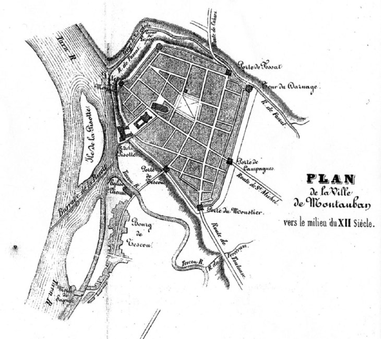
“Plan de la ville de Montauban au commencement du XIIème siècle” by Devals aîné: Histoire de Montauban. (Plan for the town of Montauban at the beginning of the twelfth century)
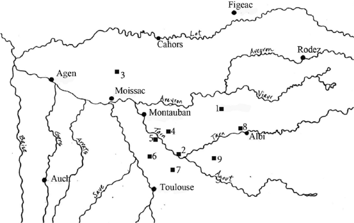
Map of the market towns established in the eleventh century North of Montauban.
This first wave of town foundation in the counts’ territory occurred in the latter half of the twelfth century, during a time when political tensions related to the growth of heresy were escalating between the counts of Toulouse on one hand and the Church and the French monarchy on the other hand. The resulting Albigensian Crusade (1209-1218) was sufficiently disruptive to halt town development for a time, but in 1222, almost immediately after his father’s death, Raymond VII picked up where his great grandfather had left off and founded a truly “new” town, the castrum of Cordes (Figure 7). The charter of this castrum at the northern border of the counts’ territory echoes the trend of commercial development begun by Alphonse-Jourdain, but the site and fortifications express the count’s intention to resist the ongoing military pressures of the French king. Cordes is a unique example of town foundation because of its paradoxical nature as both a remarkable defensive site and as a commercial success. 80 Its foundation was followed with a hiatus because Raymond VII was pre-occupied with other matters. From 1218 to 1229, tensions between the count and the king were high, and it was not until after signing the Treaty of Paris in 1229 that the count once again turned his attention to town charters. 81 In fact, Item 27 of the treaty shows us that the count was expected to continue his practice of town foundation. It notes that the count is allowed to build new towns as long as they are not fortified (Villas tamen non inforciatas bene poterimus facere in terra, que dimittitur nobis, si voluerimus). 82
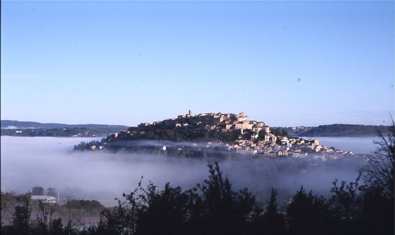
Cordes seen from the Southeast (photo by author).
Nine Charters and Their Significance
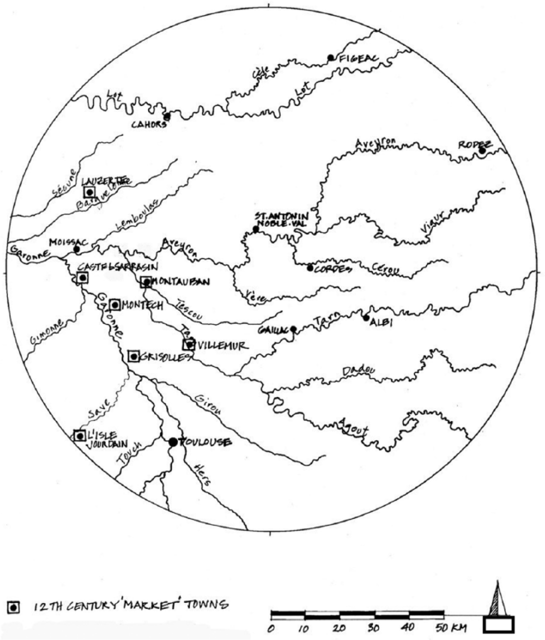
The nine towns discussed below (Figure 8) represent a small selection of a study that deserves much more work. 83 Although Histoire générale de Languedoc notes that Raymond VII founded several new towns in the dioceses of Agen, Rodez, and Toulouse and Saint-Blanquat lists twenty-six, it seems that so far only three existing charters are clearly linked to the count, and only one of those concerns a new town foundation: that of Cordes. 84 The three charters discussed here, which were issued by Raymond VII, include those of Cordes, Buzet, and Lauzerte. 85 In addition, Saint-Blanquat includes two towns in his list of foundations by the count for which we have charters, but for which the dates—and the studies by Vacquié—make it seem impossible that the count was involved: these are Verlhac-Tescou and Villebrumier. 86 These two town charters are included here, however, because they contain formulae or information similar to the others and are therefore useful for comparison, or because they were chartered by Raymond V, the grandfather of Raymond VII. In addition, four other towns are discussed, which were founded by the lieutenant of the count, Sicard Alaman, or by his mother Fine. These are: Bouloc, Montastruc, Castlenau-de-Lévis, and Puybegon. 87 Brief as it is, this list offers a useful glimpse into concepts of town structure in the count’s territory in the years following the Albigensian Crusade and before the 1250s when Alphonse de Poitiers began his issuance of bastide charters in earnest. 88
Map of the nine towns chartered by Raymond VII and by Sicard or Fine Alaman, by author.
None of these nine towns were called bastides in their original charters; however, all are listed as such in one of the most recent definitive texts: that of Lauret et al. (Bastides: Villes Nouvelles du Moyen Age). 89 In the Saisimentum of Alphonse de Poitiers, about half are listed as bastides in the lists of castra et ville within the districts or baileys controlled by the “chief town,” or chef-lieu. Those listed as bastides include Bouloc, Montastruc, Verlhac-Tescou, and Villebrumier. The inventories of the Saisimentum are provocative, because they list several places called bastides within these baileys with notes explaining that these places were founded by Raymond VII, yet the evidence for that is usually an act or complaint not a charter. 90 However, there is evidence in the charters for Bouloc and Montastruc that for Sicard Alaman at least the word bastida denoted a new town.
These towns are the among the first to continue the trend of market town establishment begun along the Garonne River corridor a century earlier, and their charters contained elements that were not found in those earlier towns and that began to define a new way of life for town inhabitants. They are similar to earlier charters in some ways; most of them express a commitment to commerce on the part of the founder through their detailed lists of goods and taxes and, in some cases, mention of a marketplace. Also, as at Montauban, they all offer inhabitants equally sized houses or plots of land and establish a relationship based on money instead of service. What is new and significant is that they all provide for or suggest self-government through the presence of consuls who are often elected officials and that most substitute monetary terms for the previous terms of service to lords.
There are a couple of issues to note regarding the equal property allotments. One is that although it is tempting to associate equally sized allotments with new foundations and also with grid forms, evidence makes it clear that in some cases, the new lots were located in existing towns and that in others, if a grid ever existed, it has been obliterated over the centuries through property sales and exchanges. Whether new or existing, very few of the towns in this region have grid forms, and there are several reasons for this. One is that medieval dimensions were notoriously fluid, and even as lots and land parcels were described as having certain dimensions on a side, this did not necessarily translate into an orthogonal shape. Another reason for irregular lots is that these charters were often describing communities that had already been established so that existing land ownership patterns would have impinged on newly developed parts of town, at least on one contingent side. The charter of Buzet is one example, as the boundaries of town in the “founding” charter are described in relationship to existing boundaries, many of which were natural features such as rocks, trees, or waterways. Much of the area in which Raymond VII and Alaman were developing their towns had been already exploited, whereas those towns established by Edward I in Aquitaine, for example, were placed in areas that were not so well developed. 91 Finally, although it may have been ideal for the notaries of the count and his lieutenant to collect taxes in a tidy manner from a given number of equally sized properties, in reality people quickly bought and sold property and their property boundaries shifted accordingly. This process was facilitated by the Roman laws of inheritance that were still in use in this area; several children could inherit a percentage of a single building or piece of property. 92 The growing numbers of notaries and recorded acts related to property exchanges in the mid-thirteenth century also support the idea that property boundaries were in flux.
The other important issue related to property allotments is that each town adhered to a system of local measure. A medieval sétérée in Cordes measured 63.98 ares (1.58 acres) whereas one in Castelnau-de-Lévis—just fourteen miles away—measured 52.35 ares (1.29 acres). 93 We find the reinforcement of distinction in the charters, where the terms are somewhat variable. At Buzet, using Latin for the charter, Raymond VII measured the houses in bracchia and the land with the terms pugneratam, quartenatam, and sexteriatam. 94 His contemporary Sicard Alaman, using Occitan for the charter of Castelnau-de-Lévis, measured his houses (or house lots) in canna and the property in quartairada and eminada. In general, houses’ dimensions averaged twenty by forty feet in size, or eight hundred square feet, and people received up to four acres for growing a garden and for planting vines and crops.
The towns with charters from Raymond VII are found North of the Tarn River in the area considered his frontier. Cordes (1222) was the first and probably the only truly new town that the count founded. Its charter is very brief, containing only fourteen items (Figure 9). This charter does not mention house or lot measurements, but there is the unusual offer of complete tax relief for one year for new inhabitants. 95 The charter also notes that “goodmen” (proborum virorum) will value property. 96 Growth is assumed (suburbs are mentioned in Item 2), and commerce is addressed in four items, the most specific being Item 12, which specifies the tax for market stalls. 97 There is little question that the count issued the charter for Cordes in 1222 and that of Buzet in 1241, as both charters begin with his salutation. Both are in Latin, and in both, the towns are referred to as a castrum. 98 Each would have had special significance for the count. Cordes would have been important as his first new town foundation, and he was undoubtedly proud of his choice of site and plans for the fortifications. Although Buzet before 1241 was just a small settlement on the Tarn River, it was the site of an important castle where the counts kept their treasure. 99
1222 Foundation charter of Cordes (69EDt AA2).
Buzet was a town that came into existence as a castrum between the years of 1237 and 1241, as Raymond VII gradually bought up property on either side of the Tarn River (Figure 10). 100 In 1241, Raymond VII chartered Buzet as castri nostri (our castrum) with a list of forty-three items. The charter is in Latin, and it is one of the most informative acts we have from the count with respect to his town foundations. It is a relatively long and detailed charter, perhaps reflecting the importance of the site as a treasury for the counts. The first ten items of the charter are about property, taxes, and land use. House (domum) sizes (Item No. 2) are specified rather than lot sizes: four brachiarum in width and six in length (about twenty-five by thirty-eight feet in size). However, inhabitants already owning smaller or larger homes could keep them and pay accordingly—this charter item suggests that there was an existing settlement of some kind. Anyone living outside the town boundaries, whether in villa seu in boria, would pay less for their property: three denari (pennies) instead of six. New inhabitants would receive one pugneratam in local measure (or quarter acre) for one penny, and one quartenatam of land (one-third to half acre) for growing vines for three pennies—but everyone could have one sexteriatum (one-sixth of an arpent or about 8,920 square feet) for free. Market activity is expected. There is the usual description of fees and penalties regarding goods sold at market, and Item 38 stipulates that the weekly market will be held on Wednesday qualibit, or “where you will.” Both the terms consules (consuls) and probis hominibus (goodmen) are found in nine items in the charter with respect to resolving issues of justice and of recording property ownership. 101 There is no description of the election process; it may be that the settlement had already been operating with a consular body when the count wrote this charter.
Cadastral plan of Buzet.
Lauzerte, called lo castel di Lauzerta, was a hilltop site like Cordes to the Northwest of the count’s territory, in Quercy, at the intersection of ancient Roman roads which came from Moissac and led to Cahors and Agen (Figure 11). Raymond VII confirmed its late twelfth-century charter in 1241. The charter of Lauzerte is of interest because it merges the model of the sauvetés with that of Montauban insofar as it includes specifications for house sizes. It is written in Occitan and is thought to have been issued by Count Raymond V after the land was given to him by Arnaud Gausbert de Castanher and his son so that the count might build a castle and two hundred houses. These houses (maios) were three by six brassas in size, or about six by twelve meters (about twenty by forty feet). 102 Looking at a contemporary cadastral map, it can be seen that several lots of this size still exist, although it is hard to believe that two hundred units would fit on this hilltop site in the area available for development. However, it was not uncommon for charter language to reflect the ambitions of its creators for town growth. 103 Consuls, or proshomes, are mentioned several times—in twenty-three items—primarily in relationship to justice but also as having the final word if there are any complaints about the bailiff. Commercial activity is well-represented; about one-third of the items are related to market activity, and the market day is set for Thursdays.
Cadastral plan of Lauzerte.
Verlhac-Tescou and Villebrumier were small towns just seven kilometers apart in the northwest sector of the count’s territory (Tarn-et-Garonne). Both were inventoried as bastides in the Saisimentum of 1271, although they are vilas in their charters. 104 Their attributions in inventories of bastides are confusing; either one or the other will be missing, or Raymond VII is listed as the founder of one or both. 105 The dates of their charters would make his presence or confirmation impossible, however. According to De Vacquié, the original charter for Verlhac-Tescou was issued in 1144 in Latin, confirmed in 1306 by the count of Périgord, and then confirmed in Toulouse in 1473 by monsur Peyre del Bosquet for the King of France, at which time all the charters were translated into Occitan. 106 The first charter, if the date of 1144 is correct, was written the same year as that for Montauban, which was issued in October. It is likely that it was issued by Alphonse-Jourdain’s son, because in the opening item, Raymond the Count of Toulouse gives a place called Verlhac for the building of a borc o vila o castel: Ramon per gracia de Dieu conte de Tolosa duc de Narbona e marques de Provenza donec un loc appelat Verlhac ad obra de bastir e edificar un borc o vila o castel. 107 Raymond would not have officially been count until 1148, the year of his father’s death, at which time he became Raymond V, but it is possible that he was allowed to call himself count for the issuance of this charter. Regardless, the charter suggests that it was modeled closely on that of Montauban; the houses (hostal o casal) are exactly the same dimension and taxed the same amount (six stades wide by twelve deep for twelve diniers per year), and at both places, inhabitants were required to build a bridge for the count. 108 In both charters, many items relate to the taxation of commerce, and for Verlhac, the market day is set for Mondays. A subtle but important difference between the two, however, is the role of consuls, who become slightly more important in the charter for Verlhac. Whereas in Montauban’s charter they only appear once, as consulting with the count over the maintenance of the bridge, at Verlhac, they are also able to approve the alienation of property in the absence of the count. Things have changed significantly by 1306, because in that confirmation, there is a new item that describes the election of consuls and their duties, which have expanded considerably to reflect the pattern we find in the other charters among this group. 109
The charter for the vila of Villebrumier is dated 1268 and was issued by Pierre of Lombaresse, the lord of Villebrumier, who rendered homage to Alphonse de Poitiers in 1255. 110 Its formal salutation is in Latin but the body of the charter is in Occitan. Three consuls were present at the signing, so it seems the vila was pre-existing. Out of eighty-four items, the consuls were mentioned in only five. De Lombaresse is distinctly present as the seignor and as the highest authority in town. 111 The interest of this charter lies in the specifications of property allotments and in the priority given to house lots over space for the marketplace. It also confirms evidence that whereas charters before 1200 seem to restrict their allocations to house dimensions, those after 1240 all seem to include property for the cultivation of crops and gardens. In this charter, the second item gives the inhabitants one ayral for a house sized five brassas wide by ten brassas deep (about thirty-two by sixty-four feet) for one dinier or penny per year, but then goes on to describe land allocations, which were one cartarada de terra obz de casal de d’ort, or “for what is necessary for a house and garden”—this would have been about half acre, for one penny. In addition, there was half cartonada for a field or for “what is necessary,” and half cartonada de terra for vines or for “what is necessary” as well. These two parcels cost six pennies each and would have been about one acre each. Thus, the total package cost an inhabitant of Villebrumier fourteen pennies per year. The lord was generous with his land: inhabitants wanting more land for fields or vines only need ask, as the lord lor ne due donnar com obs lor [naura] ab bonase. Whether or not one would consider the following a boon, it too was an unusual item: Lombaresse gave the inhabitants the roads and gates with the approval of the consuls (Item 7). The terms for dimensions are dissimilar: stades versus brassas. Lombaresse is more specific than any other charter writers represented here about commercial space. He offers cinq cestaradas de terre obz de beurados et del plassa (five sétérées of land for fairs and for the market) at specific locations, but if it is found that new houses must be built there, the markets can be moved elsewhere. 112
The Towns of Sicard Alaman
Raymond VII named Sicard Alaman his lieutenant in 1242 after the man had been his constant companion and counselor for three years. Alaman served the Count as a diplomatic shield in that he came of age after the Albigensian Crusade and was neither associated with heresy in the way the counts had been nor was he resistant to the annexation of the South by the monarchy. His family, which had been close to the counts since the late twelfth century, enjoyed better relations with the powerful bishops of Albi than the counts had. And finally, his father Doat had a history of founding towns. 113 By 1242, Alaman had already realized significant profit from the development of lands inherited from his father and had even established a mint at the castle site given to him by Raymond VII, Castelnau-de-Bonafous (which would later become Castelnau-de-Lévis). 114 Alaman’s towns are all South of the Tarn River (save one—see Figure 8), located in his family lands and also located to protect the weak frontiers of the count. 115 Those discussed here include Bouloc (1242), Montastruc (1242), Puybegon (1246), and Castlenau-de-Lévis (1256). 116 Alaman’s charters—and that of his mother Fine for Puybegon—all include two of the elements described above: dimensional allotments of land and references to a body of consuls. None of them mention a market per se, although that of Castlenau-de-Lévis has typical lists of fees for market goods. Alaman’s charters are interesting because they confirm the increasing presence of consuls and prefigure the idea of a bastide as a new town, but at the same time, they contain elements that seem archaic for the time they are written.
It is in the charters for Bouloc (Boniloci or “Good Place”) and Montastruc (Montastrux) that we find the word bastida used in such a way that it implies a new town foundation, although the word is not used to describe the towns themselves, which are named as a locum (both towns were later inventoried as bastides in the Saisimentum, however). Their charters were written in the same year just six months apart and are almost identical. Written in Latin, they contain about the same number of items: 22 for Bouloc and 17 for Montastruc. Both offer the same formulae to attract inhabitants as part of the first item, and both refer to the customs of the opido et villa of Castelsarrasin as their model. Alaman gives inhabitants land to build their houses: dedit & concessit eis in eodem loco ad faciendum & hedificandum ibi domos. One cartonada of land (about one acre) costs twelve deniers or one solidus, although in Montastruc two cartonadas are offered. House sizes are not mentioned, but it is clear that people are expected to build, and as usual, the woods belonging to the founder are made available for construction materials. In addition, people in both towns were entitled to one eminatam of land (about one-third acre) for planting and cultivating vines (ad plantandam et tenendam ibi vineam) for three pennies, and one punharatam (again, about one-third acre) for a garden (ad ortum) for two pennies. It is in Item 9 that Alaman suggests that he considered the new towns that he and Raymond VII were founding and issuing charters for as bastides: . . . a bastida a domino comite aut ab eodem domino Sicardo noviter facta vel constructa. . . . 117 In an effort to prevent people from leaving these bastides that he refers to, he refuses to accord them the tax relief that would be enjoyed by new inhabitants of Bouloc or Montastruc who had come from elsewhere. The charter for Bouloc also contains a spatial reference to pasturage: men and women are given three communal fields for pasturage (plassas pro pascuis que sint comunia), one location is to be between the fountain of Gairalde, the town, the road to Castelli-novi, and the road rivi Canelle; the second between the fountain of Candelh, the town, and the public road (carrariam publicam); and the third near the road that comes from Fronton. The lord (domino) and his bailiff (bajulo) are more prominent here in the first items than in the charters associated with the counts, but consuls are mentioned in both charters in the context of issues of justice, in five items in each. Commercial activity and markets are not addressed, rather justice is the focus. It is much the same for Puybegon (Pueg Beguo) chartered in Occitan by Fine Alaman, Sicard’s mother, in 1246. Hers was the first charter for this castel, and it too offers equal opportunity to inhabitants in the form of land allocations. Here people received one airal, four brassas wide and six brassas long (about twenty-six by thirty-eight feet), for three pennies. The airal, or ayral, was usually the lot for the house. In addition, people were offered one cestairada of land (about two acres) for four pennies, one eminada for three pennies, one sestairada de prat for four pennies, and one cartairada ad obs d’ort for two pennies. Sixteen pennies total for about five acres of land and a house plot. Consuls are present as prohomes, but as with Bouloc and Montastruc, there is no mention of a market or taxes on goods sold there.
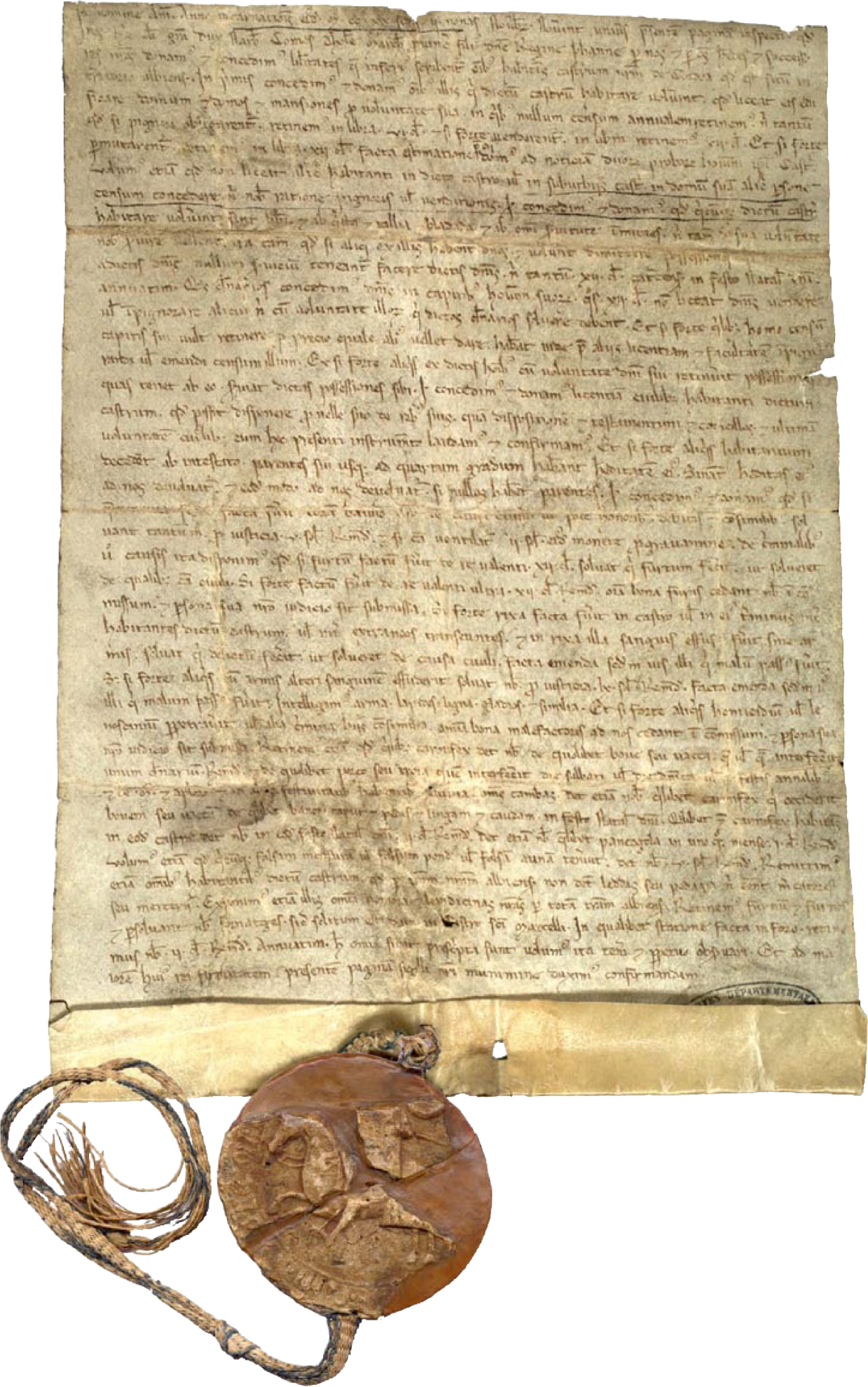
Finally, there is Castelnau-de-Lévis, which began as the Puy de Bonafous (a puy is a high, rocky outcropping or small butte) given to Alaman by Raymond VII in 1235. Twenty-one years later, at the request of ten prohomes, a group that included cavalles et barrians, Alaman issued a new charter for Castlenau de Bonafous in Occitan with forty-nine items (Figure 12). This charter is of interest for a couple of reasons. One is that it emphasizes a new life for an existing settlement through the rhetoric of the charter, lo seinhor Sicart Alaman agues faig bastir castell en lo pueig Bonafos(the Seigneur Sicard Alaman would have a castle built on the puy of Bonafous) and another is the language that defines social segregation and that reminds us about the rights of service that were once common for lords but that Alaman now moderates. The site is segregated into the cap del castel (the “head” or top of the hill where the castle was located) and the barri del castel (the suburbs on the hillslopes; Figure 13 is a view of the spiral stair of the castle tower looming above one of the parcels in the barri). The town layout, which has changed very little since the fourteenth century, is the classic form of the castlenaux of the eleventh and twelfth centuries (Figure 14). The cavalles who lived in the cap enjoyed privileges that the barrians living below did not: their houses were not taxed but those in the suburbs were, and new inhabitants were not allowed to build in the cap. Suburban dwellers were given an airal of four cannas wide and six cannas long for their house (about seven by ten meters or twenty-two by thiry-two feet) for three pennies a year. There are other words that suggest an “old” order and that are not found in the other charters discussed here. In Items 41 and 42, Alaman refers to host e calvagada, which he shall have when he is in lo castell and to alberga, which he will not enforce on anyone against their will. 118 Consuls (cossols) are mentioned in the salutation, and in Item 8 their composition is described: four are to be chosen from the barris and two from the castel. Their responsibilities, primarily related to justice, are listed in sixteen of the items. This long charter includes fees for selling various goods at market, but no mention is made of a market day or a marketplace.
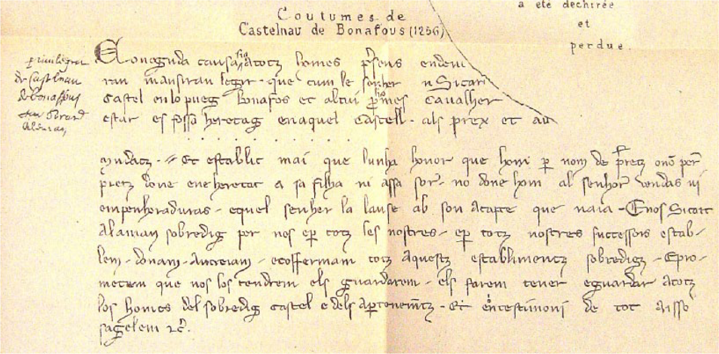
Transcription of fragment of 1256 charter for Castelnau-de-Bonafous (Lévis), from Cabié and Mazens, Cartulaire et divers actes des Alaman, des de Lautrec et des de Lévis (photo by author).
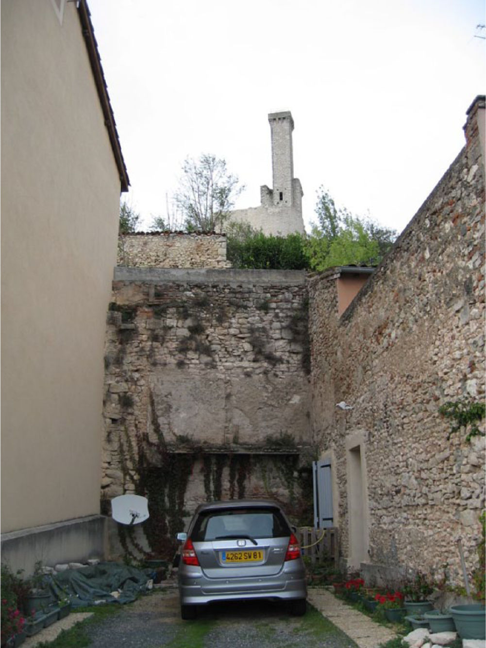
View of spiral stair of castle at Castelnau-de-Lévis seen from the town below (photo by author).
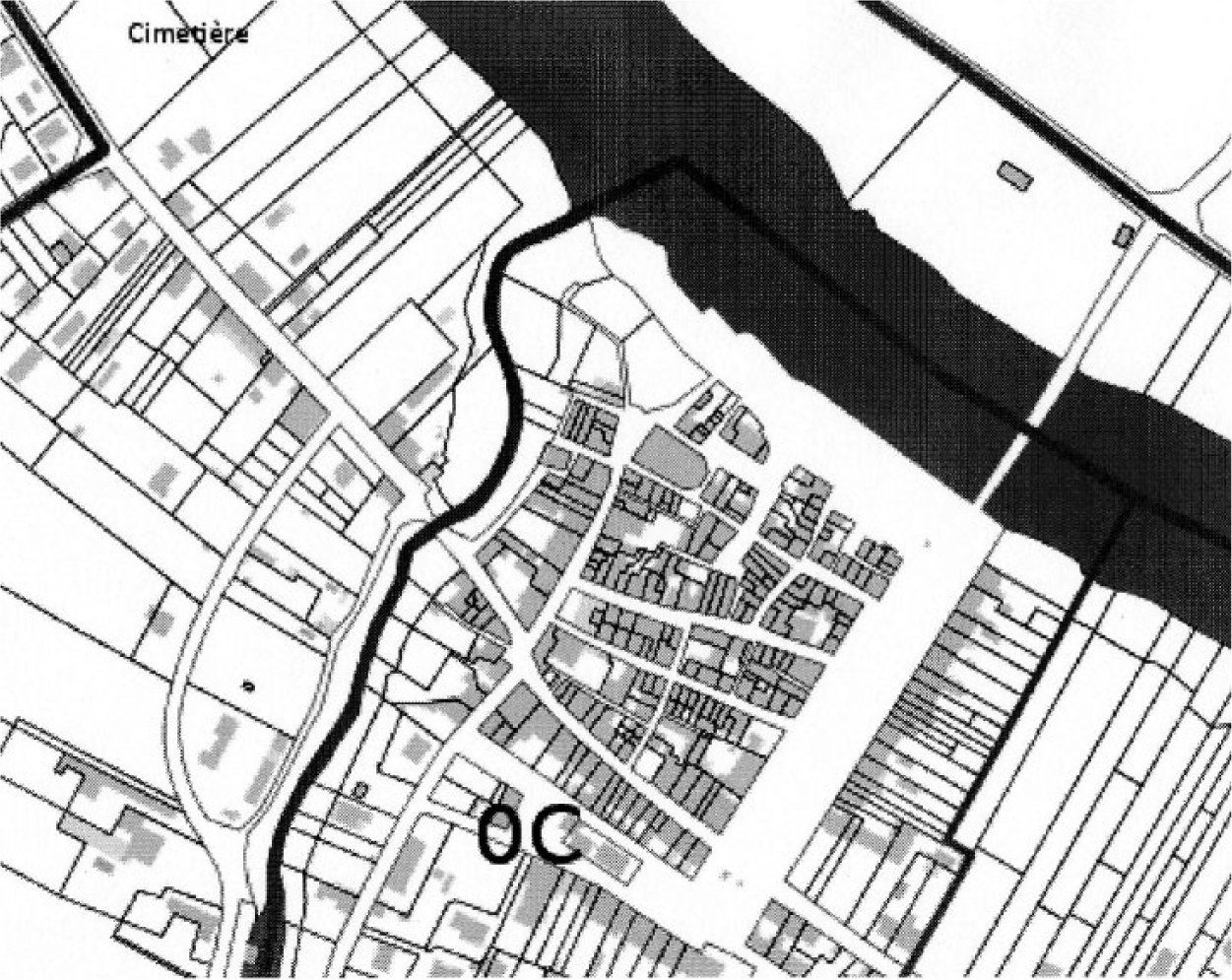
Cadastral plan of Castelnau-de-Lévis.
Conclusion
These towns in the territory of the counts of Toulouse deserve recognition as the predecessors of the bastides. The offspring of the sauvetés and the creations of lords learning how to use a monetary economy, these towns were marked by charters that often advertised opportunity based on commerce and equality for new inhabitants. The trend began before the Albigensian Crusade, with Count Alphonse-Jourdain and his son Raymond V trying to take advantage of the growing economy and establish some control in an area becoming increasingly independent of their influence. During and after the Crusade, many families and friends living in this region were displaced by persecution and inquisitorial practices. Raymond VII followed the example of his ancestors in using town charters to consolidate this population and put land back into production, and his lieutenant Sicard Alaman similarly developed the land he had inherited. Subtle differences in Alaman’s charters suggest that he was more interested than the count in maintaining his control over town affairs and perhaps less concerned about revenues from market activity. Alaman’s identity as domino is stressed in the first half of the charters for Bouloc and Montastruc, and at Castelnau-de-Lévis, he persists in maintaining a rapidly disappearing social order by physically separating cavalles et barrians and by using language that had disappeared from other charters of the mid-thirteenth century. Yet it is in his charters that we find the association of new town foundation with the word bastida. The differences may lie in the respective backgrounds of these men and what little we can parse about their personalities from chroniclers and documents. Raymond VII was an excellent warrior, always on the move, and at times politically volatile just as his father had been. Chronicles suggest that he was not inclined toward detailed documentation. He probably wanted to get his towns up and running as quickly as possible, and as long as he could collect his taxes through his bailiffs, he may have been perfectly content to let local administration take care of ongoing town affairs. He was well aware of the power of consuls as they had figured in the history of Toulouse for almost a century by the time he became count, although this is not to say he was content with that power. 119 Sicard Alaman, however, is depicted as a careful administrator whose ancestors had gradually amassed a great deal of property through the favors of the counts. Alaman’s concern with control may reflect a desire to guard his carefully gained resources. His use of the term bastida may derive from the fact that his ancestors had called some of their properties bastides, referring to them as fortified places, but it may also reflect his willingness to embrace new cultures and ideas. He had, after all, proved his value as a diplomat during the years of transition from the rule of the counts to that of Alphonse de Poitiers. At Castelnau-de-Lévis, the social zoning and his use of antiquated terms related to service may have derived from the fact that he was in fact charged with maintaining the castle as a defensive site.
Regardless of their motives, these two men were key instruments of change in this region, and set the stage for the significant surge of urban development that followed the count’s death in 1249. There is utility in categorization. Defining towns as bastides with certain identifiable characteristics helps the tourist industry, and it helps professors who are trying to acquaint their students with a medieval phenomenon. This article was written to argue against the generalization of the term “bastide” in scholarly discourse, to promote more awareness of both the origin of the term and the phenomenon as it existed in the thirteenth century, and to emphasize the gradual development of the urban landscape in Languedoc under the counts of Toulouse.
Footnotes
Acknowledgements
The author wishes to thank the anonymous reviewers of this article for their helpful comments; Professor Meredith Clausen as the initiator of my interest in bastides; Professor David Streatfield for his continuous support and encouragement; Claude Calmettes for the generous assistance of his office, the Centre d’Etude des Bastides in 2002; Professors Maurice Berthe and Mireille Mousnier for their assistance in locating documents; Research Librarian Claire Vernon; and Professor Robert C. Stacey for his assistance in Latin translation and for my education in paleography.
Declaration of Conflicting Interests
The author declared no potential conflicts of interest with respect to the research, authorship, and/or publication of this article.
Funding
The author received no financial support for the research, authorship, and/or publication of this article.