
Abstract
The material relics of socialism continue to affect present-day rural Romania. This article explores the nexus of socialist/post-socialist agricultural infrastructure, groundwater, soil transformations, the privatization process and the constitution of power relations along the Lower Danube rural areas. Positioning ourselves in the anthropology of infrastructure, we document both ethnographically and with Geographic Information Systems tools the social and political consequences of broken agricultural infrastructure in a village located on the banks of the Lower Danube, Romania. We show how the local political elite is able to exploit the surfacing of groundwater in their favour, resulting in economic loss only for small landholders and villagers without power. The interface of the multiple temporalities inherent in infrastructure with the various materialities of groundwater – its propensity to leak, infiltrate and surface – precipitated the emergence of a new ecological order. The new hybrid ecology is made up of pre-socialist feral groundwater, the socialist ‘hydraulic society’ that reclaimed agricultural land, and the post-socialist political economy. We engage a more-than-human perspective in order to offer a more sophisticated – and realistic – picture of post-socialist rural power relations.
The point was to prove that mature Socialism could control everything, from the course of history to the behavior of micro-organisms. (Kapka Kassabova, Border: A Journey to the Edge of Europe, p. 10)
Wandering along the Romanian bank of the Lower Danube is like walking through a cemetery of industrial wreckage. Rusty, twisted water pipes emerge from the ground and concrete structures that once sheltered large electric pumps are now scattered ruins. The relics of agro-industrial infrastructure remain as wraiths of the socialist agricultural sector – which was once an essential part of the national economy. In the 1950s, the eye would have met a very different landscape. Before the socialist state started to build massive levees to separate floodplains from the river, yearly floods filled marshes, lakes and ponds with water and silt through interconnecting natural channels. Animal husbandry thrived due to the tall wetland vegetation nurtured by a thick layer of silt which enriched the floodplain soil after floods. Villagers learned to ‘dance with the river’ (Lahiri-Dutt and Samanta, 2013) by using its flood pulse. In 1947, the advent of the socialist regime in Romania changed all this. From the 1960s, almost the entire Danube bank was dammed, lakes and ponds were drained and a large network of pipes, water stations, water channels and electric pumps filled the floodplain. The once-amphibian landscape was transformed into an agricultural plain of cereals – mainly corn, wheat and rye – worked with large machinery. Whereas the land on the terraces was collectivized, the reclaimed agricultural land became part of the socialist state farms, which particularly benefited from industrialization.
The breakdown of the socialist regime triggered the restitution of land to historical owners or their heirs. This caused land fragmentation: an average agricultural holding in contemporary Romania is 3.45 hectares (ha). The privatization of agricultural-oriented industry and fishing enterprises also increased unemployment, especially in rural areas. Today the degradation of agricultural infrastructure has contributed to low agricultural productivity. Thus, a majority of rural inhabitants are forced to live on subsistence agriculture, meagre pensions, and social or unemployment benefits (Dorondel et al., 2016).
While anthropologists have studied the various socio-economic processes linked to land restitution and privatization, the attention paid to agricultural infrastructure and unseen geomorphological processes is marginal. Scholars of post-socialist transformations have focused almost exclusively on the social, political and economic aspects of agriculture and neglected the agency of infrastructure, water, soil and geophysical processes (Münster, 2015: 237). But the material aspects involved in infrastructure – including the geomorphological transformations of soil and groundwater – affect post-socialist agriculture at least as much as politico-economic relations.
This article examines the nexus of post-socialist agricultural infrastructure, groundwater, transformations of the soil, the privatization process and the constitution of power relations along the Lower Danube rural areas. Instead of looking directly at the social and political relations we look at the (non)functionality of agricultural infrastructure and how the ‘tamed’ groundwater was ‘uncaged’ during post-socialism. The transformations in the soil triggered by these processes have grim consequences for subsistence agriculture and smallholders, reshaping local power relations. We engage ethnography to explore the social and political consequences of broken infrastructure in a village located on the banks of the Lower Danube, and focus on entanglements between non-functional infrastructure, groundwater, (lost) crops, weeds, smallholders and various manifestations of power. In this way we hope to deepen the understanding of power and inequality manifested in rural areas, and to move the discussion from purely political economic theories which dominate the anthropology of post-socialism towards a more-than-human perspective.
The article proceeds as follows. First, we explain the theories which inform our research. Then we present the physical changes along the Lower Danube floodplain initiated by state socialism that were intended to buttress radical economic and social morphing. We proceed to briefly describe the decollectivization process and land restitution to former owners in the early 1990s to late 2000s. We highlight the neoliberal policies of the rickety Romanian state, the ruination of infrastructure and its consequences for groundwater, and the advantages gained by the local political elite in dealing with such changes. The conclusion emphasizes the theoretical contributions of post-socialism to the anthropology of infrastructure.
Post-socialist agriculture and infrastructure
We employ Stenning and Hörschelmann (2008) theorization of the term ‘post-socialism’. That is, we not only acknowledge the importance of narratives and everyday life situations inherited from the socialist period but also recognize that these narratives and situations are intertwined with pre-socialist ones. Legacies of socialism are identifiable in many aspects of the post-socialist economic and political domains, but especially so in the field of agriculture. The unequal access to resources based on the affiliation to different powerful political networks constituted in the socialist period and the difficulties accessing markets without the correct political connections played a significant role in the process of decollectivization and land privatization (Mungiu-Pippidi, 2010; Verdery, 2003). Lampland (2002) talks about the ‘advantage of being collectivized’; the knowledge and skills acquired during the socialist period that proved important for economic success in the new ‘capitalist’ world. The process of decollectivization and land restitution to historical owners or their heirs – mostly implemented in Central and East Europe rather than in former USSR countries – uses the period before collectivization as its baseline. As Verdery (1994) has put it, land reform triggered a war of memory and local knowledge as any claim to land and forest was in competition with other family members’ memory of pre-socialist ownership (Dorondel, 2009). Moreover, for the post-socialist state which sought to unburden itself of the legacies of socialism, land restitution represented a strategy to reverse history – to undo the economic ‘bads’ of socialist agriculture (Giordano and Kostova, 2001; Verdery, 2003). Again, the conditions of the pre-socialist period became the goal of the post-socialist situation.
Scholars of post-socialism have focused on land and forest restitution from the political economy perspective, as these changes – in economic policies, social relations and property rights – were rapid and visible (Hann, 1998; Hann, 2002; Hann and the ‘Property Relations’ Group, 2003; Humphrey, 2002; Humphrey and Verdery, 2004; Verdery, 1996; Verder, 2003). But the ruination of agricultural infrastructure and the transformation of the soils due to tenure system changes were more discreet and gradual processes. The post-socialist state privatized land, land-related assets and forests, but kept agricultural infrastructure in its own custody. The irrigation system, water adduction, electric pumps and metal pipes were costly to maintain and repair – as well as constituting an energetic ‘black hole’, requiring enormous electric power – and were thus unappealing to the private sector. The socialist state was able to use the ‘energy-intensive infrastructure’ to improve agricultural performances because the state owned both the agricultural and the energy sectors. Land privatization after state socialism’s fall complicated the economic relationship between the new private landowners and the state. The smallholder was simply not able to pay for the use of state infrastructure.
As Jessica Barnes (2012; Barnes, 2014; Barnes, 2016) shows, without infrastructure agriculture is impossible in many areas. Agricultural infrastructure provides water where there is scarcity and drains it where there is excess, thereby creating ‘new landscapes of agricultural possibility’ (Barnes, 2014: 151). For a farmer, excess water can be as bad as water scarcity. While much scholarship discusses the benefits of water abundance (e.g. Alatout, 2009), less has so far focused on water excess, as this article will do.
Larkin (2013: 328) defines infrastructure as networks that facilitate ‘the flows of goods, people and ideas’ – things that facilitate the movement of other things (2013: 329). A consequence is that we can understand agriculture as comprising a community of humans and nonhumans. This community is formed of infrastructural networks that bring or drain water, transformations produced in the soil by irrigation or drainage, crops, weeds, farmers, local political elites and state agencies. Human actors with different levels of power have different agency regarding infrastructure. Infrastructure is a technological material assemblage influencing or even generating social relations (Amin, 2014; Harvey et al., 2017); it is intimately linked to social (in)justice and power. As Lockrem and Lugo (2012) put it, ‘studying the everydayness of infrastructure means investigating the intimacy of power in human life’.
Infrastructure is intimately embedded in processes of social and political change. As Harvey and Knox (2012: 523) show, infrastructure brings ‘promises of emancipatory modernity’. Designed to transform an amphibian landscape into an agricultural one, the large socialist infrastructural constructions along the Lower Danube were a sign of Romania’s economic modernity. Socialism was, among other things, a project of infrastructural modernization (Collier, 2011; see also Richardson, 2016a; Richardson, 2016b). Building levees – setting up thousands of kilometres of pipes, electric pumps and water stations to drain large surfaces of backwaters and lakes and replace them with an agricultural landscape – was a way to transform ‘the natural into cultural’ (Graham, 2010: 11). The ‘infrastructural work’ (Richardson, 2016a) mediated the transformation of nature – a nature nevertheless already shaped by human work for centuries – into a built landscape. For example, the drainage system was put in place to tame the groundwater, transforming the myriad of small underground creeks that crossed the former floodplain into orderly water. But, as Carse (2012) points out, people can use nature the same way they use built infrastructure. Carse (2012: 544) understands ‘nature’ as ‘processes beyond human control’, referring to the watershed forests and landforms around the Panama Canal. In this article I show how the natural canals of the floodplain (through which the river flooded the lowland) were put to work in the infrastructural network as carriers of water from and to the river. The natural canals added to the pumps, pipes, and electric stations that were part of the agricultural infrastructure.
Anthropologists working on infrastructure point out that many people only notice the existence of infrastructure when it stops working (Graham, 2010; Larkin, 2013; Star, 1999; Star and Ruhleder, 1996). Over-extended infrastructural networks are especially prone to failure (Barnes, 2016; Carse, 2014; Harvey et al., 2017: 11), and therefore require regular maintenance. This may be a question of life and death for the people that depend upon it. Collapsed infrastructure can teach us a lot about those who have the power to repair the system, and about politics and the state that finances this operation (Barnes, 2016).
Studying infrastructure means paying attention to materiality and its interaction with social and power relations. By looking at the transformation of the post-socialist agricultural infrastructures and the transformations induced in soils by broken infrastructures, we seek a more comprehensive and sophisticated understanding of privatization policies and how they affect the environment and rural population. Linking infrastructure, soil transformation and unruly groundwater is essential to understanding social phenomena in rural areas. Bringing the human organization of agriculture and nonhuman assemblages into the same analysis (Latour, 1993; Lowe, 2010) allows us to better understand the power relations produced by large infrastructure, the history of ecological transformations and the despair of rural people living in the former floodplain of the Lower Danube.
We base our analysis on long-term fieldwork in Gostinu village (Giurgiu County, Romania). The village has 1980 inhabitants living in 750 households. The village has 3637 ha of agricultural land, 480 ha of forest and 705 ha of ponds. Sixty-six per cent of the agricultural land is used today either by small landholders, who work their land individually – as subsistence agriculture – or by tenants of small and medium-size plots of land. There is one large company which works 1235 ha, which is 33% of the agricultural land of the village. 1 Agriculture plays a major economic role alongside animal husbandry. During fieldwork we explored central and local historical archives. However, following Star (1999) we also consider large infrastructural elements as historical data which provide a record of the social, economic, political and ecological past as much as any archival document. Infrastructure has a history: it changes over time, becomes redundant, obsolete or is updated. Infrastructure reveals its history and speaks to those who pay attention to it. Finally, we have used remote sensing data – orthophotoplans and Geographic Information Systems (GIS) methods – in combination with the ethnographic data. 2
Marshland into agricultural fields (1960–89)
At the end of the Second World War, when the socialist regime came to power in Romania, the riparian population of the Lower Danube floodplain had lived with floods for hundreds of years. The myriad of water canals, backwaters, marshes, agricultural land, pastures, small sand dunes and forest patches formed a heterogeneous landscape which was guarded at the north by the higher terraces of the river and limited at the south by the river. Crossed by the canals that naturally linked the Danube to its floodplains, and by small natural levees (interspersed with small patches of acacia forest and sand dunes) temporarily flooded in the spring, the floodplain was a highly irregular landscape. People adapted their economy to this environment by fishing, cultivating cereals on the small natural levees and keeping animals ‘in the marsh’ outside of flood periods.
The ethnography we carried out in the village of Gostinu, lying less than 1 km from the bank of the Danube, provides rich detail. ‘Droves of pigs turned almost into boars roaming the marshes, sometimes destroying the crops’, an old villager remembered. In local language, keeping animals ‘in the marsh’ referred to animals grazing in the marshy area of the village territory six months per year, during the time it was not flooded by the Danube. The village economy was based on selling fish and rushes used for making floor mats. As one of our interlocutors, now in her mid-eighties, recalled: We were the richest village thanks to the fish. We used to cut and salt the fish, especially carp and pike, and smoke the catfish. My mom sold it in Bucharest markets. You couldn’t believe how much carp we had.… Our livelihoods were secured by fish.
The economic importance of fish was signalled by the number of boats villagers owned; according to an elder, there was a boat to every second or third household (as opposed to the mere ten that remain today in the whole village). Villagers without boats had to work for boat owners who were better off. Usually men were involved in fishing while women practised agriculture, but this was not an iron rule. Agriculture was practised on the higher terraces and on small mounds of land ‘in the marsh’ after the water withdrew in the spring (see Ianovici et al., 1969; Posea, 1984) and was a less important economic activity. As Gostinu was located in the floodplain and surrounded by lakes and ponds, agricultural land was scarce. In fact, as one villager remembered, families would travel west to the villages located further from the Danube, in the Bărăgan plain, to exchange fish for corn and wheat. Women and elderly inhabitants especially would also travel in the same direction to take seasonal work.
The yearly floods of the Danube transformed the river’s floodplains into a mixture of different soils. These included, in various proportions, humus, organic material decomposing at different rates, clay, silt and sand. Vertisoil, a type of clay-silty soil that compacts like clay brick and cracks easily when the sun dries it, was very common. On higher ground (the eroded levees of Danube and the levees of the natural canals connecting the Danube with its floodplain) and in patches of forest there -- were also more stable and mature soils such as chernozem.
This way of life changed in the socialist period. In the 1960s, the socialist government drafted programmes and created the institutional base for a thorough damming of the Danube. The landscape, previously only partially agricultural, was transformed into a large intensive agricultural field. Since the 1960s, a total of 430,000 ha of the floodplain were reclaimed and 1200 km of levees were constructed (Botzan et al., 1991: 64). The socialist dream was to extinguish ‘unproductive’ lands – the floodplains’ swamps, lakes and water channels – replacing them with ‘productive’ agricultural grounds. An economy based on fish was transformed into an economy based on agriculture.
Gostinu village was an epicentre of the economic and environmental transformations of the floodplain. Between 1964 and 1965 a solid levee was built – ’26 metres at its base’ as the levee warden informed us – to cut the link between the Danube and the floodplain. During the period 1965–77 intensive works were carried out to drain the lakes, swamps and water canals. Large irrigation systems were constructed and a network of underground pipes was set in place to drain surplus water from the soil. The agricultural infrastructure was connected to electric pumps and water stations, all built concomitantly. In the Gostinu area alone, a network of 900 km of underground drainage pipes was installed (Botzan et al., 1991: 102). This infrastructure was bidirectional: when the year was dry, the pumps sucked water from the Danube and irrigated the agricultural fields; when the year was rainy, the surplus water was drained from the soil and fed into the Danube. Some natural channels were maintained, regularized and morphed into irrigation canals. In addition to the built infrastructure, large tracts of land were levelled to ease access for the large machinery used to work the fields. Socialist agriculture was intensive, performed on large consolidated plots with relatively high productivity (Bărăscu, 1999). As a former member of the collective farm remembered: One year we had the best sugar beet production in the entire region. We had to ask the fishermen
3
to come and help us to load it into the trucks for the sugar enterprise in Giurgiu city. Another year we produced so much corn that we did not have enough space in the collective farm yard and put it on the street as well.
Using GIS tools and an orthophotoplan, Figure 1 shows the magnitude of the socialist transformation. The upper image shows the patchy landscape of Gostinu in 1929, including several large lakes (baltă) and swamps (light blue), and the area prone to flooding (shaded blue).
4
It shows the complexity of the ground, ranging from sandy soils to more stable ones supporting a mix of wetland vegetation. This amphibian landscape was not only fed by the river’s water but also by the many small creeks springing from the northern terraces of the village, the water from which flows down the hill and terraces, and accumulates in the floodplain. As a result, the water table was always very high in Gostinu village. The lower image – a 2009 orthophotoplan of the exact same area as in the upper image – shows agricultural fields that have completely replaced the wetland. The blue lines mark the network of water channels and the red dots the electric pump stations built by the socialist state, highlighting the central role played by infrastructure. Once a semi-natural landscape controlled through minor transformations by the villagers (e.g. digging small channels), the floodplain was transformed into a highly artificial and heavily controlled productive space within 30 years of the socialist regime coming to power. Upper image: Gostinu village, Giurgiu County, in 1929. Lower image: Gostinu village in 2009. The entire architecture of the socialist agricultural infrastructure is marked with blue and red.
The enthusiasm of state officials for transforming the floodplain was not shared by many geographers and soil specialists, who pointed out that the soil on the bottom of the many lakes and ponds of the region is unsuitable for agriculture. These were not only sands (as optimistically presented by agronomists), but also very fine dust which sinks easily. This type of soil, if cultivated, would need permanent amelioration, fertilization and drainage (Botzan et al., 1991), making agriculture an expensive business. The high-ranking officials of the socialist state were deaf to such technical details. In order to transform the biochemical composition of the salty floodplain soils into something fit for cereal production, a complex irrigation and drainage system was put in place. Moreover, the socialist government founded a large institute in Băneasa village (neighbouring Gostinu village) that was charged with carrying out interdisciplinary research on the soils, technology and infrastructure, and to supervise and implement any necessary technological changes. The institute hired over a thousand geographers, geologists, hydrologists and engineers, and had over a hundred large machines and tractors. These experts drew hydrogeological maps (the last ones were drafted in 1988) to show the groundwater levels, and accordingly advised the presidents of the collective and state farms where to irrigate and drain. 5 They also tested different types of pipes to see which were more resistant to clogging.
The transformation of the floodplain was an attempt by the socialist government not only to control, but also transform, the soil and groundwater. The implementation of the drainage system was intended to ‘cage’ the groundwaters technologically within the political order. The soil from the bottom of the ponds and lakes, previously unfit for agriculture, was transformed through technology. A new ecological order emerged in which the groundwater and the soil were put to work for the socialist state economy. In this way the socialist state became a ‘hydraulic society’ (Wittfogel, 1957), one in which the state exerts its power through water infrastructure. Yet, as also recognized by William Wheeler (2019) and Richardson (2016b), different materialities of groundwater and soil resist control: water constantly seeped through pipe joints and the soil resisted changes to its chemical composition, demanding continually increasing inputs to bear good crops. These three elements – drainage system, soil and groundwater – must work in perfect unison. Extract one from the equation and the entire system collapses.
Non-functional infrastructure and the return of the swamps
After 1989, the entire floodplain region went through another radical change, this time in land tenure: decollectivization and privatization of the land and land-related assets of the collective and state farms. Moreover, the injustices produced by the dissolution and sell-off of collective and state-owned farms led to destruction and theft, such as the stealing of large electric pumps by a population that felt that this was the only way to get something from the state, whose privatizations excluded them. The irrigation system had the same fate – most pipes and pumps were stolen and sold as scrap iron, while cement plaques which paved the irrigation water channels were transferred into villagers’ backyards. The drainage and irrigation canals stopped being maintained by state employees and were overrun by silt and weeds. The entire former floodplain is a graveyard of deserted and looted buildings. Only the immovable rusty pipes and the water canals remain as testimony to the recent existence of an enormous man-made infrastructure. The entire huge network of subterranean pipes, which once served to both irrigate and drain, lies unused underground.
Decollectivization was a complicated social and political process, as many anthropologists have shown (e.g. Hann, 2006; Verdery, 2003). In Gostinu (and other villages in the Danube floodplains with similar historical and geographical characteristics) the process was even more complicated, given the geography and soil composition of the agricultural fields. The village had two main types of agricultural land: the Danube terraces, with a good microclimate and high-quality soil fit for agriculture (black earth); and the agricultural fields created from former marshland, which were of poorer quality and needed fertilizer and landscaping. As decollectivization was an utterly corrupt political process, high-quality land was mostly distributed to those close to the local members of the Land Reform Commission, whereas villagers with weaker political connections received marshland liable to periodic flooding (Mungiu-Pippidi, 2010; Verdery, 2002, 2003). The few artful villagers who knew how to negotiate often received plots in both areas.
Older villagers who understood the agricultural fields categorically refused to receive marshland: they knew it was unfit for small-scale agriculture. Villagers have detailed knowledge of the local geography, the quality of the soils and the history of the floodplain. They knew they would not have the same economic power as the state farm to invest in fertilizers, would not be able to rely on heavy machinery and would not benefit from the irrigation system, all of which was already expensive in the last days of the socialist regime. Moreover, some land was already exhausted by the intensive farming during the last years of socialism. But several villagers with specific geological knowledge of the floodplain who worked for the Institute of Băneasa succeeded in getting the few small mounds of higher land which never flooded. Even in the years with severe drought, they have double the cereal production of other landowners, and the land needed no irrigation, nor was it regularly infiltrated by groundwater.
There was another reason the villagers sought to avoid receiving land in the former floodplain. Despite the construction of a solid levee, which prevented the Danube from flooding, groundwater infiltrated almost every year. Between 10% and 30% of the agricultural fields of the village have been – and still are – under threat of excessive water. When the river starts to drop at the end of June, the groundwater rises and floods the agricultural fields in the marsh. Villagers refer to this phenomenon as ‘drowning (îneca) the fields’. The affected areas became islands of lavish wetland vegetation in a sea of cultivated fields. Irrespective of the owners’ efforts (such as the use of herbicides), the wetland plants continue to overwhelm the crop. As our host in the village told us, she would often cut rushes as thick as her hand on her supposedly agricultural field. As forest is scarce here, people use rushes for cooking fires, but the value of rush is radically different from that of corn, wheat or sunflower seeds.
The soil of the floodplain is prone to such infiltrations. Even after so many years of drainage ‘the weak soil is not yet consolidated’. 6 The only way to keep infiltrations under control is to maintain permanent drainage – as soil experts warned in the 1960s. Geomorphological research carried out eight years after the floodplain was drained showed that the soil on the bottom of the former lakes remained ‘immature’ and ‘unstable’, and this had direct negative consequences for agricultural production (Botzan et al., 1991). A natural phenomenon in the Danube floodplain, known well to geologists and hydrologists, was ignored by both the socialist and post-socialist governments.
There are several particularly bad areas for agriculture in the floodplain. One of them is near a small pond called Gropana (Romanian for ‘a big pit’, which some villagers say is 18 metres deep). ‘Gropana was there since the world begun’, an old villager told us. The general belief in the village is that this pond, which never dries, regardless how severe the drought is, must be linked underground with the Danube, and there are all sorts of village legends about its depth. Every year the fields around Gropana turn into a swamp due to groundwater resurfacing. Villagers’ explanations for the annual water infiltrations in the former floodplain are different from the explanations provided by scientists. Villagers observed that groundwater surfaces at the end of the period of ‘high waters’ of the Danube – May and June. Villagers explain this phenomenon through the ‘principle of communicating vessels’: the pressure of the Danube pushes groundwater towards the surface. Geologists recognize that there is a perfect hydraulic communication between the floodplain’s pits and ponds and the main canal of the Danube, but it is not about the ‘principle of communicating vessels’. It has to do with the higher quantity of terrace waters pouring down the hill (streams invisible to the naked eye), which adds to the groundwater. If the drainage system does not work, water surfaces. Before the transformation of the floodplain, groundwater would have swelled the lakes. Now, it ‘drowns’ the agricultural fields.
Water usually infiltrates in areas of lakes and swamps that were drained by the socialist regime. Combining data from orthophotoplans (taken in 2009) and GPS with interviews with villagers shows this clearly. In Figure 2 (lower image) the light green represents the areas with high soil humidity in 2014. The upper image shows the lakes and swamps in 1864. These areas are at the bottom of two former lakes drained during socialist times, and they remain the lowest in the floodplain (around 14 metres above sea level). The agricultural fields mostly affected by the infiltrations. Upper image: the lakes on a map of 1864. Lower image: Lighter spots within the boundary mark water infiltrations.
As long as the pumps and electric stations functioned during socialism, the infiltrations were kept under control to some extent. However, the land reform of the 1990s created hundreds of new private landowners of small plots operating alongside the state-owned agricultural infrastructure. During socialism there had been one single owner – the state – which was relatively unconcerned by the high energy cost of the large pumps. In the neoliberal context, the state is no longer willing to pay a high price for energy or to subsidize private agriculture in this way. Most new landowners were unable to pay the high prices the state would have charged them for drainage. Thus, the electric pumps ceased to drain water from the soil and the infrastructure fell into ruin. Villagers who own land in the marsh accepted the situation as a sort of lottery and the planting of cereals in that area as a gamble. In 2015, one small landholder in the area told us: ‘Last year (ground)water infiltrated my land and it rained a lot, more than 130 litres in 24 hours. I had already seeded the corn. Obviously, no cereal grew. I just accepted this as a loss.’ Yet this farmer was lucky. He owns ‘a bit more than 4 hectares’ and lost the production from less than one. Other smallholders lost half their production or more.
The mayor of the village suggested an investment programme to build small ditches in the marsh to partially reduce the water surplus, but this idea was not without problems. One difficulty is the necessity of huge investment, which the central government refused. Another is that there are different soils in the marsh: ‘A plot of 2500 m2 may have two or three types of soil with different consistencies and water needs’, says the mayor. 7 Different types of soil behave in different ways in relation to water infiltrations: the clay-silty soil known as vertisoil is able to absorb more water than the black soil, which would be transformed into a swamp.
However, as several villagers told us, in the few years when the drought hit hard (as in 2007 when there were highs over 40 degrees Celsius for more than two months) only farmers on the floodplain were able to have a successful yield as the residual groundwater helped the cereals thrive. Hence the lottery metaphor. Aside from these exceptional years, farmers in this area lose much of their crop. In the context of deindustrialization of the region – when most former socialist enterprises linked to agricultural production were closed and staff laid off – and with the lack of off-farm jobs, subsistence agriculture represents the most important income alongside meagre social benefits and pensions, which makes this loss highly significant. While, in 1995, 198 of the 2645 inhabitants worked in off-farm jobs, in 2014 only 99 of the 1980 inhabitants receive a regular salary. 8 Thus, the small plots of land – 44% of agricultural production comes from plots of less than 1 ha 9 – play a central role in villagers’ livelihoods. The poor transport infrastructure, which renders access to the outside world and health care difficult, also makes life harsh in the village. The general impoverishment is visible in many of the dilapidated houses. Although the outmigration is, as in many other villages, high, 10 the remittances are not enough to pay for house restoration.
Water infiltration does not impact all villagers in the same way. The large agricultural company which works more than 30% of the agricultural land, and some of the heads of the agricultural firms that are connected to local political offices, have been less affected by water infiltration economically. One such head is the mayor. 11 Like many mayors in Romania, he started an agricultural firm based on his family’s land and leased land – up to 400 ha – from other villagers. His previous experience as the head of the local forestry service – which indicates highly placed political connections (see Dorondel, 2016) – convinced many villagers to lease land to him. Well adapted to the Romanian political milieu – he first represented the Social Democrat Party, then the Liberal Party when they came to power – he succeeded in buying agricultural machines to improve the firm’s productivity. The mayor seems to take advantage of his political position in dealing with excess water on his lands. In certain years, some villagers told us, the mayor apparently used agricultural machinery belonging to the municipal office to create small ditches, which would drain the excess water off the land he farmed. We witnessed the moment in 2014 when he asked a private firm to bring mobile pumps to drain the water from the fields he leased from different villagers. Some allege that the firm was paid from public money as the mayor claimed this was in the public interest – that the land of several fellow villagers was affected by infiltration. But those villagers who leased their land to his firm fiercely defended the mayor and assured us that he and another arrendator paid €22,800 to drain the water. In any case, the mayor keeps paying the owners of the land he leases the same amount of products every year, regardless of infiltrations. 12 Other heads of agricultural firms who did not hold a political office were unable to do so. The other firms in the same situation passed the loss to those whose land they farmed, who received less than the amount promised in their contract. 13 Likewise, small landholders who work the land themselves cannot utilize political capital to cope with water infiltrations.
The nexus of socialist non-functional infrastructure, water excess, neoliberal state policies, corrupt political practices and socio-economic inequality is evident throughout the Lower Danube rural areas. Two neighbouring villages, Fântânele and Suhaia, around 100 km west of Gostinu, had 1700 ha of pastures and agricultural fields ‘drowned’ in August 2016.
14
The situation was so serious that mayors from the entire region had a videoconference with the vice-prime-minister asking for central government support. In these villages, infrastructure and politics merged perfectly. One of the richest business persons in Romania, I.N., worked around 50,000 ha of arable fields in the area. Known as the ‘boss, the owner and the God of this region’ as one interlocutor put it, I.N.’s agricultural company paid fees to the state to get the infrastructure working. His firm even cleaned the drainage channels which still belonged to the state. His firm and many adjacent small landholders benefited from the drainage. After the firm ceased to exist in 2015, and thus ceased to pay dues for infrastructure, villagers experienced severe flooding in 2016 which destroyed their crops and made their investments in agriculture ‘money thrown to the wind’ as one villager expressed it (see Figure 3). Fântânele village, August 2016 – ‘drowned agricultural fields’.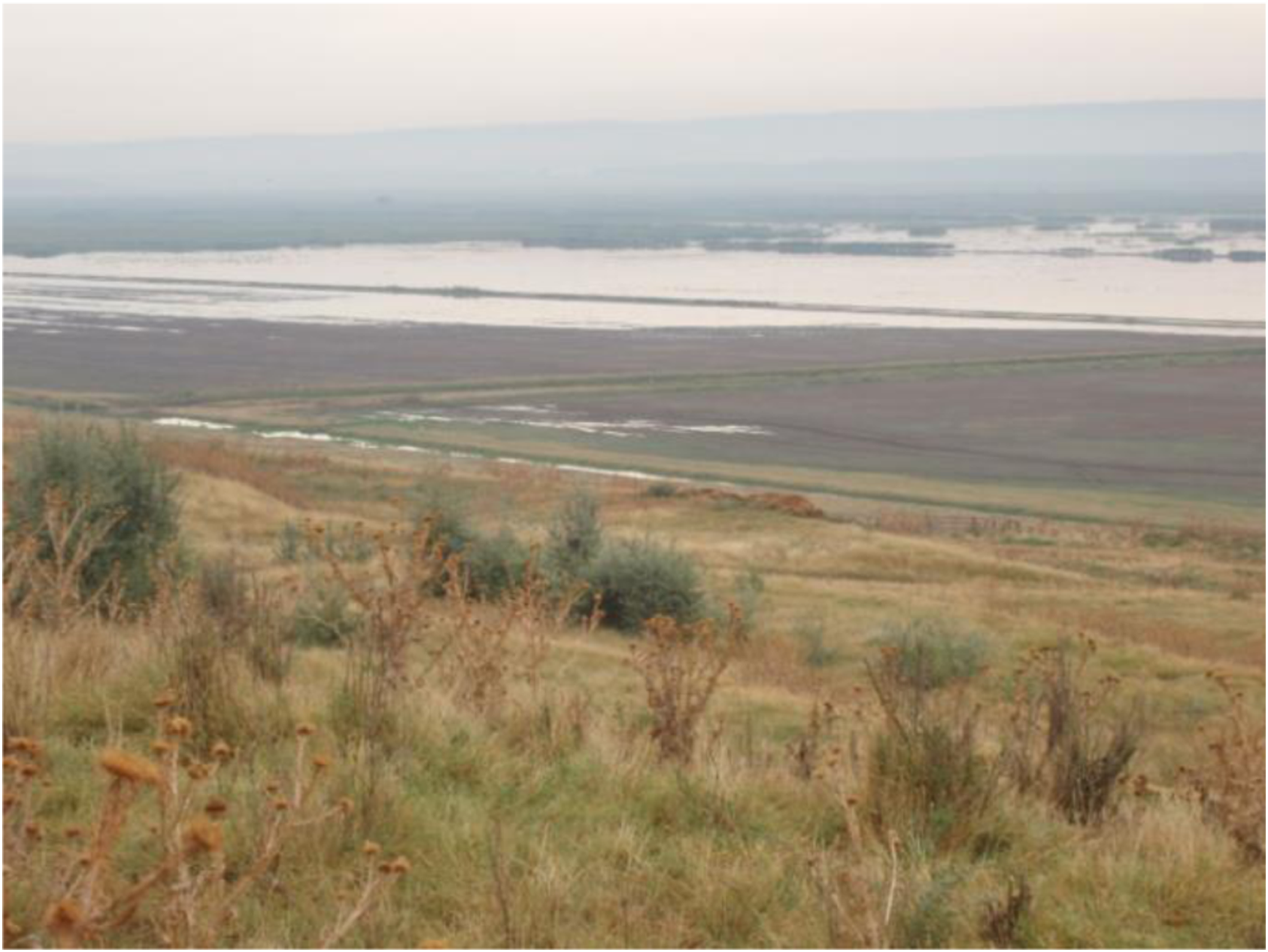
One may ask why villagers do not go back to fishing, but this is no longer possible as the entire landscape has been changed. The lakes, ponds and water canals were replaced by flat agricultural fields with no places to fish except the Danube (itself heavily technologized and polluted after 1945, but that is another story). Villagers are trapped between the socialist era, when state tried to control the groundwater and soil through infrastructure, and the post-socialist state which relinquished control. As a result of this transition, the orderly groundwaters have again become, from a human perspective, feral. Their uncaged movement and the non-functional infrastructure transform crops into rushes and other wetland plants that have low economic value for villagers. The interaction between the three elements exacerbates social inequality among humans and creates new manifestations of power. Local political elites are able to undo some consequences of uncaged groundwater by bringing mobile pumps to do some of the work of the non-functional infrastructure. Unlike the situation described by De Laet and Moll (2000), where a pump ‘built’ a rural community in Zimbabwe, these mobile pumps do not serve the whole community. In Gostinu the mobile hydraulic system does not replace the broken socialist infrastructure as it does not tame the unruly groundwater. It is a techno-political approach utilized by and benefiting only the most powerful villagers. As such it builds new economic inequalities.
Socialism and a more-than-human post-socialism
This article shows the importance of engaging a more-than-human perspective in the analysis of post-socialist rural transformations. Following Tsing (2014), we have highlighted the agencies of dysfunctional infrastructure, groundwater and soil transformations in order to suggest a different perspective on post-socialist rural power relations. The more-than-human perspective allows us to depart from purely political economy approaches and illuminates the relevance of socialist materialities for post-socialist everyday life in rural areas.
The quixotic socialist transformations of nature through infrastructure have left deep scars on the landscape. Post-socialist villagers undertake their farming activity within the socialist framework of organizing the landscape but without a functional infrastructure. Socialism thus remains significant in the lives of people and local economies. A more-than-human perspective shows that dysfunctional infrastructure brings back some aspects of geophysical realties from a period before socialism. The ‘uncaged’ groundwater returns to a feral state. Infrastructure – in which pre-socialist, socialist and post-socialist temporalities coexist – can be a means by which to influence existing power relations. The intertwined temporalities are manifest in geophysical features of the soil that resisted fifty years of efforts of an authoritarian regime and in feral groundwater mediated by infrastructure. The materiality of infrastructure, soils and groundwater should be as central in anthropology of post-socialism as markets, land ownership and political decisions. The new social relations around infrastructure have occasioned new ways of manifesting power and inequality among villagers. This is the lesson post-socialism offers to the anthropology of infrastructure: different temporalities coexist, especially when infrastructure stops working. Infrastructure is not just a network that facilitates the movement of other things but a mediator of time, a powerful tool that brings the past to the present. Yet, adding to the literature on the anthropology of infrastructure, this article shows that the coexistence of multiple temporalities combined with multiple materialities of (ground)water (Richardson, 2016b; Wheeler, 2019) to contribute to the emergence of a new ecological order. The new ecology is a hybrid, composed of pre-socialist feral groundwater, the socialist ‘hydraulic society’ that reclaimed agricultural land, and the post-socialist political economy. The new ecological order is composed of elements constituted in each of the three historical periods, recombined into a new hybrid landscape. The sudden and deep socio-economic and political changes of post-socialist settings highlight the interrelations between infrastructure, ecological conditions and society.
Footnotes
Acknowledgements
Stefan Dorondel thanks the cohort of September 2020 Rachel Carson Center of the Ludwig-Maximillian University of Munich for their comments which helped him to improve this paper. Special thanks to Anna Antonova, Jemma Deer, Stephan Halsey, Huiying Ng, Kate Rigby, Alessandro Rippa and Mara Rusu for their thorough comments and critiques. We are grateful to Deema Kaneff and Anselma Gallinat, who read and commented on an earlier version of the paper. The two anonymous reviewers made an excellent job of helping us sharpen the argument. We alone are responsible for any shortcomings.
Declaration of Conflicting Interests
The author(s) declared no potential conflicts of interest with respect to the research, authorship, and/or publication of this article.
Funding
The author(s) disclosed receipt of the following financial support for the research, authorship, and/or publication of this article: This work was supported by the article uses data gathered within the project ‘Taming Post-socialist Nature: Floods, Local Strategies and National Policies along the Lower Danube’ (2013–16), financed by Romania’s Ministry of National Education, CNCS–UEFSCID (grant no. PN II-ID-PCE-2012-4-0587).