
Abstract
Understanding the similarities and discrepancies between the metabolic activities of neighborhoods in various geographical contexts and spaces is crucial to enhancing effective resource management and sustainability. Yet, research comparing the urban metabolism (UM) of compact urban centers and spatially dispersed suburbs across different international contexts, through the lens of space and socio-material processes is notably lacking. This gap therefore raises an important question: “how do socio-material processes influence the metabolic characteristics of neighborhoods across different cultural and spatial settings?” To address these questions, we conducted a comparative analysis of the metabolism of four neighborhoods located in the metropolitan areas of Paris (France) and Boston (United States): République and Back Bay, representing compact urban centers, and Noisy-Champs and Westwood, representing dispersed suburbs. To do so, we developed dynamic metabolic models at the scale of the neighborhood, using QGIS, Excel, and Sankeymatics. The findings reveal that, while similar spatial characteristics foster comparable metabolic dynamics across the sites, differences also emerge from complex multi-layered socio-material processes at different scales. Understanding these dynamics is essential for urban planners and policymakers seeking to develop sustainable urban environments that integrate local practices with broader regional and global resource networks.
Keywords
Introduction
The concept of Urban Metabolism (UM) is crucial for advancing our understanding of the complex and dynamic interactions between cities, resources, and ecosystems, thereby contributing to the development of more sustainable cities (Musango et al., 2017). As an interdisciplinary concept, first introduced by Abel Wolman (1965), UM facilitates the exploration of how cities utilize resources and generate waste, along with the societal, economic, and environmental challenges associated with these processes. It also seeks to characterize the consumption, transformation, and disposal of flows of materials, energy, and water within urban systems (Baccini, Brunner, 2012; Kennedy et al., 2007). Researchers have explored this concept from various perspectives and disciplines (Kennedy et al., 2011; Ramaswami et al., 2012). Recently, there has been a growing trend toward examining UM as interconnected and cyclical processes, emphasizing resource efficiency rather than viewing them as linear processes (Bahers, Rosado, 2023; Lucertini, Musco, 2020; Papageorgiou et al., 2024). Furthermore, studies have integrated UM with climate science to devise strategies for enhancing urban resilience (Ariyaningsih et al., 2023; Bhadouria et al., 2023), and explored the application of emerging technologies, such as artificial intelligence, to analyze urban metabolic processes (Bibri et al., 2024). This study, however, aims to address the calls from Wang et al. (2021) and Bahers et al. (2022), specifically calling for further investigation into advanced spatial analyses and case studies.
Most works on UM have focused on large territorial units, such as regions or cities, which exhibit diverse metabolic activities (Kennedy et al., 2011; Maranghi et al., 2020) However, fewer research efforts have concentrated on smaller urban units (Wang et al., 2021), particularly at the neighborhood scale (Codoban and Kennedy, 2008). While socio-ecologists and geographers have recognized that “neighborhood” is a genuinely amorphous concept (Sastry et al., 2002), this study considers it to be a geographically localized community within a larger area, characterized by distinct social, economic, and cultural attributes. Neighborhoods are often delineated by physical boundaries, such as streets, natural features, or landmarks, and are recognized for their distinct identity, sense of place, and strong social networks among residents (Marti et al., 2021).
As an initial estimate, the metabolism of a neighborhood can be considered a population-weighted portion of the entire city’s metabolism. However, this approach may not be accurate for construction materials, given that cities are typically in continuous construction, while specific neighborhoods may not experience such activity (Codoban and Kennedy, 2008). Neighborhoods also exhibit significant spatial diversity associated with various urban fabric and land use, which can lead to different material stocks and flows depending on their location within a metropolitan area, such as in a compact historical city center versus suburban areas (Augiseau, Kim, 2021). These areas also present various population densities, demographics, and socio-economic activities that potentially impact metabolisms (Thomson, Newman, 2018). Furthermore, the socio-material configuration of a neighborhood plays a key role in shaping its material flows (Kuruoğlu et al., 2021). This includes not only the layout of infrastructure and the choice of construction materials but also the social practices of those who have contributed to the neighborhood’s development, as well as the behaviors of its users—both residents and temporary visitors. Together, these factors influence the types and quantities of resources consumed and waste generated. While several approaches to socio-materiality exist, Moss et al. (2016) argue that urban metabolism as a socio-material approach related to urban political ecology reflects the dynamic interplay between society, space, and materiality. It involves the co-creation of new socio-spatial forms marked by the intertwining of materials and enmeshing of social nature (Heynen, 2013), local policies, cultural norms, and socio-economic considerations associated with specific geographies (Moss et al., 2016). Yet, research comparing the socio-material configurations associated with the metabolic characteristics of compact urban centers and spatially dispersed suburbs across different international contexts is notably lacking, particularly regarding material flows. Therefore, this gap raises an important question: “How do socio-material processes influence the metabolic characteristics of neighborhoods across different cultural and spatial settings?”
To address these questions, we conducted a comparative analysis of the material metabolism of four neighborhoods located in the metropolitan areas of Paris (France) and Boston (United States): République and Back Bay, representing compact urban centers, and Noisy-Champs and Westwood, representing dispersed suburbs. While including the study of water and energy metabolisms could have provided additional insights, we limited the scope of this paper to materials. We developed original and dynamic metabolic models using QGIS, Excel, and Sankeymatics for the four study sites. The findings reveal that, while similar spatial characteristics foster comparable metabolic processes across the sites, differences emerge from complex multi-layered socio-material processes at different scales. Understanding these dynamics is essential for urban planners and policymakers seeking to develop sustainable urban environments that integrate local practices with broader regional and global resource networks.
Literature review
Toward a spatial turn and smaller scale comparative analyses
The concept of UM has been widely used across various academic disciplines over the past century to describe the complex socio-technical phenomena occurring within urban spaces (Newell, Cousin, 2015). Despite disciplinary differences, a unifying theme across these fields is the recognition of spatial dimensions as critical for understanding UM (Gandy, 2018). While the theoretical discussion on the spatialization of UM is often underdeveloped, Bahers et al. (2022) emphasized that scholars utilize the concept of space in both direct and indirect ways. Space can be used to explore the power dynamics between different territories (Bahers, Giacchè, 2019; Demaria, Schindler, 2016), particularly through the identification and tracking of metabolic flows of resources and waste beyond urban boundaries (Zhang et al., 2016). It also helps to understand the development of economic activities associated with urban metabolism (Kampelmann et al., 2021) as well as the socio-ecological regimes within urban settings (Barles, 2014; Haberl et al., 2016). Space then can be leveraged to understand how urban metabolism can be operationalized and integrated with infrastructure, urban planning, and design (Perrotti, 2019). Yet, the inclusion of spatial analysis methods is a relatively recent development and has not become a dominant research area, even though it marks a shift towards a more nuanced understanding of UM (Bahers et al., 2022).
UM research that addresses spatial aspects has only partially explored the territorial differentiation within urban systems and the heterogeneity of urban spaces and networks (Wang et al., 2021). This includes distinguishing between central urban areas, suburbs, and rural regions, which can yield more granular and context-specific insights (Thomson, Newman, 2018). Neighborhood-scale analysis within these broader regions can offer valuable insights, despite adding another layer of complexity to UM studies. Different neighborhoods, based on their construction status, era, proximity to city centers, population densities, and socio-economic factors, exhibit distinct metabolic characteristics (Codoban and Kennedy, 2008). This underscores the need for a more detailed understanding of UM at smaller spatial scales. As spatial analysis becomes increasingly integrated into UM research at these smaller scales, the field not only expands but also refines its insights.
Additionally, comparative neighborhood metabolic analyses at the global scale are notably scarce, yet such comparisons hold significant potential for understanding how urban metabolism varies within and across different territories. Comparative analyses can explore differences in community lifestyles, such as residential habits, consumption patterns, recycling practices, and mobility behaviors associated with specific spatial features (Adams et al., 2014; Nematchoua et al., 2020; Ren, 2021). By comparing these factors across neighborhoods in diverse national contexts, researchers could develop a generalized understanding of the metabolism of “dense urban centers” or “suburbs,” and identify the local and spatial conditions under which these metabolic processes diverge. These analyses could also explore variations in socio-material processes related to construction technologies and urban production methods, aspects that are rarely, if ever, investigated. This approach could therefore reveal the influence of socio-economic and cultural factors on metabolism (Papangelou et al., 2023), as the socio-material configuration of a neighborhood substantially determines material flows (Kuruoğlu et al., 2021). Although various approaches to socio-materiality exist, Moss et al. (2016) argue that urban metabolism, as a socio-material concept within urban political ecology, reflects a dynamic interplay between society, space, and materiality. This perspective underscores the need for more integrated spatial and socio-material planning strategies to manage resource flows and enhance urban sustainability. Understanding this approach is crucial for developing tailored strategies for sustainable urban development and addressing unique challenges faced by distinct urban areas (Maranghi et al., 2020).
Available tools to compare the metabolism of local communities
Recent advancements in databases and data acquisition methods have facilitated the assessment of the metabolism of smaller urban units, enabling more granular studies (D'Amico et al., 2022) at scales such as neighborhoods (Papageorgiou et al., 2020), industrial parks (Shah et al., 2020), or public spaces such as avenues (Doussard et al., 2024). These studies often emphasize fieldwork over reliance solely on published statistics, yielding more targeted insights, albeit with limited broader impact (Wang et al., 2023). Geographic Information Systems (GIS) have proven beneficial in these studies, especially for comparing material flows and stocks between new and old urban areas, as evidenced by recent research on building materials and household appliances (Liu et al., 2022; Yang et al., 2023).
Beyond the collection of data, UM analysis employs various methodologies to quantify and comprehend the flows of materials and energy within urban systems (Wang et al., 2023). In their evaluation of UM assessment methods, Voukkali and Zorpas (2022) discuss and compare how each of them is used by scholars. Material Flow Analysis (MFA) tracks the inputs, stocks, and outputs of materials within cities, aiding in the identification of resource consumption patterns and waste generation, thereby providing a comprehensive view of the urban material cycle (Lu and Chen, 2015). Energy analysis represents the cumulative energy availability, expressed in equivalent-solar units (sej), provided by the ecosystem from natural or anthropogenic activities (Odum, 1983) The Ecological Footprint (EF) method evaluates the biocapacity necessary to sustain a city’s population, taking into account land use, resource consumption, and waste assimilation (Voukkali, Zorpas, 2022). It measures the extent to which urban populations exceed the ecological limits of their environment. Hybrid methods integrate various approaches, such as combining MFA with Life Cycle Assessment (LCA) or incorporating social and economic dimensions into UM studies. These hybrids offer a more holistic view by linking material and energy flows with socio-economic impacts and environmental footprints (García-Guaita et al., 2018). Among these tools, MFA remains the predominant method in UM research (Rosado et al., 2016; Wang et al., 2020a, 2020b). However, to the best of our knowledge, there have been few comparative analyses employing MFA at the neighborhood scale (Codoban and Kennedy, 2008)
Methodology
Context
Site selection
The study aimed to compare four communities of comparable population size (approximately 7500 inhabitants), with two located in the Paris metropolitan area (France) and two in the Boston metropolitan area (United States), as illustrated in Figure 1(a). The perimeters and land areas of all sites are presented in Figure 1(b), while their spatial characteristics are depicted in Figure 1(c). Location and description of the four neighborhoods (a) Location in metropolitan areas (b) Land area differences (c) Urban morphologies and land use.
République and Back Bay exemplify dense urban neighborhoods located close to water bodies. The République neighborhood in Paris, is located near the Place de la République, a major public square and transportation hub, and bordered by the Saint-Martin Canal. This neighborhood predominantly features classic Haussmannian architecture, characterized by buildings constructed in the latter half of the 19th century. These structures typically share similar heights, generally six or seven stories, and are constructed with limestone façades, large windows, and Mansard roofs (French, 2006). The Back Bay neighborhood was originally a tidal body of water, used for mill operations. Extensive landfilling began in the mid-19th century, resulting in over 450 acres of usable land by the 1880s, bordered by the Charles River. The Back Bay emerged as an early planned fashionable residential district, inspired by Baron Haussmann’s vision for remaking Paris. It is renowned for its rows of Victorian townhouses, which are considered among the best-preserved examples of 19th-century urban design in the United States (Petronella, 2004) Additionally, it is located near a vital transportation hub, the Hynes Convention Center.
In contrast, Noisy-Champs and Westwood are suburban communities encircled by highways, railways, as well as industrial and retail parks. The Noisy-Champs neighborhood is located in Noisy-le-Grand, a commune in the eastern suburbs of Paris. Like many other suburbs in the Paris metropolitan area, Noisy-le-Grand underwent rapid urbanization in the postwar period, driven by the need to accommodate a growing population migrating away from Paris. This period saw the development of numerous residential neighborhoods characterized by standard mid-20th-century architecture, which typically includes mid-rise apartment buildings and single-family homes (Apur, 2014). The Noisy-Champs neighborhood is conveniently located near a Grand Paris Express and RER train station, and is also served by the A4 highway. The Westwood site, on the other hand, spans three municipalities: Westwood (predominantly), Dedham, and Norwood. Similar to many American suburbs, Westwood experienced a population surge and construction boom during the post-war era. This period saw the emergence of numerous single-family homes, particularly in styles such as Cape Cod, Colonial Revival, and Ranch, which were popular in the mid-20th century. The expansion of transportation infrastructure, including Interstate Highway 95 and commuter rail services, facilitated Westwood’s growth as a suburban community, enhancing its appeal as a desirable location for families (Wilson, Boehland, 2005).
Although these sites are located within distinct national contexts and metropolitan environments, they were selected for their comparable socio-material configurations. République and Back Bay are both vibrant urban communities developed in the mid-to-late 19th century, shaped by formal urban planning strongly influenced by Haussmannian principles, and marked by substantial material accumulation within relatively compact and densely built environments. Noisy-Champs and Westwood, on the other hand, represent post-war suburban growth, with distinct yet analogous socio-material patterns induced by car-oriented planning, mostly residential communities, and modern construction techniques. In both urban and suburban cases, the socio-material arrangement—including building typologies, infrastructure, and everyday practices—affects how materials are consumed, stored, and circulated. Comparing these neighborhoods thus enables a deeper exploration of how urban metabolism is shaped not only by spatial form but also by historically embedded material choices, urban policies, and socio-technical systems.
System boundaries
Consistent with prior scholarly work on UM utilizing MFA (Codoban and Kennedy, 2008; Wang et al., 2020a), this study examines specific metabolic processes associated with distinct spaces and activities within the boundaries of the neighborhoods under investigation. These metabolic processes are associated with building construction and operations, public spaces and infrastructure, transportation, and anthropic activities related to processes of production and consumption.
However, several activities were excluded from the analysis: - Consumption by residents and transient populations, such as tourists, related to commercial and public services was not considered due to a lack of data and to avoid redundancy in calculations (e.g., data for food and beverage consumption are typically reported on a per capita and annual basis, without differentiation between residential and commercial activities). - The underground metro and subway systems in Paris and Boston were also excluded, as they are peripheral to the République and Back Bay sites. - Logistical operations associated with the industrial sites in Noisy-Champs and Westwood (e.g., the Amazon Fulfillment Center in Westwood) were not included in the analysis due to insufficient data on the goods and trucks transiting through these locations.
Data acquisition
Collecting data
One of the primary challenges encountered in conducting our metabolic analyses was the identification of reliable data. This issue has previously been highlighted by researchers examining urban metabolism (Codoban and Kennedy, 2008). To access the necessary data, we implemented several strategies.
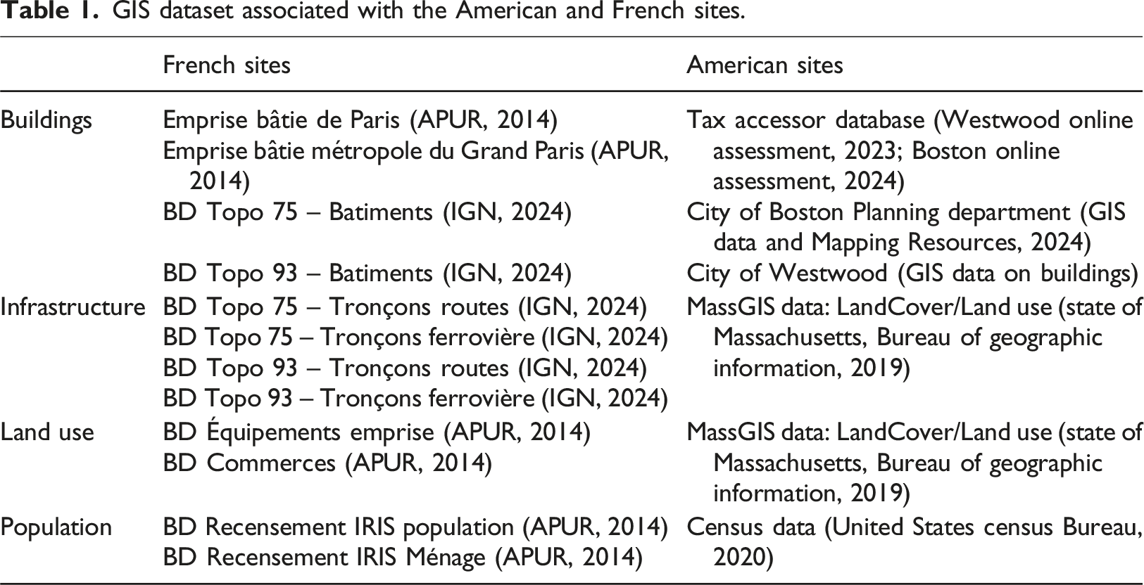
GIS dataset associated with the American and French sites.
Second, we gathered existing data from reports, specialized articles, and websites, particularly concerning specific information related to transportation, material stocks, and waste management and recycling. The sources primarily included governmental agencies, as well as proprietary sources relevant to certain types of materials. Although it is not feasible to list here all the data sources used in this study, a compilation of these sources is provided in the supplemental materials, along with the associated Excel models that accompany this article.
Efforts were made to use data from the same time frame (2020–2024). However, due to the unavailability of such data in some instances, certain calculations in our metabolic models were conducted using earlier datasets (2012–2020).
Data quality and limitations
These various approaches to data collection resulted in differing data quality, which represents a limitation of our study. In total, we categorized the collected data into three types.
Type 1 data is derived from direct and recent field observations (2020–2024) and measurements conducted by our research team, as well as from precise, reliable, and trusted sources (e.g., APUR, IGN, Tax Assessor databases about American cities) that provided up-to-date information.
Type 2 data also comes from trusted and local sources albeit not fully up-to-date (within the 2012–2020 timeframe). This includes specific census data, for example.
Lastly, Type 3 data relies on proxies derived from broader surrounding areas or scales, such as information extracted from national reports from the Ministry of the Ecological Transition in France, or the Environmental Protection Agency in the United States. This final category of data contributes to the limitations of our study, as it has the potential to introduce bias into the results associated with the metabolic analysis of the sites.
Proportions among each of these categories are presented in Table S1. All data was classified, documented, and designed to be replicable. The supplemental materials and accompanying Excel models offer additional insights into the data sources and classification.
It should be noted that while finer granularity in urban metabolism studies can unveil detailed material dynamics at local scales, such as neighborhoods or public spaces, it also introduces critical methodological challenges. Excessive spatial resolution can fragment analyses, making results difficult to extrapolate and weakening their relevance at metropolitan or regional scales. Conversely, overly aggregated data obscure local variability essential for targeted interventions. Thus, achieving an optimal balance of granularity emerges as a fundamental methodological challenge. In this study, we compiled data from a wide range of heterogeneous sources. The granularity of these datasets varied significantly—not only in spatial and temporal resolution but also in their material specificity—raising key questions about data compatibility and integration.
Metabolism: Models and representational considerations
Modeling metabolism
To create a model of the metabolism of the sites we used the mass conservation principle. According to this principle, the mass of inputs in a process equals the mass of outputs plus a storage term
This principle was applied to analyze processes associated with materials stocks and flows within the study. To achieve this, we developed two models using Excel (one for each national context), which share a similar structure and accounting methodology inspired by MFA (Derrible et al., 2021). MFA quantifies the flows of specific materials across various sectors and predominantly relies on two primary methods: the bottom-up and the top-down approaches The bottom-up method focuses on directly collecting flow data from a city or neighborhood, whereas the top-down method uses broader input-output data, often at the national level, which can subsequently be disaggregated to the city or neighborhood scale.
For this article, we employed a hybrid method. Hybrid approaches have more recently enabled the development of methodologies suited for more complex metabolic analyses (Derrible et al., 2021). Consequently, using the bottom-up approach, we primarily examined the stocks and flows associated with GIS databases, supplemented by direct field observations. We also implemented a top-down approach when data were available only at the regional or national scale, such as for recycling rates. To estimate material stocks, we utilized hybrid dynamic stock assessment models that are contingent upon the service life of built environments and the rates of stock renewal (Fishman et al., 2014). These were estimated for stock-built artifacts such as buildings, the road network, as well as vehicles and other specific goods.
Material
Our study predominantly utilized four software applications. QGIS 3.22 was employed to generate maps and get relevant input data for our metabolic models. We also used Excel 16.78 to model the metabolism of the four sites. The output from this model was a script compatible with the software SankeyMATIC (v.2024), which enabled us to create Sankey diagrams that visualize the intricate processes from source materials (inputs) to end-use consumption types (useful outputs), and ultimately to outcomes (waste management) through clear one-directional flows. Finally, the produced diagrams were exported to Adobe Illustrator (v.28.4.1) to enhance their readability.
Representing and comparing metabolisms
The final results are represented graphically using Sankey diagrams. These flow depictions of data are generally categorized under alluvial diagrams, named for their visual resemblance to the alluvial flows of soil deposition. The primary distinction, however, is that Sankey diagrams explicitly illustrate how quantities of specific elements transition from one state to another. In a Sankey diagram, the width of each flow is proportional to the quantity represented.
Through this method of representation, we were able to compare the metabolism of the four sites both visually and mathematically. We analyzed the production, consumption, and waste of resources in both relative and absolute terms to assess the extent to which the metabolic processes of our sites were similar or divergent.
Due to the substantial size of the produced diagrams, which exceed the journal’s formatting constraints, they have been included as supplemental materials.
Results
As a first observation, the majority of materials are eventually stocked in buildings and infrastructures across all sites: 99.1% in Back Bay (Figure S1), 96% in Westwood (Figure S2), 97.7% in République (Figure S3), and 95.3% in Noisy-Champs (Figure S4). Neighborhoods typically accumulate more materials than they consume and discard over time, even more so than cities when considered as a whole, as previously indicated in the literature (Codoban and Kennedy, 2008). While there are notable differences in everyday consumption and waste between the American and French sites—for example, Americans consume 45% more food-related products than their French counterparts, and French recycling rates are, on average, double those of Americans—these differences are negligible when evaluating the overall metabolism of the neighborhoods. The primary difference between the sites is the substantial variation in the quantities of materials reported: the American sites indicate 3,908,524 tons/year for Back Bay and 1,833,511 tons/year for Westwood, whereas the French sites account for 635,893 tons/year for République and 528,586 tons/year for Noisy Champs. République exhibits the highest density, with 486 residents per hectare, nearly four times greater than Back Bay. This significant difference in density may account for the 6.1-fold increase in material quantities. However, this trend does not hold when comparing Westwood and Noisy-Champs. Specifically, Noisy-Champs has a population density of 79.5 residents per hectare, while Westwood has a markedly lower density of 7.7 residents per hectare—approximately 10 times less. Nonetheless, the amount of materials considered for Westwood is 3.4 times greater than that for Noisy-Champs, suggesting that population density may not be a sufficient explanatory factor for these discrepancies. An alternative approach for comparison involves examining the density of material stock-flows per year. In the context of dense urban sites, Back Bay reports a density of 59,946 tons/hectare/year, while République has a density of 40,246 tons/hectare/year. In contrast, Westwood and Noisy-Champs exhibit significantly lower densities, at 1905.1 tons/hectare/year and 5471.9 tons/hectare/year, respectively. This comparison may provide more insightful findings, as dense urban areas typically demonstrate material densities that are approximately 10 times higher compared to suburban areas, even though further studies at the scale of the neighborhood should confirm such a number. Consequently, the average weight of materials consumed for the built environment per hectare appears to serve as a more effective indicator than population density in this context.
Despite these substantial variations in the absolute quantities of materials reported between the French and American sites, some similarities can be observed in relative terms, especially for the dense urban center neighborhoods. In Back Bay, 68% of the total quantity of materials is attributed to consumption related to residential purposes, 27.9% to commercial and public activities, 3.9% to infrastructure, 0.1% to transportation, and 0.1% to greenspaces. In République, the figures are relatively close, with 70.8% of materials allocated to residential use, 25.3% to commercial and public activities, 2.7% to infrastructure, 1% to transportation, and 0.2% to greenspaces. Yet, despite these similarities, the predominant construction materials greatly vary between the two neighborhoods. Back Bay primarily features brick structures, while République is characterized by the extensive use of limestone for Haussmannian buildings. However, limestone in République is also utilized for other applications, such as aggregates or cement for concrete. Furthermore, although Haussmannian buildings tend to incorporate more metal for structural purposes, this is not the case in Back Bay, where timber is favored over metal. Looking more precisely at infrastructure, while oil is primarily associated with road and parking surfaces in both neighborhoods, its presence is considerably limited when compared to suburban sites.
Indeed, while the relative distribution of materials associated with neighborhood activities is relatively similar among dense urban sites, this is not the case for the considered suburban neighborhoods. In Westwood, the breakdown is as follows: 20.1% residential, 22.5% commercial and public, 1% industrial, 46.2% infrastructure, 1.8% transportation, and 8.4% greenspace. In contrast, Noisy-Champs exhibits a distribution of 49.2% residential, 5.9% commercial and public, 11.3% industrial, 15.2% infrastructure, 7.3% transportation, and 11.1% greenspace. The main difference lies in the amount of material associated with road infrastructure. Westwood encompasses 910,845 m2 of roads, while Noisy-Champs features only 204,656 m2—an area that is four times smaller. Additionally, disparities in parking infrastructure contribute to the observed differences. The commercial strip in the southeastern portion of Westwood contains 940,803 m2 of parking lots, exceeding the road area, whereas Noisy-Champs has only 31,531 m2 dedicated to parking. This discrepancy accounts for variations between the sites in both absolute terms (total quantity of materials considered) and relative terms (the amount of asphalt required for roads in relation to the total quantity of materials present in the neighborhood).
Discussion
Socio-materiality and UM in practice
In their discussion of the “material turn” in social scientific endeavor, Moss et al. (2016) distinguished three fields of scholarship on the co-production of material and social phenomena: dispositives, assemblages, and metabolisms. The latter is then associated with the integration of neo-Marxist and post-structuralist approaches in urban political ecology, which has yielded a nuanced concept of urban metabolism as a dynamic process. Urban political ecology dismisses strict boundaries between nature and society. It underscores that urban metabolism results from the intertwinings of materials and the enmeshing of social nature, where power relations, manifesting as “shifting geometries” (Heynen et al., 2006), determine resource access. The urban fabric of global cities, such as Paris and Boston, offers compelling case studies to explore the interplay of socio-material configurations that define urban metabolism. We can analyze how historical evolution, material stock and flows, and socio-political dynamics shape the metabolic processes in these cities.
Both Paris and Boston underwent significant urban transformations during the 19th century, enlightening capitalistic processes. In Paris, the Haussmannian renovation, guided by principles that merged formal urban planning with social order initiated under the French Second Empire, laid the foundation for a dense cityscape (Freemark et al., 2022). République reflects this transformation. Its urban metabolism is intricately tied to its architectural fabric—characterized by limestone façades, classic Haussmannian layouts, and substantial material, and capital, accumulation. These design choices were not random but were deeply rooted in the socio-material configurations of the period. For instance, Haussmannian building’s prestigious and large living spaces, particularly on the lower floors, were inhabited by the new bourgeois class, while smaller spaces were attributed to their staff, enlightening the difference in material and capital allocation across social classes within buildings. However, beginning in the early 20th century and extending into the post-World War II era, many of these expansive apartments were subdivided into smaller units to address the increasing housing demand in Paris. The growing population, coupled with economic changes and the need for more affordable housing, necessitated the transformation of these spacious flats (French, 2006). Meanwhile in Boston, Back Bay represents a parallel yet distinct case. Originally a tidal area transformed through extensive landfilling in the mid-19th century, Back Bay was developed with a vision mirroring that of Paris. The urban planning principles, inspired by European models, resulted in a grid of townhouses and other structures that consolidated dense material stocks into a compact urban area. Originally constructed as single-family residences to house Boston’s affluent populations, the Back Bay townhouses were also designed following the Haussmann architectural model (Petronella, 2004). After World War I, many of these structures were also repurposed into multifamily units, medical offices, schools, and later, condominiums (Bagley, 2021). However, while both Paris and Boston share common historical roots in their urban transformations, their socio-material cultures diverge, shaped by local environmental and socio-economic conditions. For instance, Paris’s République relies heavily on limestone, a material emblematic of its historical legacy. Yet, limestone has a density ranging from 1192 to 2900 kg/m3, contributing to the overall heaviness of République buildings. In addition to the walls, the foundations are also constructed from limestone, and the building framework incorporates substantial amounts of iron, a metal with a density of 7800 kg/m3, which can explain the substantial proportion attributed to mostly residential uses in our metabolic models. In contrast Back Bay’s architecture frequently employs bricks and other locally available resources, a factor that reflects both technological adaptations and ecological constraints (Petronella 2004). Back Bay was developed on reclaimed land, where the soil conditions could not support excessively heavy structures. Timber piles were essential for construction, as they extended to the bedrock; the surrounding groundwater prevented these piles from drying out, crumbling, and causing structural failure (Shoham, 2006). Coincidentally, waterstruck bricks—widely used for construction in this period—are also relatively lightweight, with a density between 1430 and 1950 kg/m3. Brick and wood construction began during colonial times, with bricks consistently used over centuries, benefiting from the abundance of nearby timber and clay in the Boston area (Bunting, 1967). Waterstruck bricks in New England proved resilient against the climate in the Northeast, while also offering fire resistance, durability, and regional availability (Prieto, 2024). These local material choices based on available resources resulted in a lighter structural composition in Back Bay compared to Haussmannian buildings in République. By contrast, the Paris metropolitan area has a significant limestone supply, with extensive underground quarries that provided material for constructing buildings above ground (Augiseau, Kim, 2021).
The suburban neighborhoods of Noisy-Champs in the Paris metropolitan area and Westwood in Boston provide another example of how differing socio-material configurations shape urban metabolism. Noisy-Champs, located on the periphery of Paris, has evolved with post-war urban expansion and strong public transport investments (APUR, 2014). Noisy-Champs features a combination of individual houses and apartment buildings that cater to the French middle class, reflecting the average suburban development in the Seine-Saint-Denis department, where the average sizes for apartments and individual houses are 54 m2 and 92 m2, respectively (Chambre des notaires De Paris, 2017). While the automobile remains a significant mode of transportation, public transit—primarily via the RER A, which was developed after World War II—is preferred for commuting to Paris. This preference can be attributed to robust public transportation policies that continue to evolve, particularly with initiatives such as the Grand Paris project, which will enhance connectivity by introducing two new metro lines at the Noisy-Champs train station (APUR, 2014). The district is set to play a major role in the new metropolitan transport system, with Noisy Champs station expected to be one of the main nodes for the interconnection between lines 11, 15, and 16 and the RER A. In contrast, Westwood appears to be designed more for the upper class, emphasizing larger housing estates, 204 m2 on average, situated on more expansive plots (Wilson, Boehland, 2005). This area is easily accessible by car, facilitated by a well-developed road network. The Federal Highway Act of 1956 redefined access, allowing employers to reach employees more easily. The network radial and circumferential design spurred suburban job hubs, expanding peri-urban areas well beyond traditional commuting areas. In Westwood, the prioritization of motorized transport over public transit translates into a material metabolism heavily skewed toward expansive infrastructure: large parking lots, wider roads, and scattered commercial centers that require intensive material and energy inputs. Consequently, from the perspective of urban political ecology, both neighborhoods present differences. Noisy-Champs embodies a socio-material assemblage where public transportation, post-war suburban planning, and population mobility converge to shape its metabolic profile. By integrating the insights from resource geography and political ecology (Bakker, Bridge, 2006), we see that Noisy-Champs’ development reflects both the physical constraints of space and the political decisions that guided Paris’ public transportation infrastructure and suburban living, where the everyday mobility practices of residents are key to understand material flows. The material constraints of a denser, transit-oriented spatial plan led to relatively efficient material flows: mostly compact and concrete residential units close to transit nodes reduce the need for extensive road infrastructures and enable a more controlled use of resources. Meanwhile Westwood’s larger timber houses, extensive spatial reach and reliance on automobiles not only invite lower levels of material stock-flow density but also underscore a more conflictual relationship between nature and urban development—a relationship central to urban political ecology critiques of contemporary neoliberal and suburban urbanism (Swyngedouw, Heynen, 2003). Differences between the neighborhood also come from the use of construction materials. Westwood homes were built with lumber due to its wide availability in America. Lumber framing required enhanced insulation suited to the local climate, leading to the “sandwich” structure typical in suburban houses: layers of insulation and an outer siding of vinyl, aluminum, stucco, or composite materials. While the primary structure remains wooden, the insulation improves performance in colder climates, and the siding provides aesthetic appeal. In contrast, Noisy-Champs showcases the use of concrete in post-war suburban development in France, applied in both individual pavilions and collective housing. Concrete, with a density of 2400 kg/m3, is significantly denser than timber (530–1190 kg/m3), which contributes to the observed differences between these two neighborhoods. Notably, houses in Westwood offer nearly double the floor area compared to those in Noisy-Champs, despite the lighter material composition.
Spatializing a multi-layered UM
The spatial turn in urban metabolism research offers a valuable lens for analyzing urban and suburban environments where socio-material configurations differ markedly. This part of the discussion therefore focuses on how specific territorial-related parameters, spatial patterns, infrastructure planning, and spatially explicit developments—as critically reviewed by Bahers et al. (2022)—impact the metabolism of neighborhoods. It enlightens first how UM can be understood through multiple intertwined spatial dimensions, at different scales; and second how space can thus be used as a lens to explore how UM is implemented and connected to infrastructure, planning, and urban design (Perrotti, 2019).
Across these four neighborhoods—République and Noisy Champs in Paris, and Back Bay and Westwood in Boston—land use, patterns, and area differences have a profound effect on urban metabolism, despite presenting a similar population size. Although comparable spatial characteristics and urban morphology may lead to similar stocks and flows associated with analogous activities downstream—that is similar material proportions allocated to the stock of materials into buildings, as demonstrated by our Sankey models—this pattern does not persist upstream. A thorough examination of the available building materials and construction technologies has highlighted significant influences on the total weight of materials represented in the model, as well as the processes required to access and transform these materials, mainly for construction purposes. Furthermore, the compact, dense structure of République, defined by multi-story Haussmannian architecture, concentrates material stocks and resource flows within a small geographical area. Similarly, Back Bay exhibits a more horizontally oriented design, spreading material stocks over a broader area than République while maintaining a centralized flow typical of an historic urban core. In contrast, the more expansive spatial pattern found in Noisy Champs, where residential structures range from small apartment blocks to individual houses and are interwoven with extensive public transportation networks, leads to a more distributed circulation of materials and services. While French planners tended to favor commercial activities and services located on the ground floor of collective housing near the train station, as seen in Noisy-Champs, such activities in Westwood are primarily concentrated in a designated commercial area featuring large parking lots. This setup encourages residents to drive to the shopping district rather than relying on the proximity of shops and services accessible via public transportation. Westwood’s sprawling suburban layout creates a vastly larger territorial subdivision, which can be up to 60 times the size of République despite serving a similar population. The stark difference in size and density demands significantly greater infrastructure for moving people and goods, which could result in longer supply chains, higher energy inputs, and increased environmental loads, questioning the sustainability of such neighborhood.
The sustainability of this neighborhood as part of a larger urban system should be assessed based on cross-scale interaction among ecosystems and transboundary infrastructures (Ramaswami et al., 2012). Despite the previous distinct analyses of these four neighborhoods, it should be noted that they are indeed interconnected by transboundary infrastructures that facilitate the flow of people and resources across scales. In Boston, highways and arterial roads are crucial in linking Westwood and Back Bay, permitting residents in sprawling suburban areas to access dense urban centers quickly. Similarly, in the Paris region, railways and high-frequency public transportation systems link Noisy-Champs with central districts like République. Although we focused here on the flows of users, these transport also support material flows, they underscore a fundamental point: the urban metabolism of a city is not solely determined by internal processes within individual neighborhoods but is also influenced by the interconnections that these neighborhoods maintain with the broader urban fabric (Codoban and Kennedy, 2008). Consequently, these variations in community size and spatial configuration not only determine local resource efficiency but also shape how these neighborhoods are interconnected within larger metropolitan and global resource networks, reinforcing the interdependencies between urban cores and their peripheries (Bahers et al., 2020).
This is confirmed by previous metabolic analyses of both cities. The multiscalar analysis of urban metabolism, as conducted for Paris by Barles (2009) and for US cities like Boston by (Phillips et al., 2011) and Kennedy et al. (2012), underscores the theoretical importance of addressing material interdependencies between dense urban cores and sprawling peripheries. These studies converge in highlighting the structuring effect of density gradients and economic activities on input and output flows. In Paris, observed differences are explained by the transfer of urban waste flows from the dense city center towards peripheral areas and by consumption patterns varying according to urban characteristics (density vs sprawl). Similarly, Phillips et al. (2011) demonstrate for Boston that material flows differ significantly depending on spatial scale; their urban metabolism (MFA) approach reveals marked dependencies of dense urban areas on their peripheries, particularly in waste management and construction material supply. Kennedy et al. (2012) further support this multiscalar perspective, noting that Boston’s lower-density peripheries exhibit higher energy and material consumption due to increased transportation energy use and intensive utilization of construction materials.
An integrated spatial perspective further illuminates the cross-scale interdependencies within urban metabolism. At the building, neighborhood, and metropolitan levels, material choices—such as the limestone used in Parisian constructions or the brick and wood typical of Boston’s historic neighborhoods—reflect both local resource availability and historical building practices. Beyond local extraction, other materials integral to urban infrastructure, such as oil, steel, and concrete, are often sourced from farther afield. Their use underscores the fact that while neighborhoods may be distinct territorial subdivisions, they are deeply embedded in and dependent upon global supply chains. This multi-scalar interdependency illustrates how localized urban metabolism is both influenced by and contributes to regional and global resource flows. Therefore, as Angelo and Wachsmuth (2015) caution against “methodological cityism,” it becomes necessary to adopt analytical approaches that capture both the local specificity and the global interconnections of material flows. Paris and Boston, while geographically and culturally distinct, are linked by global urban dynamics that drive resource allocation, infrastructural development, and material consumption.
Consequently, the spatial dimension of urban metabolism is multi-layered, and induce several socio-material dynamics. Understanding these dynamics is crucial for urban planners and policy-makers who aim to develop sustainable, resilient urban environments that effectively integrate local practices with broader regional and global resource networks (Perrotti, 2019). Urban planners, when considering neighborhoods as distinct yet interconnected units, must address not only the intrinsic spatial properties of each area, but also how these areas interact. The challenge lies in developing planning strategies that acknowledge and leverage both the localized control of material flows and the broader metropolitan and global interdependencies. Ultimately, the study of urban metabolism across these four neighborhoods underscores the importance of integrating multiple spatial scales—from individual buildings to metropolitan regions and global supply chains—to capture the full complexity of urban systems and inform targeted, effective planning interventions.
Conclusion
This study highlights the intricate relationship between the socio-material processes and spatial specificities inducing the metabolic activities of urban and suburban neighborhoods in France and the United States. By examining neighborhoods with comparable activities and spatial characteristics, we observed significant similarities in metabolic activities, notably between Back Bay and République. Conversely, suburban neighborhoods like Westwood and Noisy-Champs revealed distinct differences, particularly in infrastructure-related materials, indicating that context-specific factors are critical in shaping material flows. However, the contrasts in construction materials—such as the use of heavy limestone in République versus lighter brick structures in Back Bay—as well as differences in mobility policies and infrastructure—ranging from transit-oriented public transportation in Noisy Champs to car-dependent highway systems in Westwood—highlight the need to account for specific socio-material processes when analyzing neighborhood metabolisms across diverse cultural and spatial contexts. Planners and policymakers therefore need multi-layered analytical approaches that capture both the local specificities and the cross-scale global interconnections of material flows, enabling more context-sensitive and integrated strategies for sustainable urban development.
Future research should focus on exploring additional urban and suburban contexts, as well as the long-term implications of these material choices on environmental sustainability. By deepening our understanding of how different factors interact to influence neighborhood metabolism, we can better inform policies aimed at optimizing resource use and reducing waste in diverse urban settings.
Supplemental Material
Supplemental Material - Urban metabolisms in context: A socio-material comparison of American and French urban and suburban communities
Supplemental Material for Urban metabolisms in context: A socio-material comparison of American and French urban and suburban communities by Claire Doussard, Priyanka Kar, Pauline Detavernier, and Peter G Rowe in Environment and Planning B: Urban Analytics and City Science
Footnotes
Author contributions
C.D.: Conceptualization, Data Curation, Methodology, Investigation, Formal Analysis, Visualization, Validation, Writing—original draft, Funding acquisition. P.K.: Data Curation, Investigation, Formal Analysis, Visualization, Writing—review and editing. P.D.: Data curation, Investigation, Visualization, Writing—review and editing. P.G. R.: Writing—review and editing, Funding acquisition.
Declaration of conflicting interests
The author(s) declared no potential conflicts of interest with respect to the research, authorship, and/or publication of this article.
Funding
The author(s) disclosed receipt of the following financial support for the research, authorship, and/or publication of this article: This research was funded by 2023–2025 FACE Foundation grant: “On the Environmental Anthropogenic Metabolism of Urban Settlement” and 2024 Faculty Grant, Harvard Center for Green Buildings and Cities.
Data Availability Statement
All data generated or analyzed during this study are included in this published article and its supplementary information files.
Supplemental Material
Supplemental material for this article is available online.
References
Supplementary Material
Please find the following supplemental material available below.
For Open Access articles published under a Creative Commons License, all supplemental material carries the same license as the article it is associated with.
For non-Open Access articles published, all supplemental material carries a non-exclusive license, and permission requests for re-use of supplemental material or any part of supplemental material shall be sent directly to the copyright owner as specified in the copyright notice associated with the article.